

Archive
- Abandoned
- Alabama
- Arizona
- Bahamas
- Books
- California
- Cemetery
- Climate
- Colombia
- Connecticut
- Diner
- Egypt
- Feature
- Florida
- Friday Fun
- Georgia
- Holidays
- Illinois
- Iowa
- Italy
- Kentucky
- Louisiana
- Maryland
- Massachusetts
- Mississippi
- New Jersey
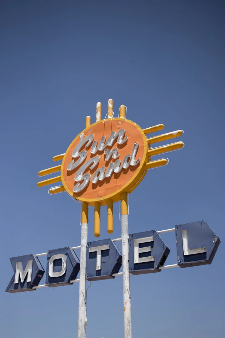
- New Mexico
- New York
- North Carolina
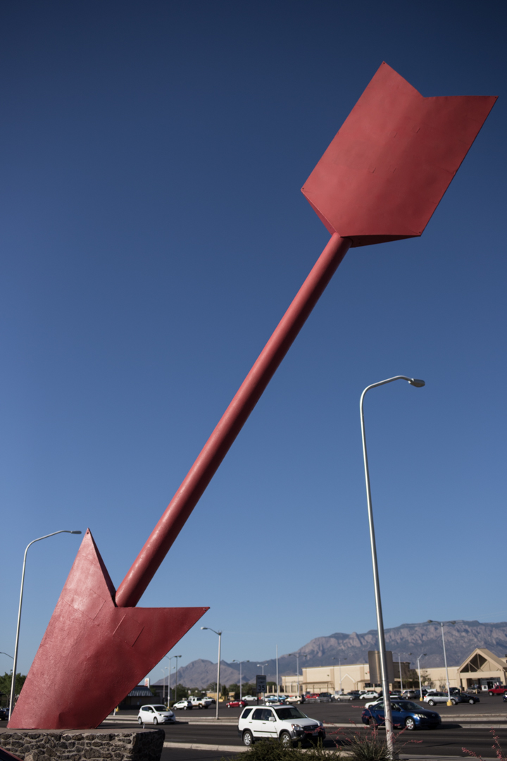
- Novelty Architecture
- Ohio
- Pennsylvania
- Personal
- Peru
- Project 365
- Protest
- Rhode Island
- Roadside Attraction
- South Carolina
- Tennessee
- Texas
- Travel Guide
- Virginia
- Walks
- Washington DC
- West Virginia
- Wisconsin

Route 66: Chicago to Wilmington

Back in December, I planned a trip to Dubuque, Iowa and parts of Wisconsin. O’Hare is the closest major airport so I couldn’t resist taking a detour along the beginning of Route 66, which starts in downtown Chicago. I wasn’t able to snap a photo of the “begin Route 66” sign because there is no good place to park, I was by myself and city driving stresses me out—but I did see it with my own eyeballs, which sometimes just has to be enough.


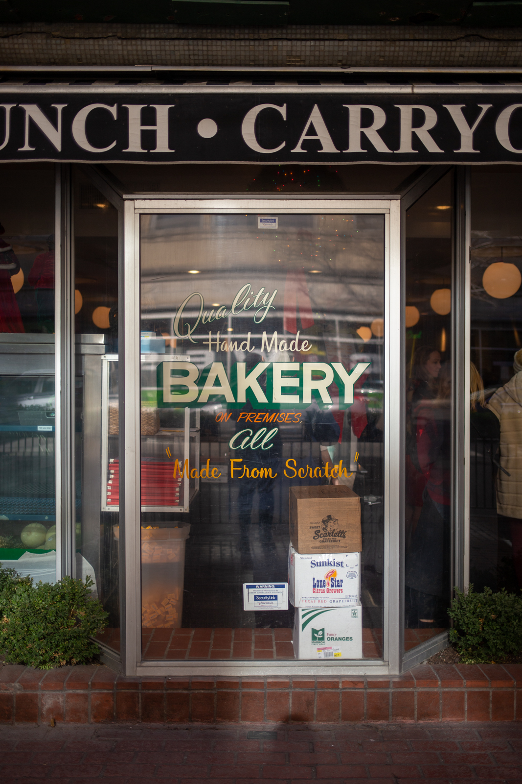
I try not to start any new adventure without first fueling up on diner breakfast—the more historic the diner, the better. You can’t get much better than Lou Mitchell’s, which has been serving travelers since 1923, predating the creation of the Mother Road by three years. I’ve never been steered wrong by choosing a diner based on age, history and signage and Lou Mitchell’s gets an A+ in all three categories.

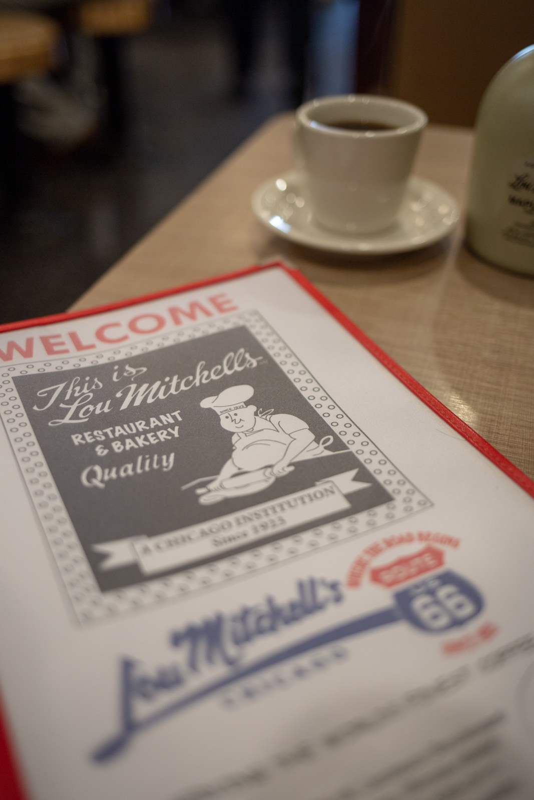


As soon as you walk into Lou Mitchell’s, you’re greeted with a donut hole and a miniature box of candy (I got Milk Duds), which is as good a welcome as I’ve ever received at a diner. My breakfast skillet came topped with a slice of ham that was literally larger than my face and even if the slogan “serving the world’s finest coffee” is a bit of a stretch, my cup was certainly adequate (and refilled frequently which is the mark of a truly fine diner).
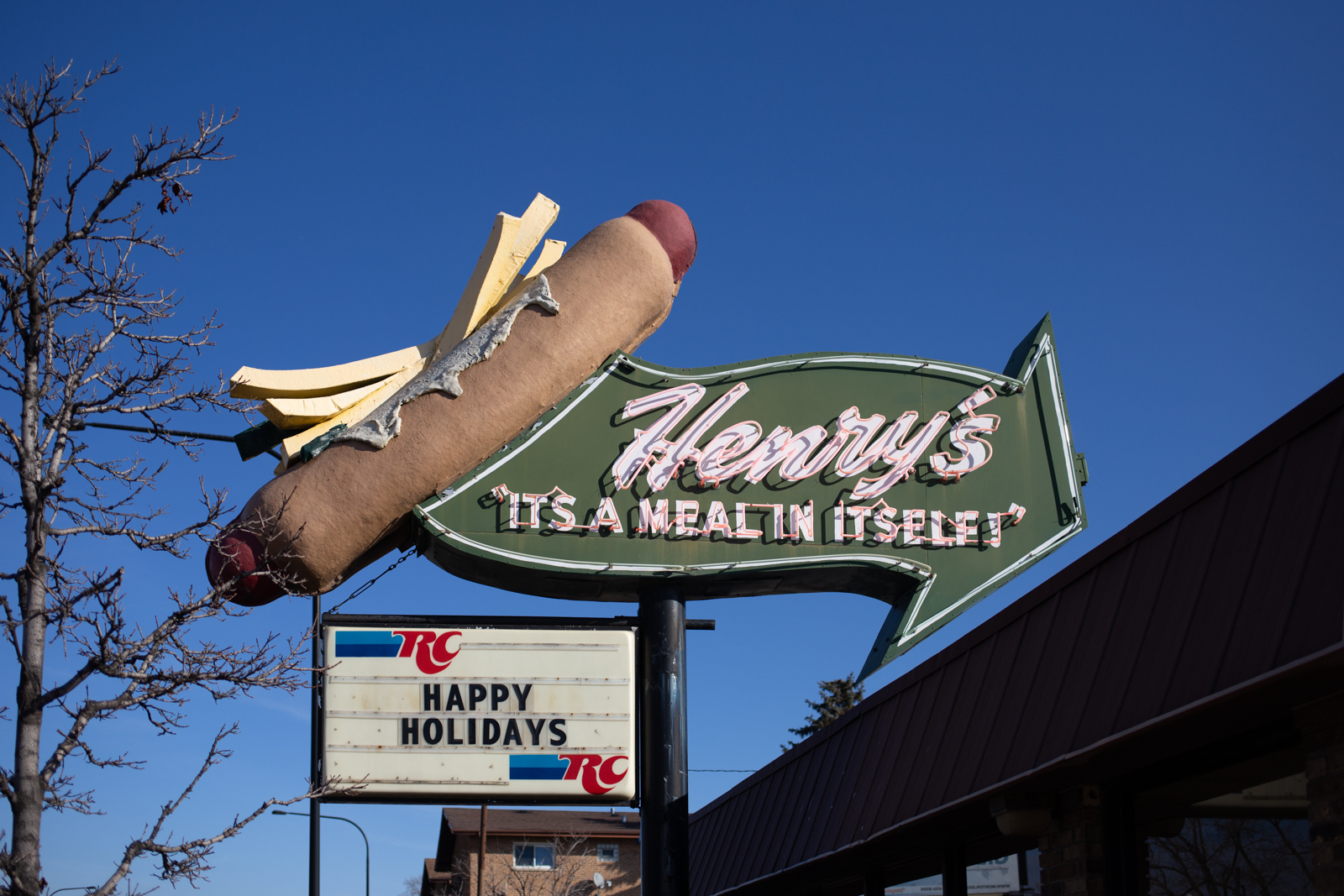
I was a bit disappointed with the lack of signs and general Route 66-ness at the beginning of the drive, but my next stop was Henry’s Drive-in, located in Cicero, IL. I’ve been known to drive far out of my way or do some fancy maneuvering just to photograph a good sign, and Henry’s is a great sign—and luckily right on Route 66. The hot dog shop has been in the same location since the ‘60s and while I can’t vouch for their dogs, I am suspicious of any sandwich that comes with the fries on top (a tradition from the beginning at Henry’s, as indicated by their sign).
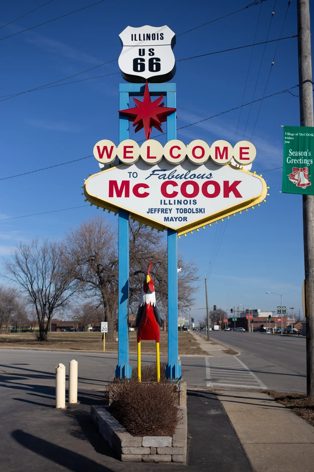
My next stop was McCook, IL, which wasn’t a planned stop but I couldn’t resist pulling over to take a photo of their Vegas-themed welcome sign. It looks new, but they tried and I appreciate the effort. I made a detour off Route 66 to see the Frankenstein Muffler Man at Haunted Trails, which was definitely worth it—if there’s one piece of travel advice that I live by, it would be: always take the detour (or in this case, a detour from the original detour).


Back on Route 66, I stopped at Dell Rhea Chicken Basket, which has been continuously operating as a bar and a restaurant since 1946. It’s a shame I couldn’t eat at every one of these historic eateries but I was still so full of ham (three months later I still feel like I’m full from that ham slice) that I just took a quick photo and got back on the road.


Route 66 takes you right through Joliet, known as the home of the Blues Brothers—even the gas station had a replica Bluesmobile perched atop a pole in the parking lot. The 1974 Dodge Monaco was built by the owners of the Route 66 Food N Fun Travel Center as a photo op and the car is just a shell—it has no fuel tank, engine or drive train.

Joliet is about 20 min north of Wilmington, IL, home of the Gemini Giant and my end point on Route 66 for the day. I headed northwest from Wilmington—stopping only to take a photo of the Sapp Bros. coffee pot sign—toward Dubuque, a three-and-a-half hour drive. I had driven all day and ended up further from my destination than when I started but I’ve never regretted taking the long way yet.

Muffler Man: Gemini Giant

When I started planning my recent Illinois/Iowa/Wisconsin trip, I realized that I would be able to travel a bit of the beginning of Route 66, which officially starts in downtown Chicago. My flight arrived at O’Hare at 8:30am and I was due in Dubuque by the evening, a 2hr and 40min drive if you drive from point A to point B without stopping—something I rarely do.
I decided that the furthest I could reasonably go southwest on Route 66, before heading back northwest, would be Wilmington IL, home of one of the most famous Muffler Men, the Gemini Giant. By the time I had reached the Giant it was 3pm and I was 3hrs and 30 min from Dubuque, but it was completely worth the detour.
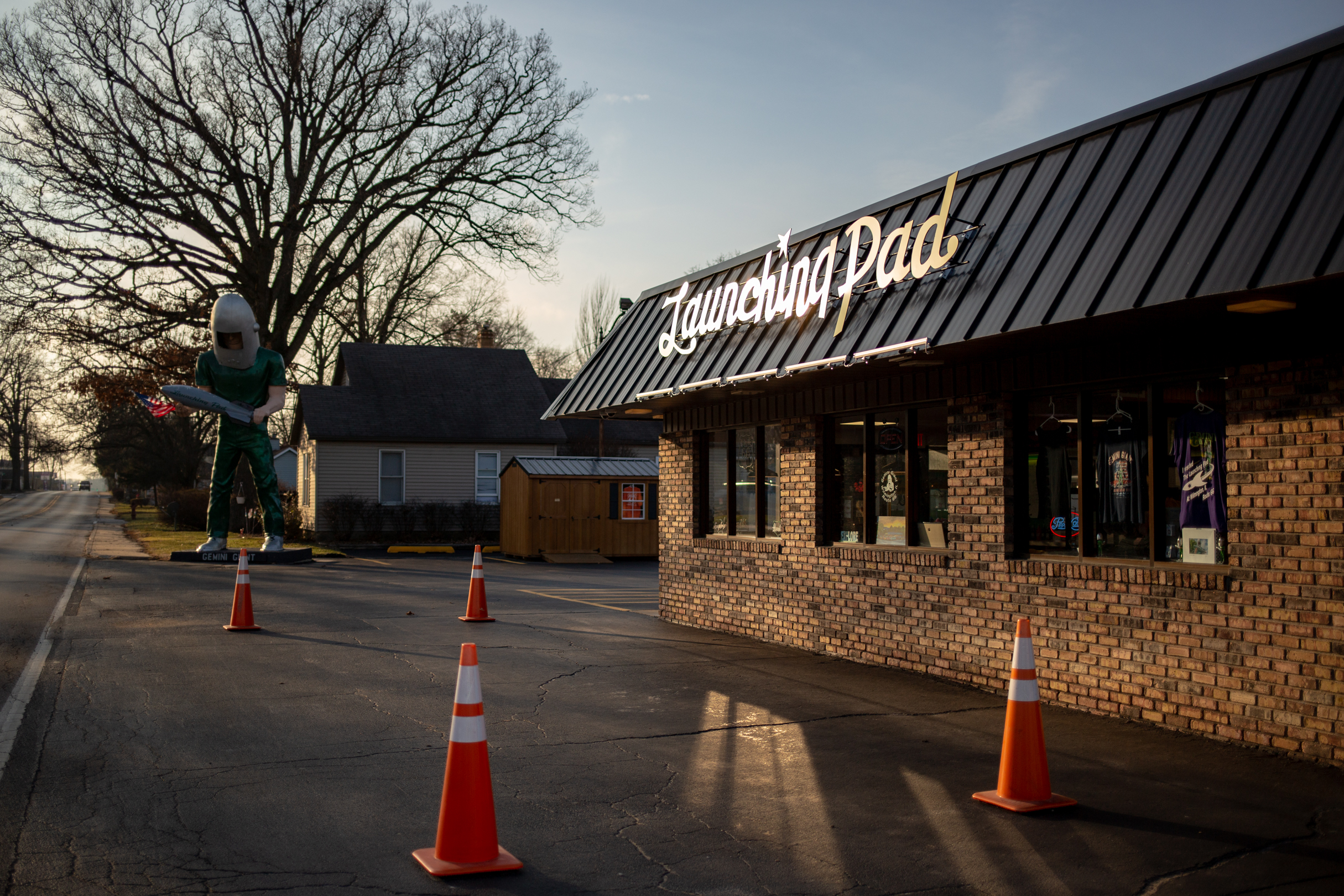

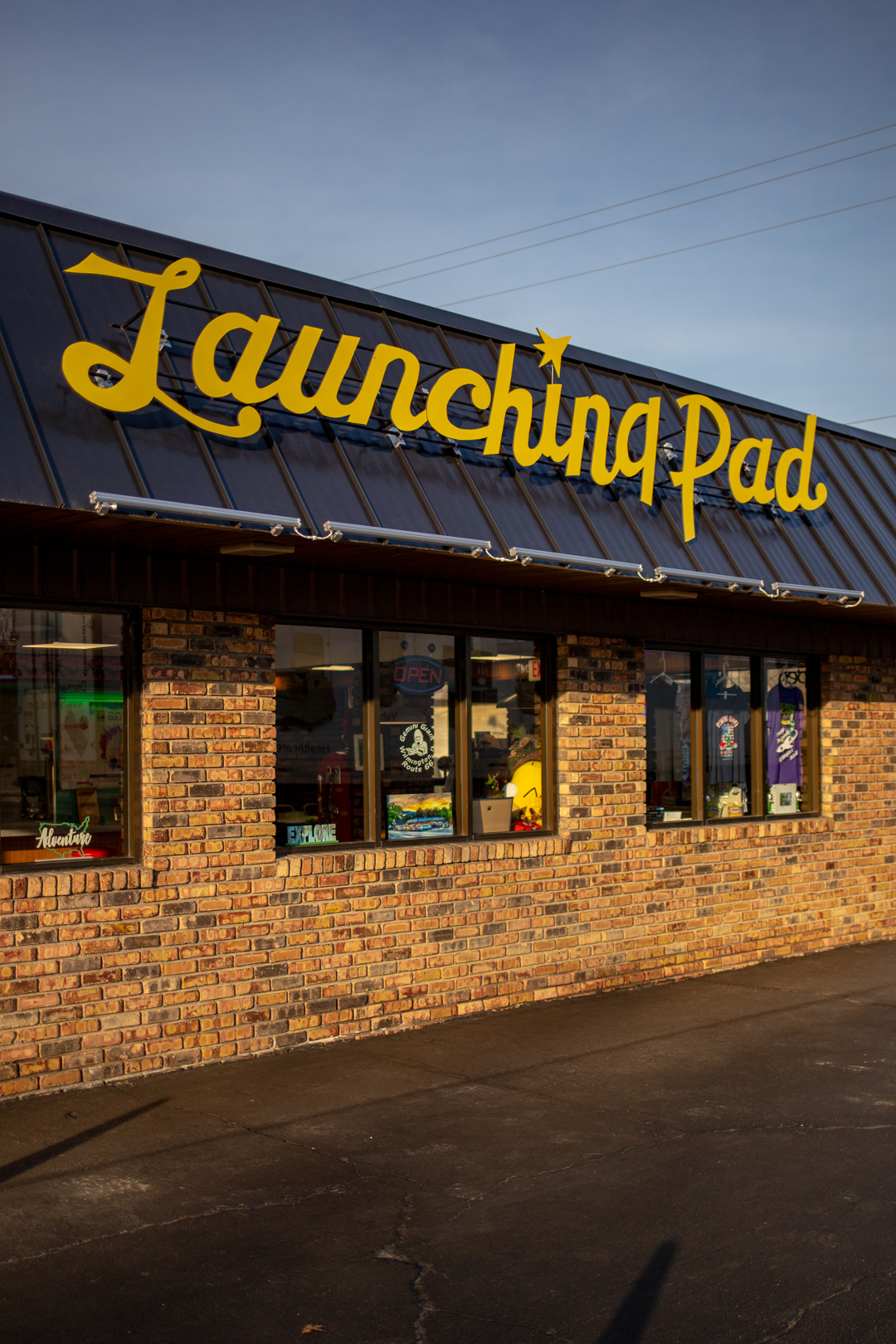


In 1965, John Korelc, owner of the Launching Pad drive-in, paid $3,500 (more than $25k in today’s dollars) for the astronaut-themed Muffler Man. When Korelc retired he sold the Launching Pad, which eventually closed in 2010. The last owner refused to sell the Giant separately from the restaurant and in 2017, Tully Garrett and Holly Barker purchased both. They have reopened the Launching Pad as a souvenir shop and have plans to add food in the future.


The Launching Pad was supposed to be open when I arrived, but the doors were locked. When I reached out via Facebook they told me they had an unexpected emergency and had to close up for a bit. I’m sad I didn’t get to meet the Giant’s new owners or squish a penny, but I’ve come to accept these little disappointments as inevitabilities in life (along with the sun, which is seemingly always in the worst position for photos). Thankfully, they sell some of their Gemini Giant- and Route 66-branded merchandise online and I might not be able to resist buying one of these little guys.


The Gemini Giant stands 30 feet tall and—not counting his rocket and concrete base—weighs 438 pounds. After he arrived at the Launching Pad, a contest was held with local school children to name the giant. Inspired by Project Gemini, NASA's second human spaceflight program from 1961 to 1966, a fifth grade student proposed the name “Gemini Giant.” At least two other astronaut variants were made by International Fiberglass—one stood at Coney Island’s Astroland—but only the Gemini Giant survives today.
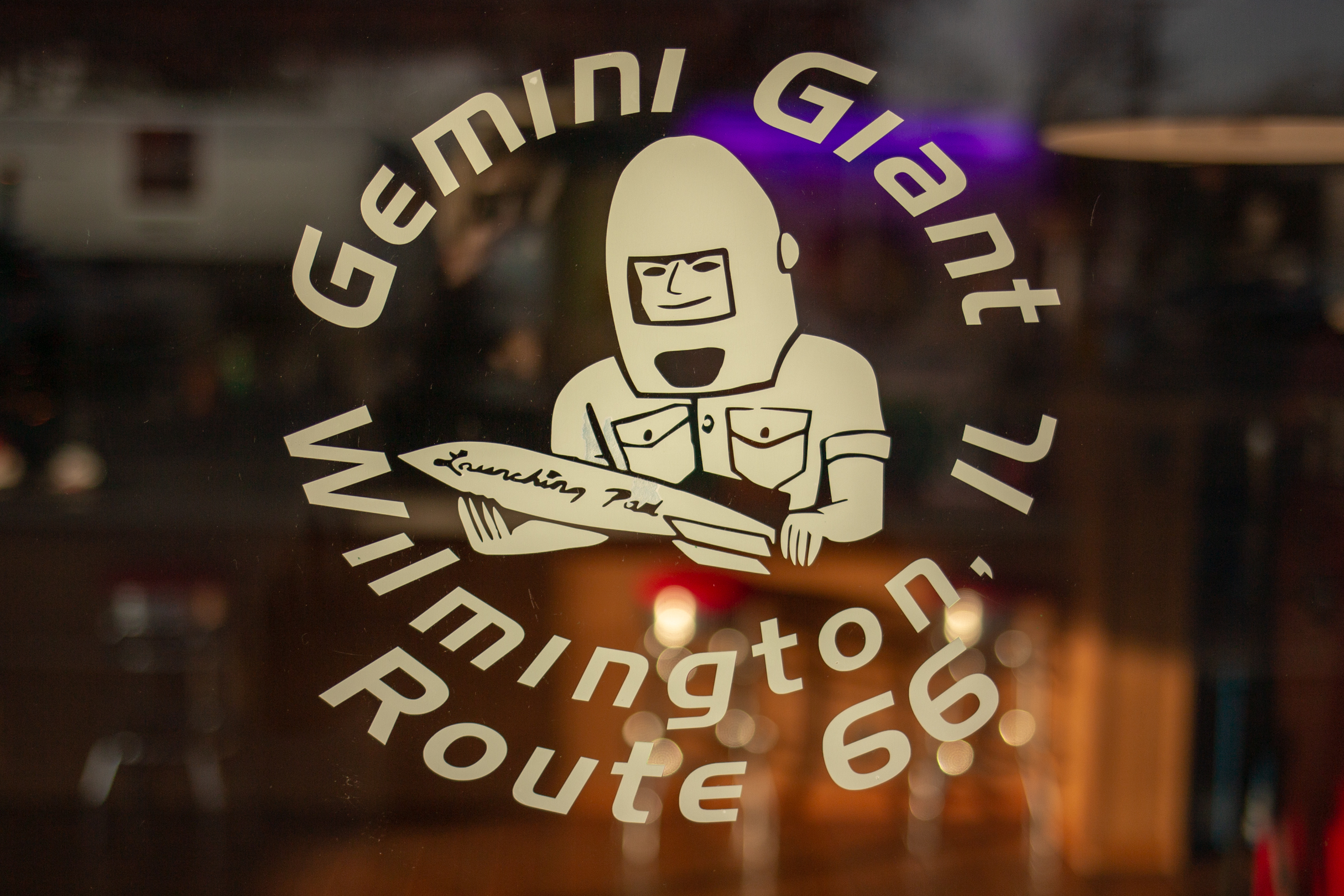
Gemini Giant
810 E Baltimore Street
Wilmington, IL 60481
Store open daily, 9am-5pm, the statue is visible 24/7 in the parking lot outside.

Bono's Historic Orange
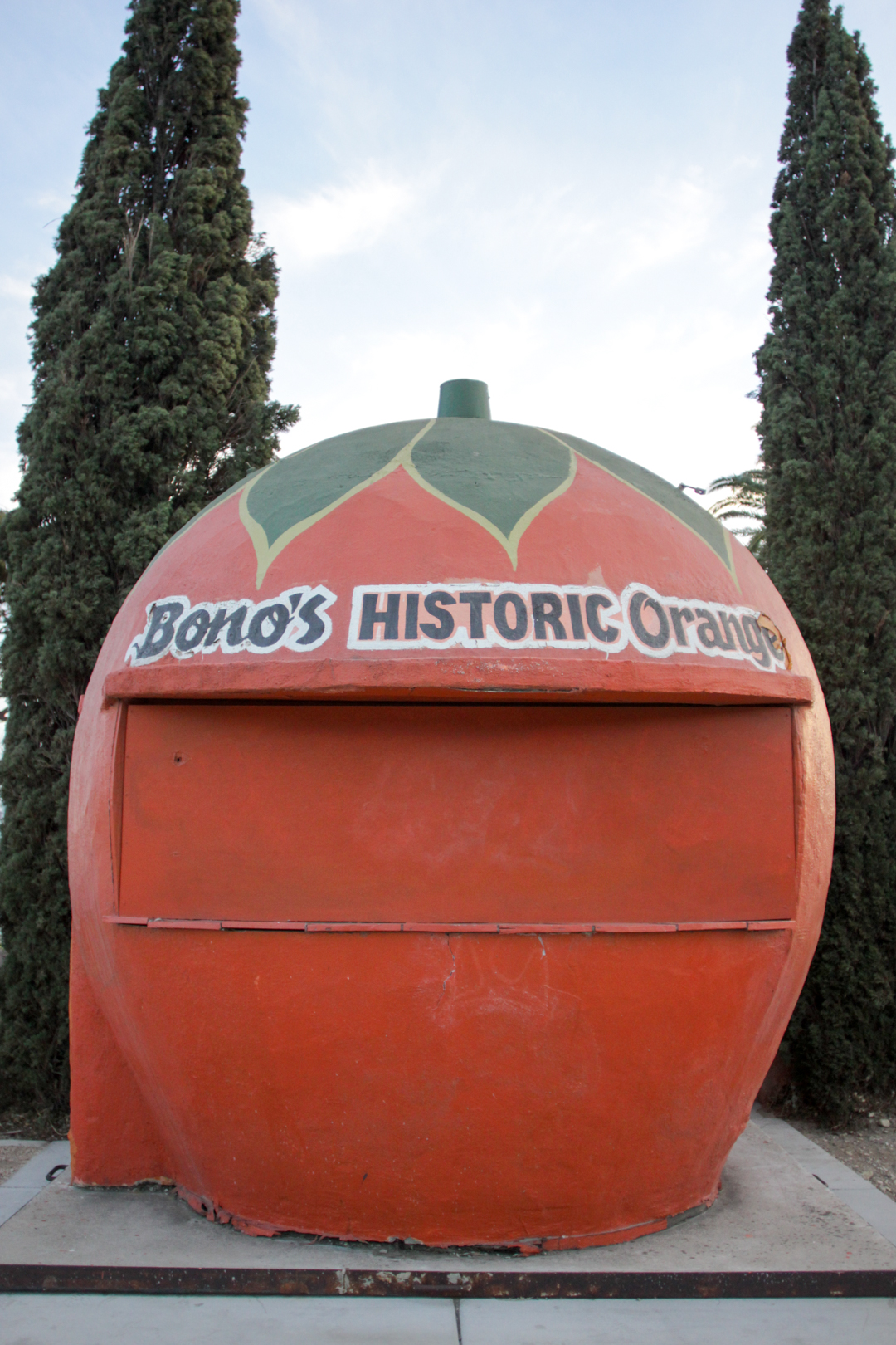
Today is my friend Jim’s birthday (go say happy birthday to him!) and I’m missing him more than usual, so I’m coping by reliving a tiny portion of our Route 66 road trip from last year. When Jim moved to California, I was obviously bummed to be losing one of my best friends to the worst coast, but I was also excited to have a reason to visit (and a place to stay in) California. Arguably the mecca of quirky roadside attractions and novelty architecture, I’ve only been to CA twice, but my list of must-sees grows daily.
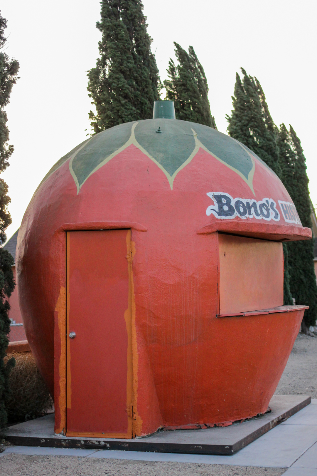


Bono's Historic Orange is one of six surviving orange-shaped buildings in California. It’s located in Fontana along a stretch of Historic Route 66, 45-minutes from The Donut Hole, and about 20-minutes fromt the Wigwam Motel. Bono's Italian Restaurant opened nearby in 1936 to supplement the revenue from the Bono family farm. The seven-foot-tall orange sits in front of the restaurant on the side of the road and thirsty travelers could buy a glass of orange juice for 10 cents.
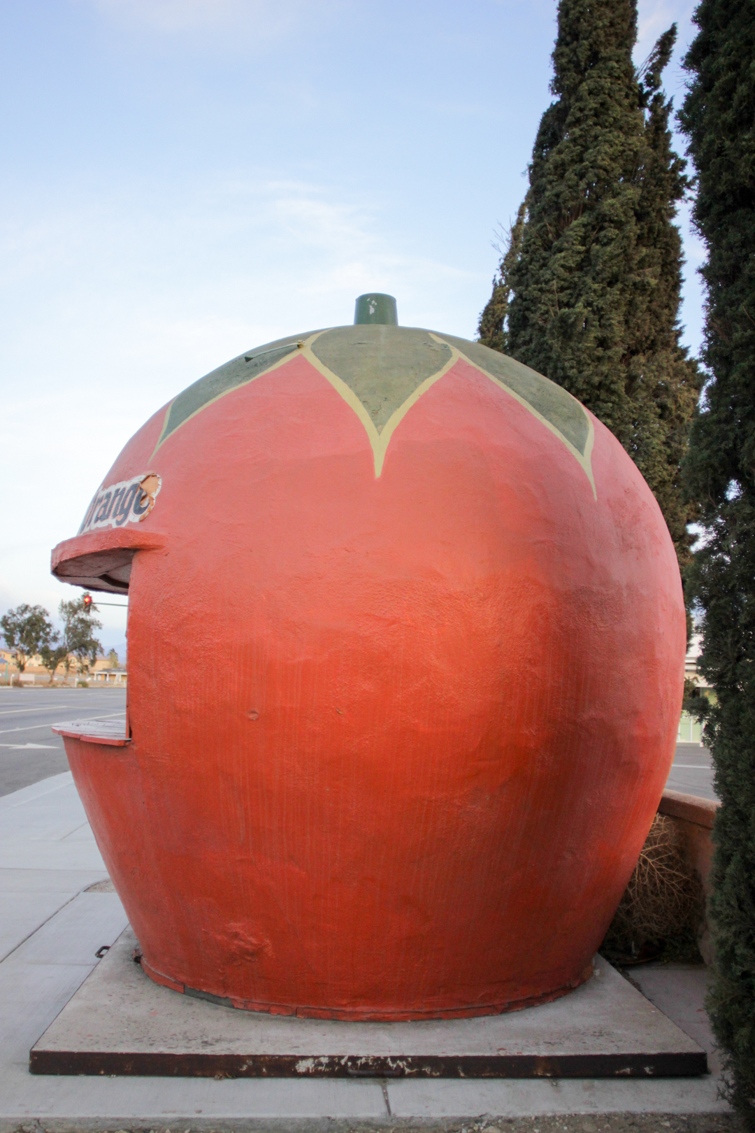


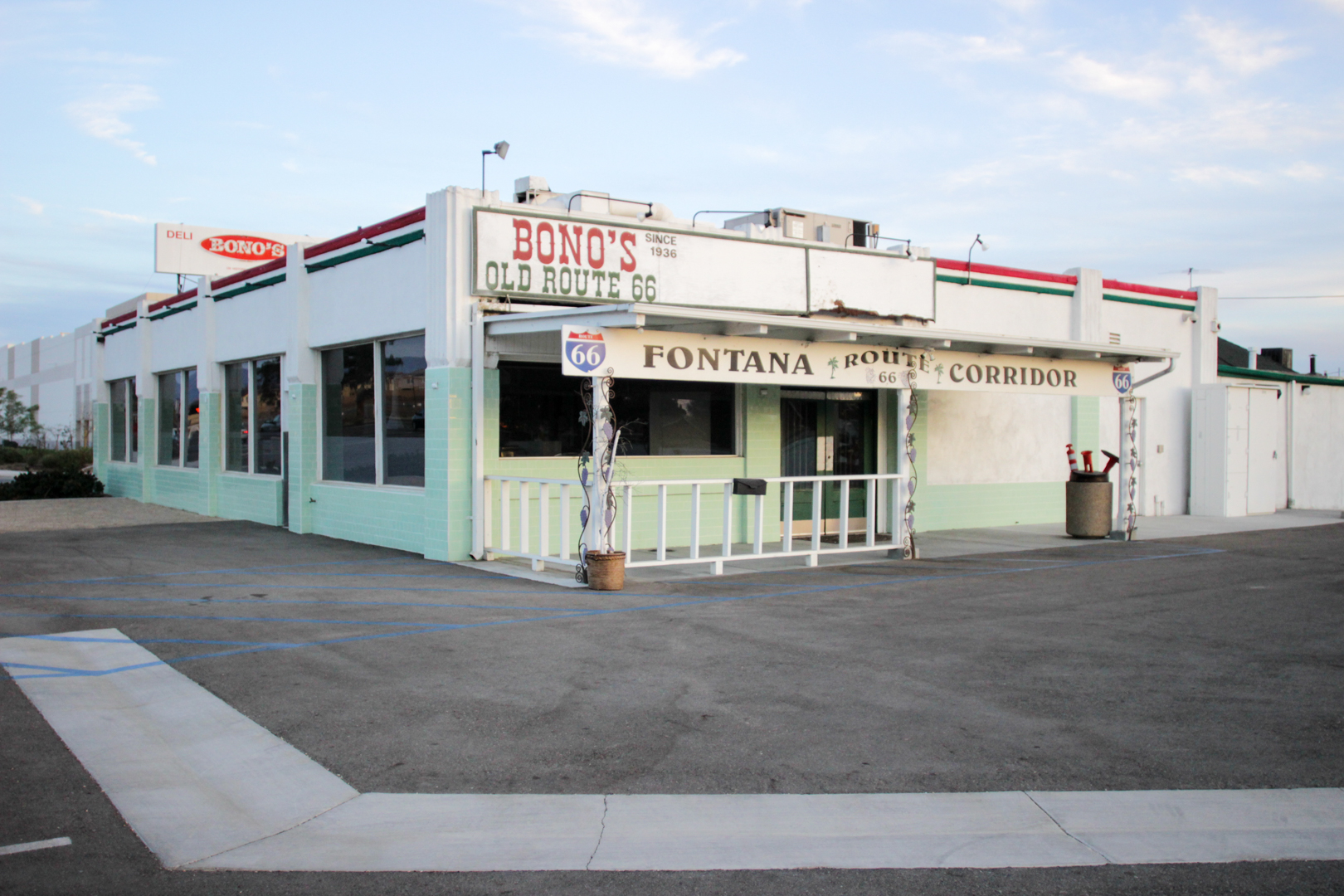
The restaurant was added to the National Register of Historic Places in 2008. In 2013, owner Joe Bono (he’s a cousin of Sonny Bono) received permission to move the building 20 feet from the street and said he had plans to reopen the restaurant and the orange stand, but both remained closed when we visited last year. I’m sad that I didn’t get to purchase something orange from the orange-shaped stand (probably my favorite thing to do, ever), but I’m happy that it survives at all.
Bono’s Historic Orange
15395 E Foothill Blvd
Fontana, CA

Route 66: Albuquerque to Santa Rosa

This may actually be the last post about my AZ/NM Route 66 road trip—a trip I took back in the beginning of June. I’ve tried to space out the posts to prevent neon sign overload (is there even such a thing?), but we squeezed so much into just a few days that it’s truly taken me six months to process the entire trip. I’m about to leave tomorrow on another five-day trip—which will include a few stops at the very beginning of Route 66—so I’m currently operating at the height of my pre-road trip excitement.


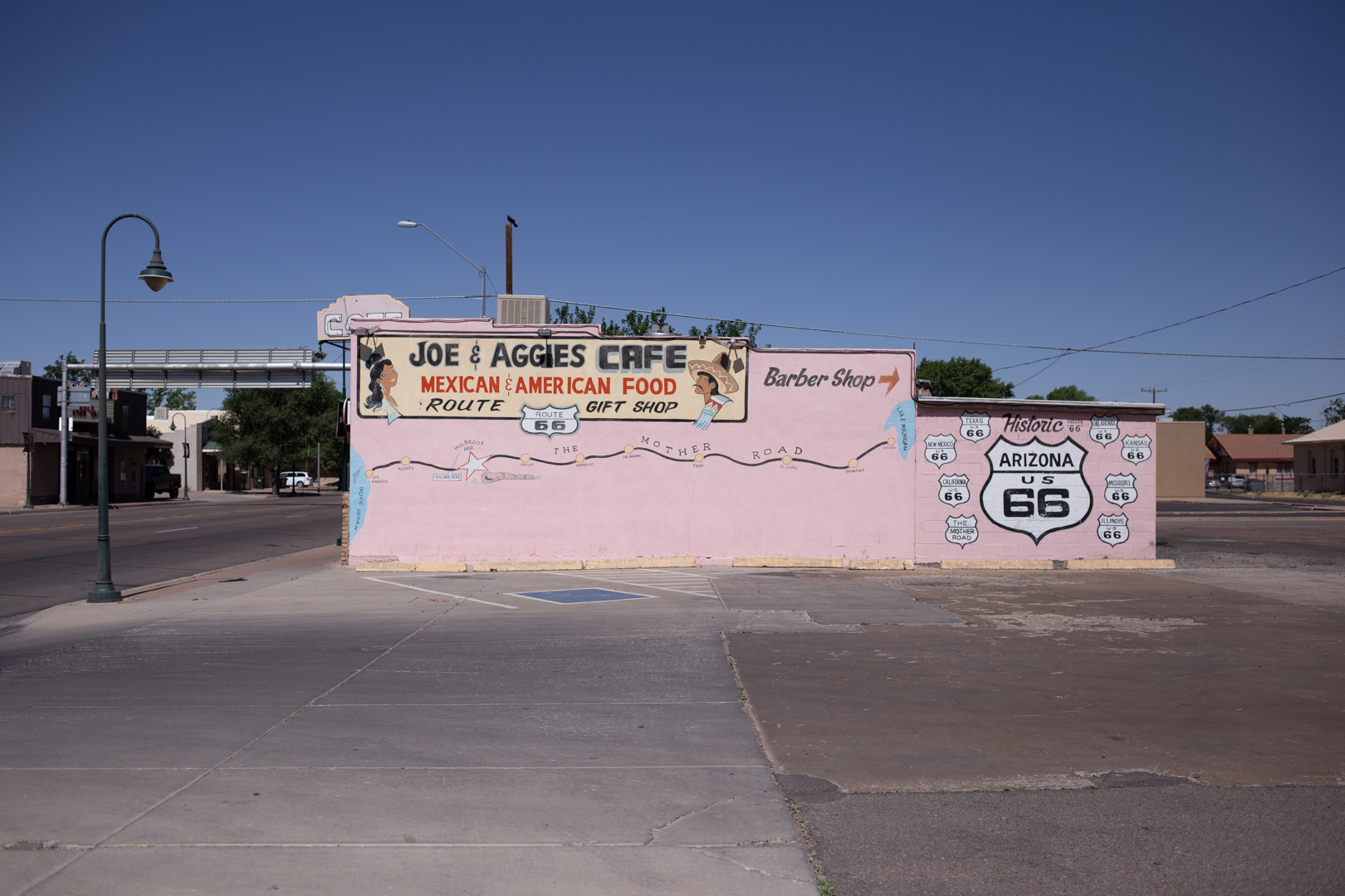
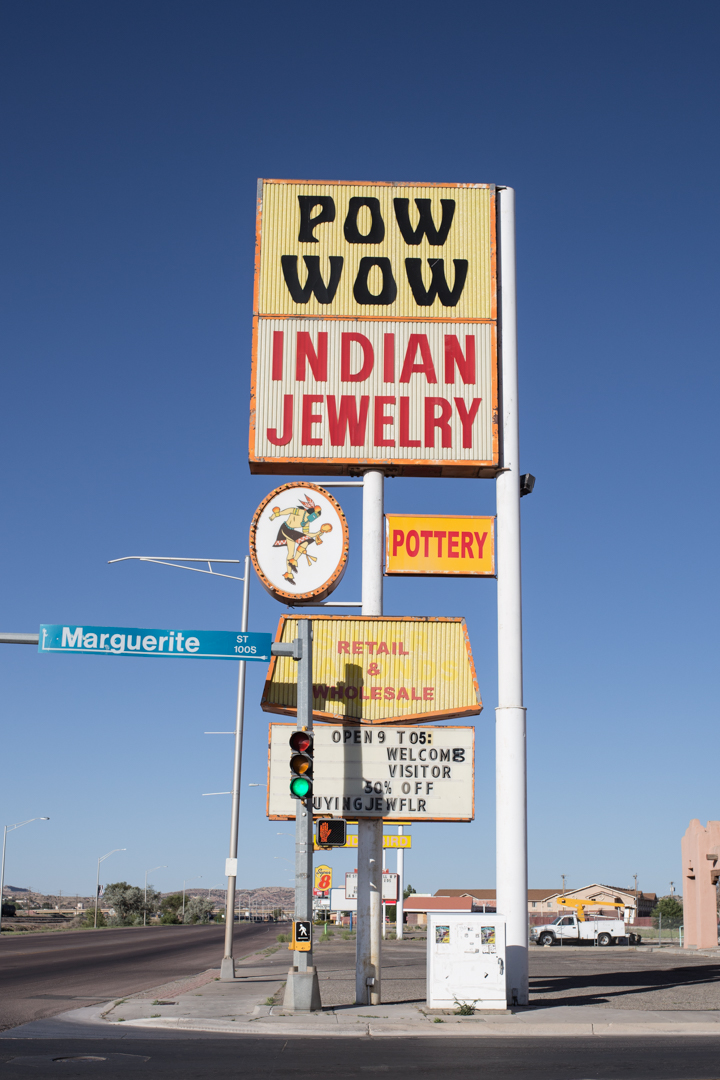
Before I decided to add Tucumcari to my itinerary at the last minute, Albuquerque was as far east as we were going to go in New Mexico. My friend Tag is from New Mexico and he was very generous with his tips on what to see while we were in town. Albuquerque is the most populous city in New Mexico and it’s divided into quadrants by Central Avenue. Central Avenue was part of old Route 66 from 1937 until the highway was officially decommissioned in 1985, but the area began to decline economically when Interstate 40 was built in the ‘60s.
We only spent a day and a half in ABQ, but we drove the length of Central Avenue, visited a few Breaking Bad filming locations, explored a cemetery, ate at the Dog House and met a few local giants.


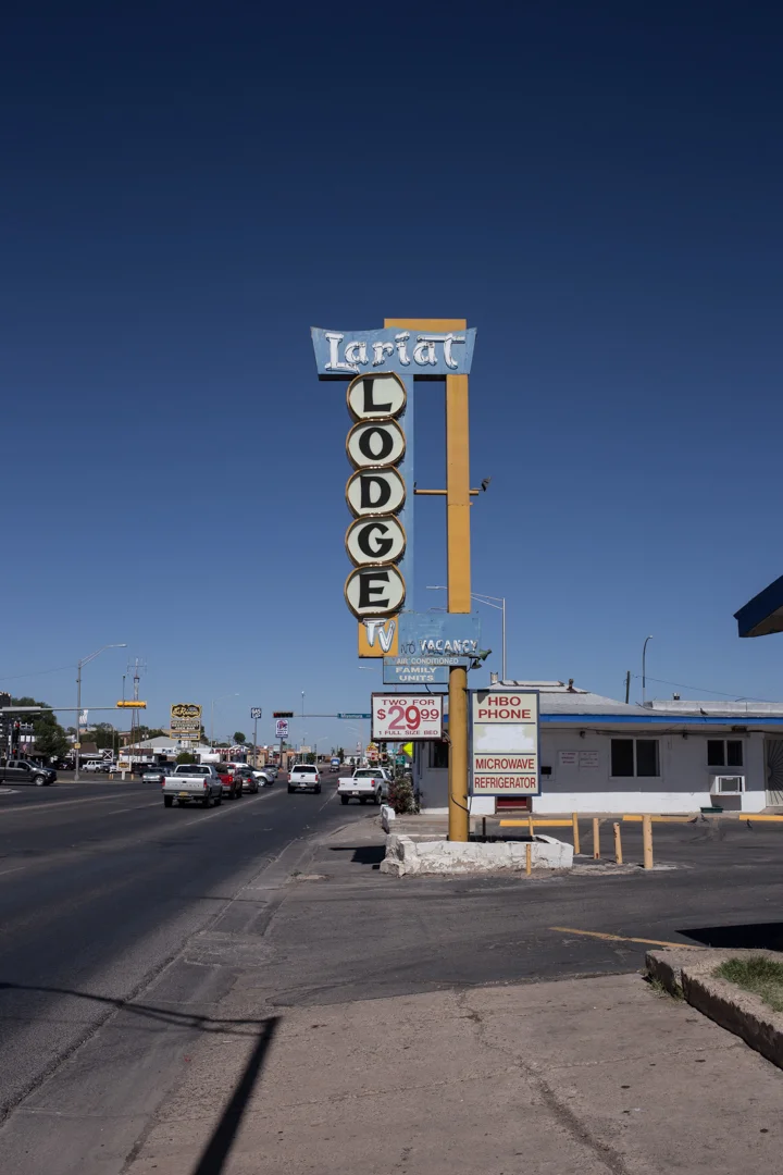
We stayed for one night at the Monterey Non-Smokers Motel located in the Old Town neighborhood. The location was excellent—right on Central Avenue and adjacent to several other historic motels and restaurants—the room was clean and the staff was friendly. I can’t think of one time that I’ve been let down by choosing a motel or restaurant based solely on its signage and the Monterey Motel neon sign looks just as good in the daylight as it does lit up at night.
A lot of the motels on Central Avenue have fallen into disrepair or have a bad reputation, but it’s not all doom and gloom in ABQ. The El Vado Motel, located right next to the Monterey, has recently undergone an $18 million renovation. Opened in 1937, the El Vado sat vacant for several years after it closed in 2005. The previous owner had wanted to tear down the motel and build luxury townhouses, but the city fought to seize the property (something we could use more of here in New York).


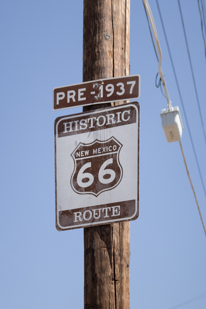
In the morning, we had breakfast at the El Camino Dining Room, located on a section of the pre-1937 alignment of the Mother Road, and right across from arguably the best sign in ABQ, the El Camino Motor Hotel. The El Camino was built in 1950 and is now owned by a local mother and daughter—the green chile huevos rancheros was excellent, and the classic diner decor is perfect.


On my way from ABQ to Tucumcari, I couldn’t resist stopping at Clines Corners, a rest stop serving Route 66 travelers since 1934. After the build up—like South of the Border, billboards herald its arrival for miles—it was a bit of a let down, but it’s a good place to use the restroom or shop for New Mexico souvenirs.


Located about halfway between ABQ and Tucumcari is the tiny town of Santa Rosa. Despite its desert-like climate, Santa Rosa has several natural lakes and was once a booming Route 66 town. I passed several diners with excellent signs but unfortunately didn’t have the time to stop for more than a few quick photos. In 1940, Santa Rosa was featured in John Ford’s adaptation of The Grapes of Wrath, but like most other Route 66 towns it feels as if time really stopped in the 1960s.

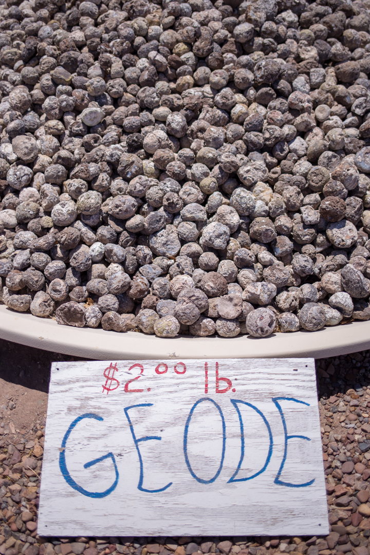
Jim Gray's Petrified Wood Co.
After striking out at the Rainbow Rock Shop and before we toured the Petrified Forest National Park, we stopped at Jim Gray’s Petrified Wood Company. Jim Gray’s, started by Jim and Cathy Gray nearly 50 years ago, is located just south of downtown Holbrook, Arizona on US-180. It’s 1.5 miles from the Wigwam Motel, and about 30 miles from the National Park.

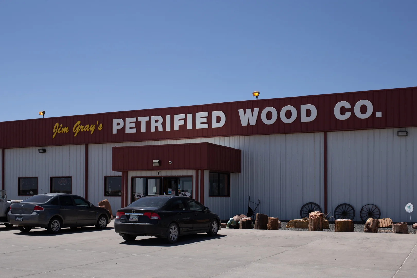


Jim Gray’s is still family operated and owned. They were originally known as the Holbrook Rock Shop, but have since become “the worldwide premier dealer of Arizona Rainbow Petrified Wood.” Wood from Jim Gray’s has found its way into the Smithsonian, the White House, and museums all over the world. We stopped at several rock shops and trading posts along old Route 66, but Jim Gray’s has the largest collection of petrified wood, by far.
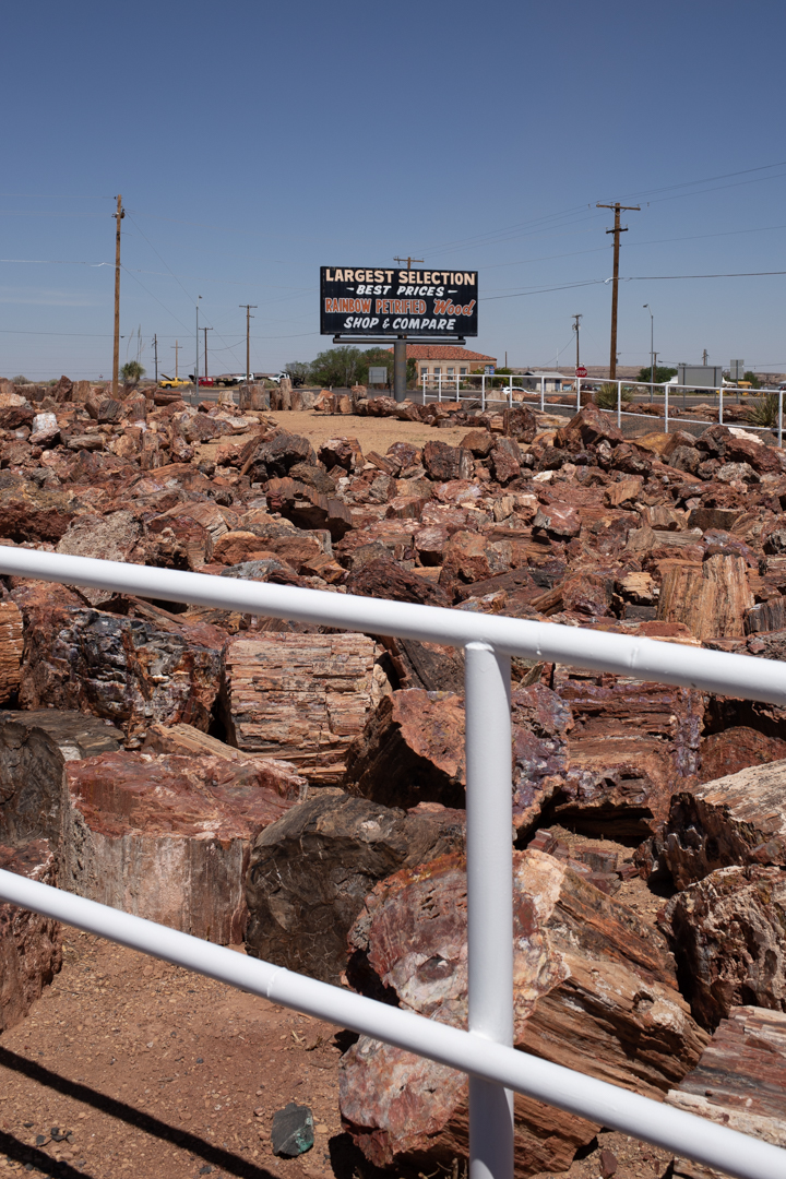

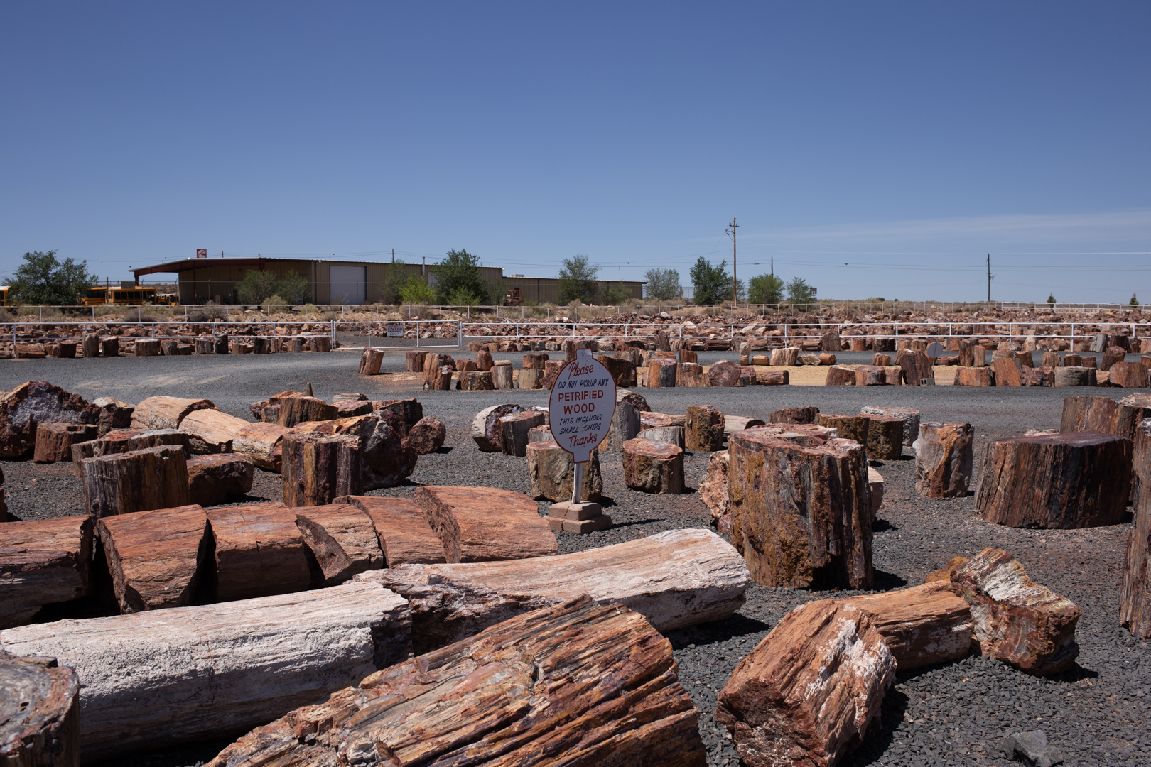

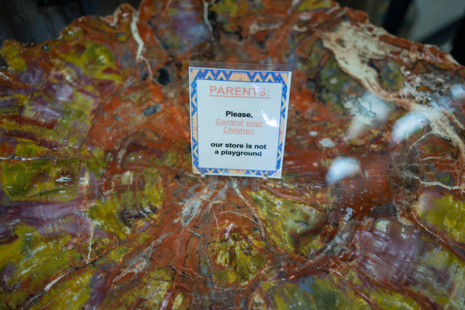
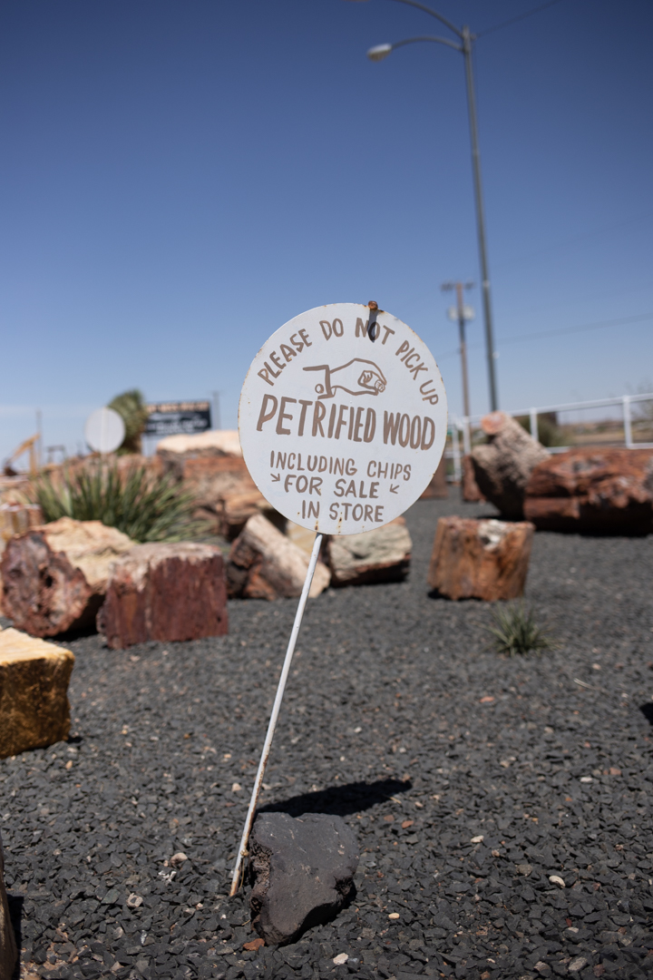
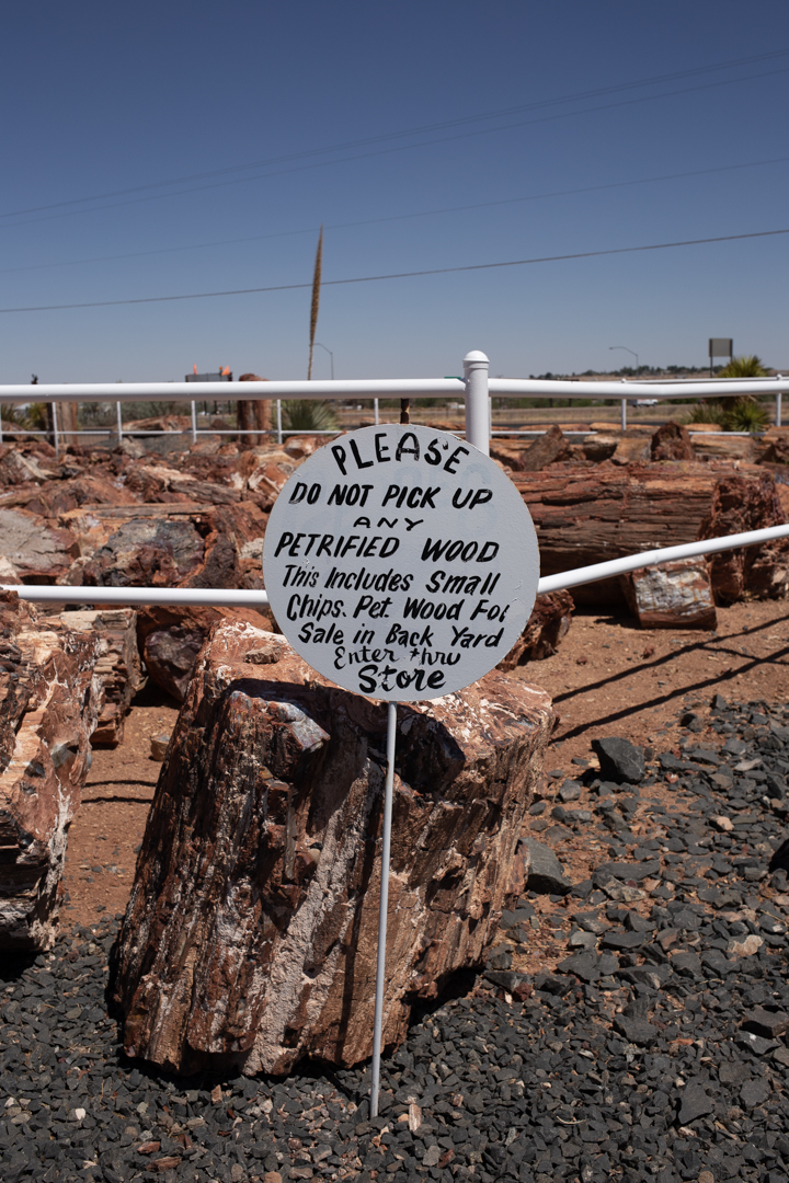
Taking specimens out of the National Park is illegal, and the park is monitored on the ground and from the air to prevent theft. Luckily for the Gray’s, they insist that "there's more petrified wood outside the park than in it," and they own the mineral rights to several pieces of land nearby. They do their own digging, cutting and polishing, turning the raw fossilized wood into polished rounds, clocks, bowls, paperweights, tabletops, bookends and other souvenirs.


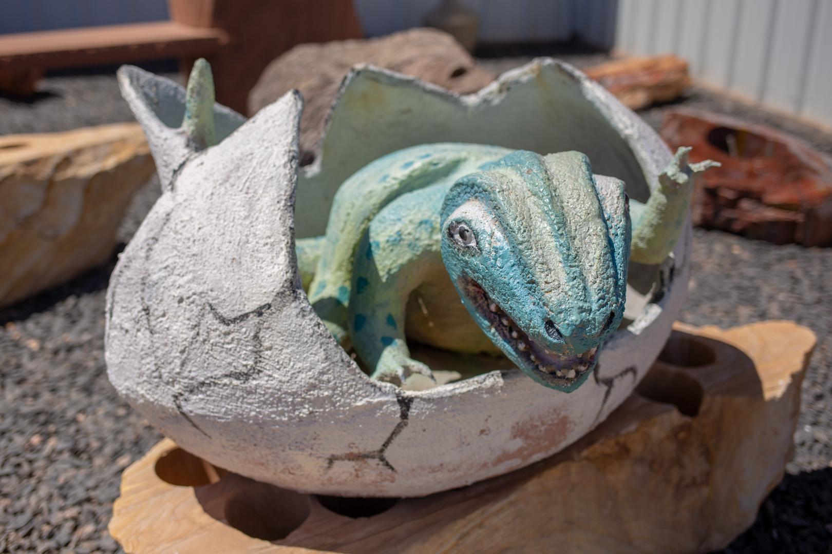
The shop is a bonafide tourist destination on its own, and it beckons visitors with painted billboards advertising its large selection of rocks, gems, minerals, fossils, souvenirs, Indian crafts, and rainbow petrified wood. It also has a squished penny machine, several large dinosaur statues and restrooms.
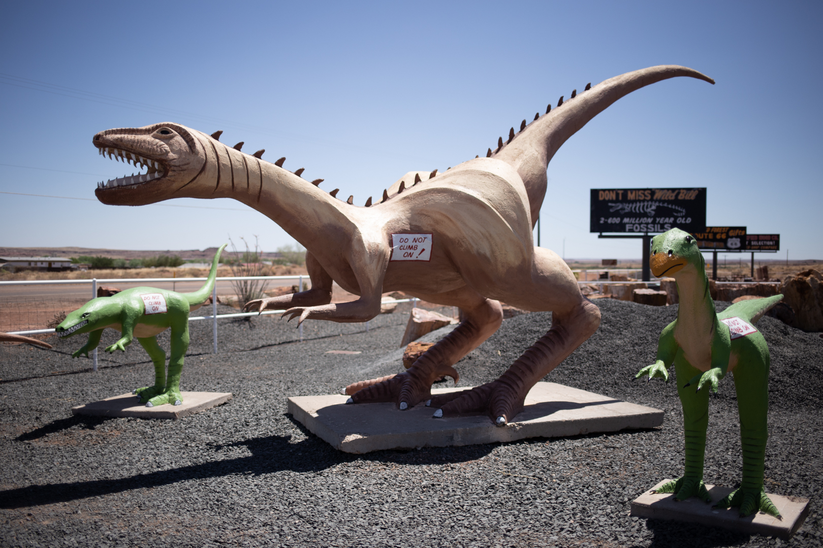


The most famous of its attractions is Wild Bill, a 2.9 million year old alligator. Wild Bill, bought by the Grays in Florida and named for a family friend, is exhibited for free alongside an extensive collection of polished wood and rock specimens from around the world.
Jim Gray’s Petrified Wood Company
147 US-180
Holbrook, AZ
Open 7 days a week, 8 am-6:30 pm

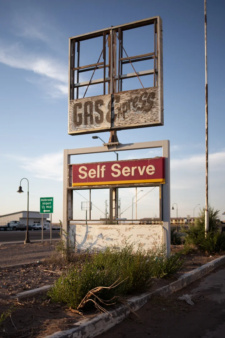
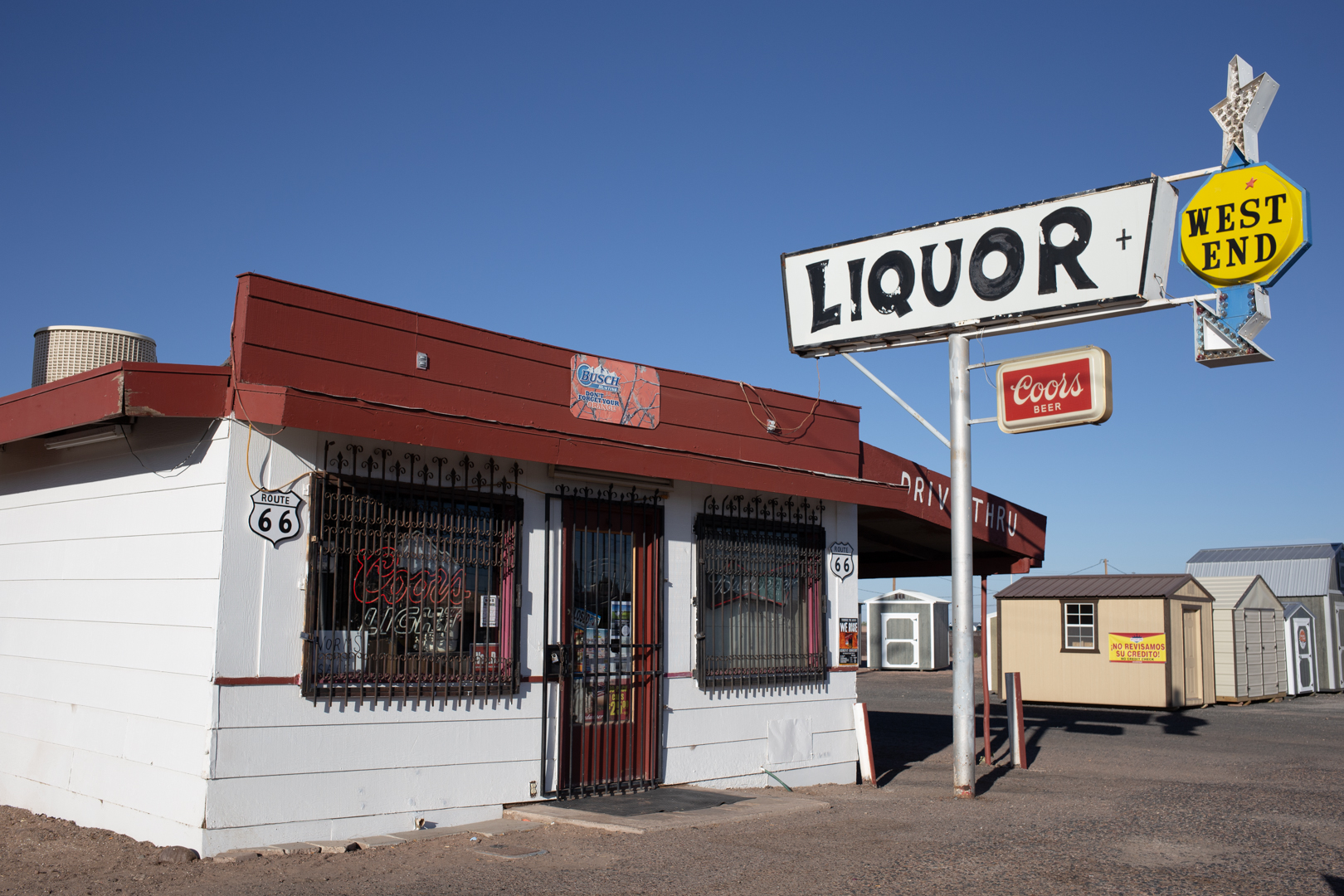
Holbrook
Picking a favorite town along any stretch of Route 66 would be like picking a favorite child, but Holbrook is definitely a strong contender. Not only is it home to one of the three remaining Wigwam Motels (and the last one I slept in), but it is full of fantastic signage, overcrowded souvenir shops and more kitsch per-square mile than any other place we stopped along the way from Flagstaff to Albuquerque.


According to the 2010 census, the population of Holbrook was just over 5,000 people. Originally inhabited by the Anasazi, Puebloans, Navajo and Apache, the town was founded in the 1880s, and named after the first chief engineer of the Atlantic and Pacific Railroad. In July of 1912, a 419-pound chondrite meteorite exploded over Holbrook, showering the area with 16,000 fragments. The largest piece, weighing 14.5 pounds, is currently housed at Arizona State University in Tempe.


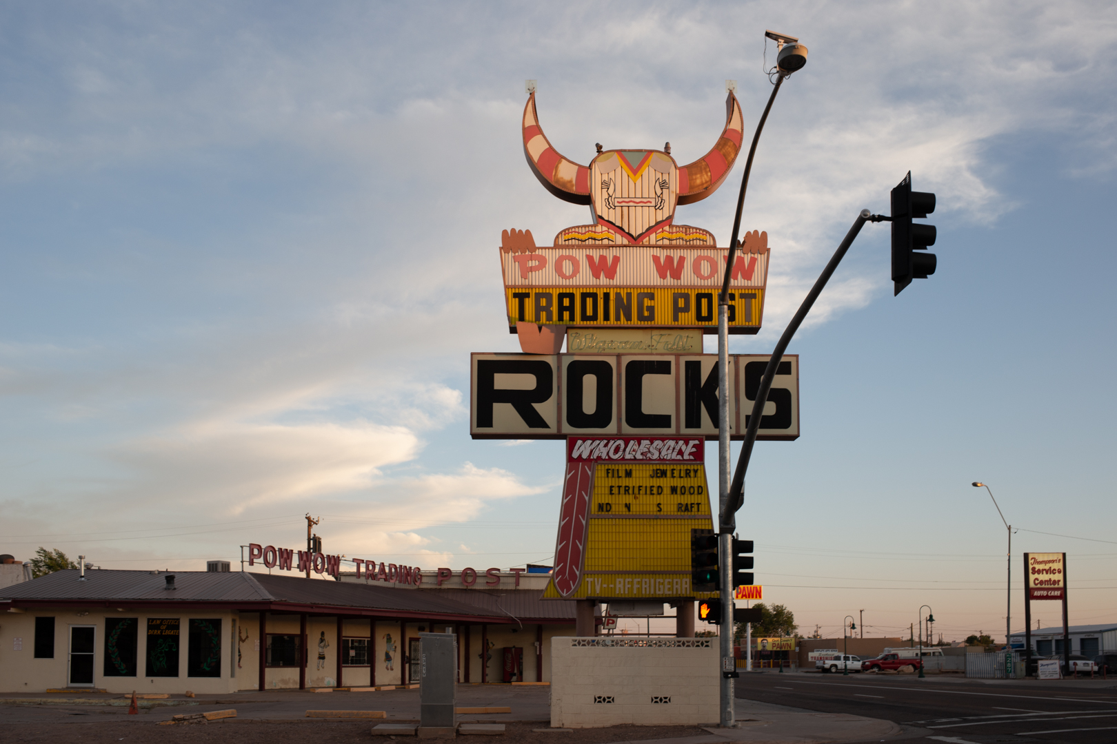


Route 66 was officially designated in 1926 and the Mother Road passed right through Holbrook and the nearby Petrified Forest National Park. Holbrook isn’t quite as iconic as Tucumcari and it doesn’t have an up-and-coming arts district or a burgeoning restaurant scene, but it’s full of charm and more than its fair share of roadside dinosaurs.


After checking into the Wigwam, JMP and I headed out to explore the tiny town and we weren’t disappointed with what we found. We ate dinner at the Mesa Restaurant, serving authentic Italian cuisine alongside seafood, steaks, ribs and burgers (all of which are advertised on a excellent neon sign). We explored as much as we could before the sun went down, and ended the night with a DQ blizzard, which we ate under another excellent sign while sitting across from the Holbrook cemetery.


The next morning, while waiting for the Rainbow Rock Shop to open (which, it never did), we explored more of the town including several dinosaurs, abandoned motels and smaller rock shops. On the way out of town, I couldn’t not make a quick stop at Bucket of Blood Street, so named for a saloon that once stood nearby. In 1886, a gunfight erupted in the bar, resulting in so much carnage that “the floors were said to be slick with a ‘bucket of blood.’”

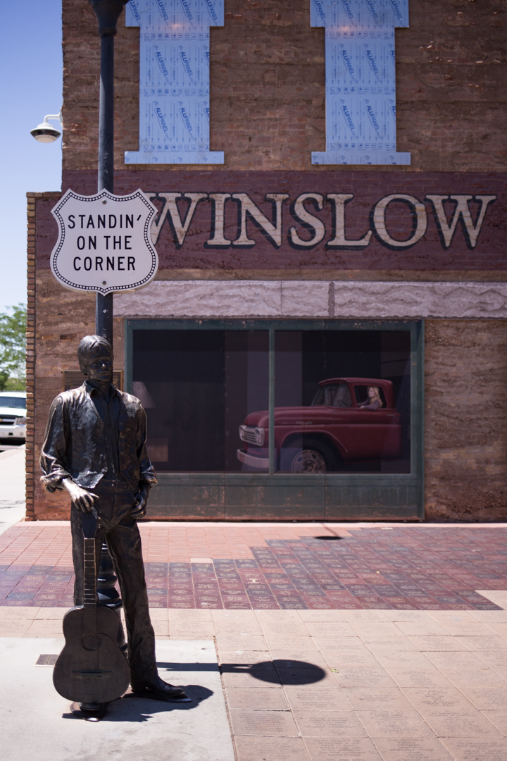
Winslow, Arizona
Winslow, Arizona is a town along old Route 66, east of Flagstaff, Twin Arrows, Two Guns and the Meteor City Trading Post. It’s about 20 minutes west of the Jack Rabbit Trading Post, 30 minutes west of Holbrook and 60 miles from the Petrified Forest National Park. Winslow wasn’t on my radar before our Route 66 trip back in June, but we had time before we had to check into the Wigwam Motel so we decided to stop.
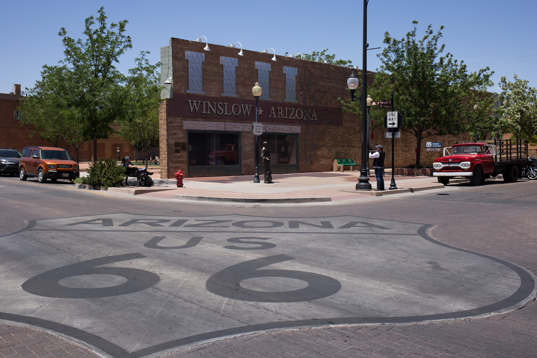


My co-pilot and frequent road trip collaborator, Jean-Marie, reminded me that I most certainly had heard of Winslow, Arizona—and you probably have too. The 1972 song Take It Easy, penned by Jackson Browne and Glenn Frey, was the first single released by The Eagles. The song peaked at No. 12 on the July 22, 1972 Billboard Hot 100 chart and contained the lyrics, “Well, I'm a standing on a corner in Winslow, Arizona and such a fine sight to see. It's a girl, my Lord, in a flatbed Ford slowin' down to take a look at me." The song was the opening track on the band's debut album; it has been included on all of their live and compilation albums and coincidentally (or not) it was playing outside of the souvenir shop when we stopped.


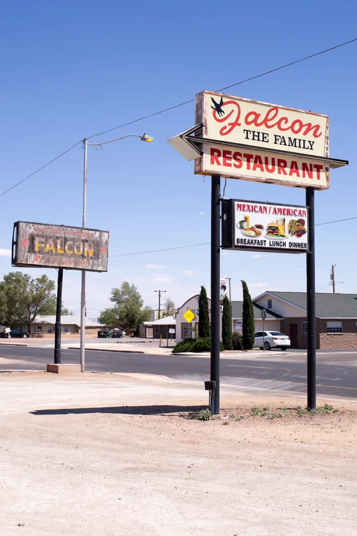


Apart from its tenuous connection to fame, there isn’t much to see in Winslow (apart from the Falcon The Family Restaurant’s wonderful signage). But you have to hand it to a city with a population of less than 10,000 for turning its proverbial fifteen minutes into a bonafide roadside attraction.
Once a thriving Route 66 destination, the town declined rapidly after it was bypassed by I-40 in the late ‘70s. The Standin' On the Corner Foundation was formed to build tourism and in 1999—funded by donors whose names are inscribed in bricks on the ground—Standin’ On the Corner Park opened.


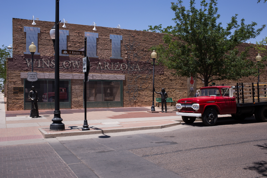
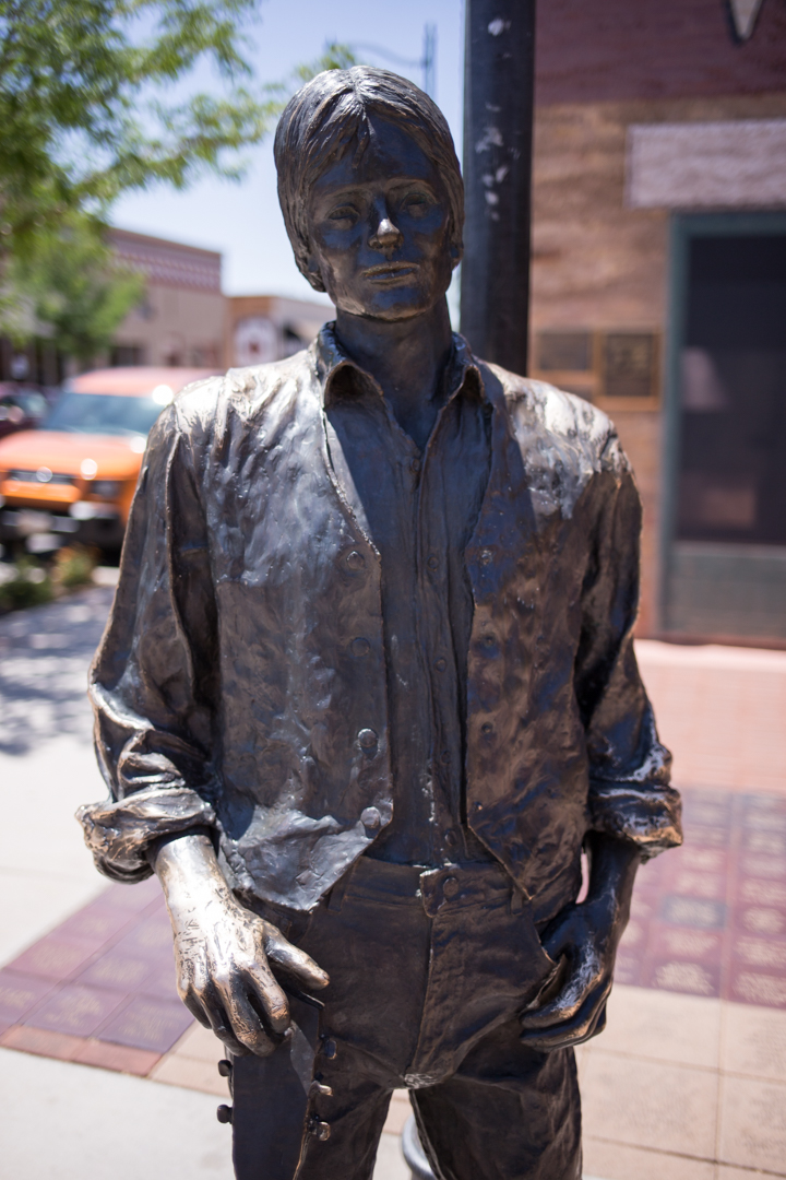

The small park features a two-story trompe l'oeil mural by John Pugh on the surviving brick face of a building that burned down in 2004. Two bronze statues stand in front of the wall, one of a life-sized man who is standing on the corner with a guitar by his side, and one of Glenn Frey, who died in 2016. A red flatbed Ford—slowin' down to take a look at me—is parked nearby.

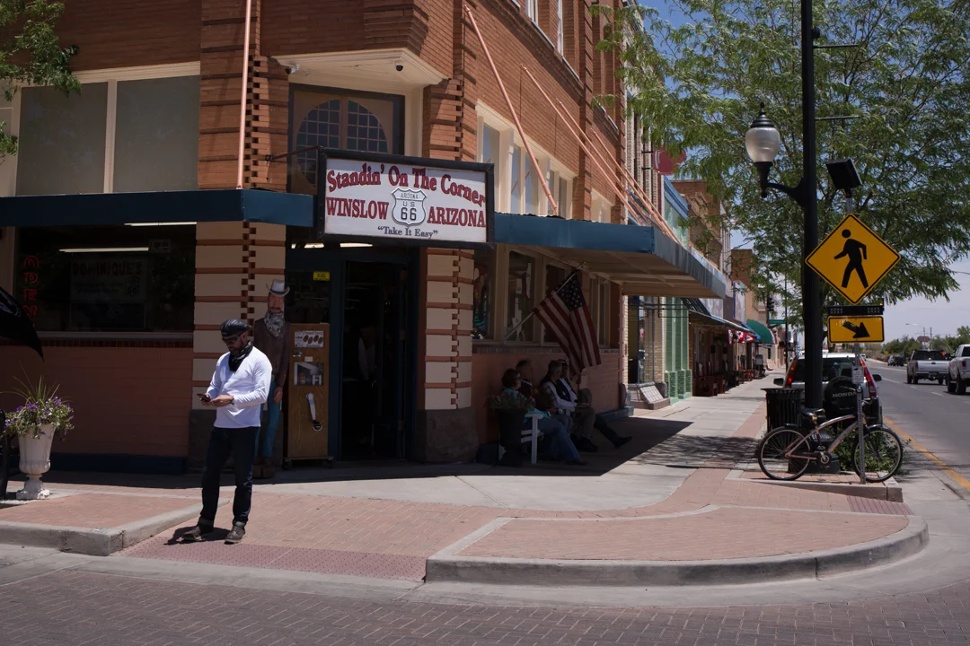
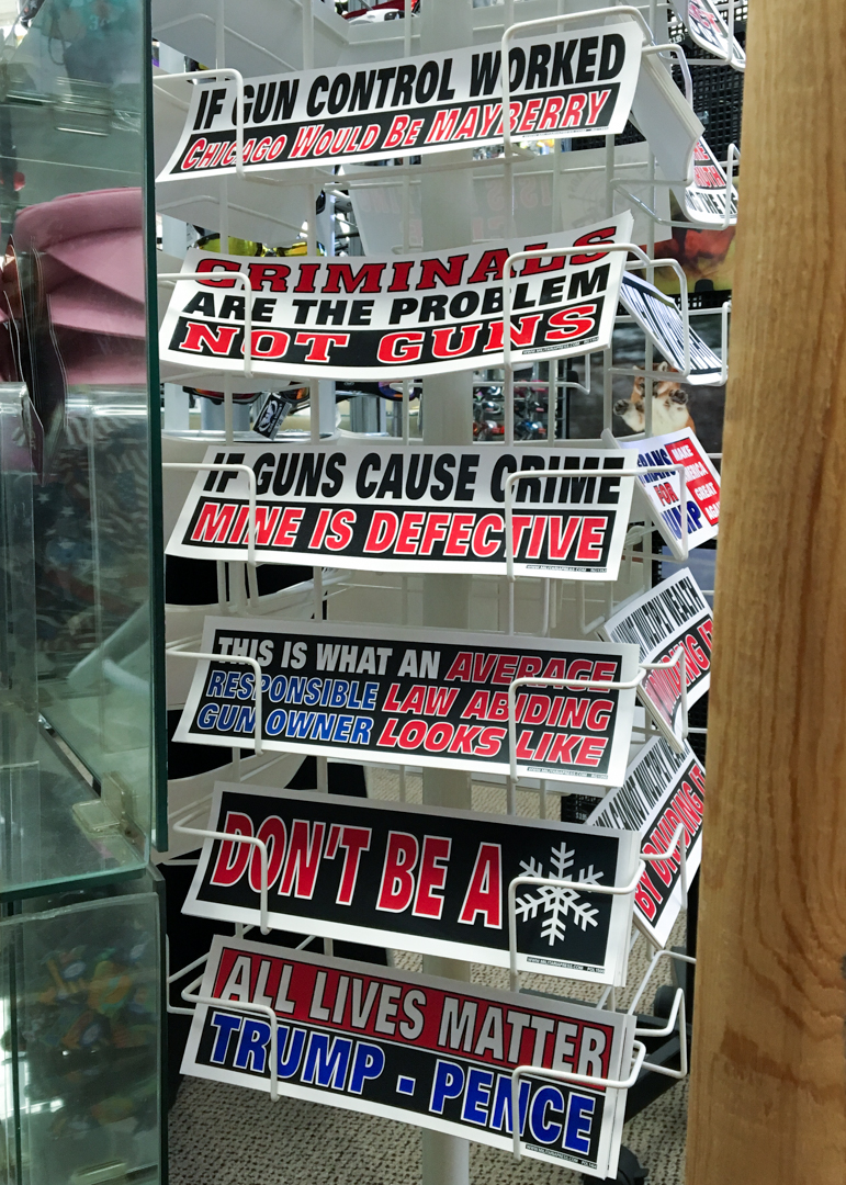


Across the street is a souvenir shop—also called Standin’ On the Corner—where you can squish a penny and buy Route 66 souvenirs or (disturbingly) pro-Trump bumper stickers and hats. Diagonal to the souvenir shop is a coffee shop and we sat outside sipping iced coffees and watched in amusement as families steadily piled out of their cars to take photos of themselves—you guessed it—standin’ on the corner (such a fine sight to see).
Standin’ On the Corner Park
Corner of Kinsley and E 2nd Street
Winslow, AZ
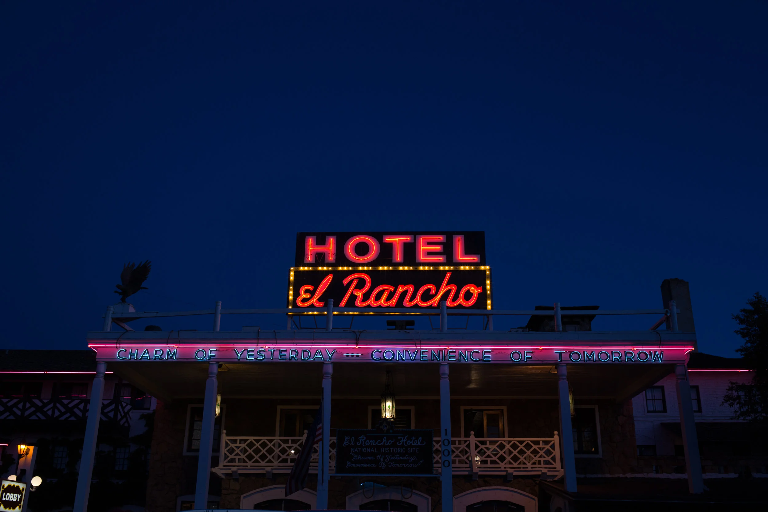
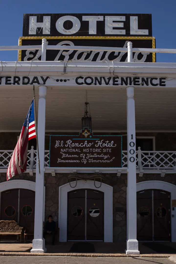
El Rancho

The El Rancho hotel and motel in Gallup, New Mexico, opened in 1936. It was built by film director D. W. Griffith as a base for numerous movie productions. As a result, the hotel has hosted hundreds of movie stars over the years, including Errol Flynn, Gregory Peck, Humphrey Bogart, Jane Fonda, Jimmy Stewart, Joan Crawford, Katherine Hepburn, Kirk Douglas (still alive!), John Wayne, Lucille Ball, Mae West, Rita Hayworth and Ronald Reagan. As you drive along Route 66, there are billboards for miles advertising the El Rancho’s “celebrity” credentials, although most of the people used in the advertising campaign haven’t stayed at the El Rancho (or any other hotel) for quite some time.


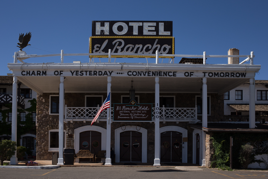

This was the first trip that I’ve taken where every hotel that we stayed in was just as much of an attraction as our other stops. Route 66 has no shortage of roadside motels but the El Rancho—older than a lot of the other surviving hotels—feels special. There isn’t much to see in Gallup (be sure to say hi to Dude Man), but it’s a great place to stop for the night in between Holbrook and Albuquerque.


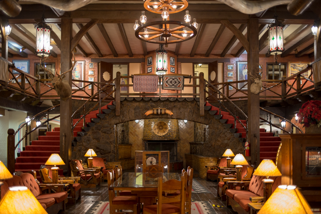


The rooms are all named for its famous past residents, and they’re spacious and clean. If you don’t want to stay over I recommend at the very least stopping in to see the beautiful lobby or to have a drink in the 49er Lounge, named one of the Top 50 bars in the US by Esquire magazine. We had dinner and breakfast in the hotel restaurant and both meals were fantastic—green chile enchiladas (when in New Mexico…) and the crispiest pancakes I’ve ever had.


The El Rancho has a lot of competition among all of the classic neon signage to be found in Gallup and along Route 66, but the El Rancho holds its own with a blinking sign that reads both “motel” and “hotel.” Their slogan is “the charm of yesterday with the convenience of tomorrow,” and while I’m not so sure the latter is still true, the El Rancho more than makes up for it in the charm department.
El Rancho
1000 E. Highway 66
Gallup, NM 87301

Petrified Forest National Park
I am constantly blown away by the variety of landscapes that you can find without ever leaving the US, and Petrified Forest National Park is one of those places—like White Sands or Joshua Tree—that feels otherworldly. Petrified Forest National Park is located in the greater Painted Desert in northeastern Arizona. The Painted Desert accounts for about 1,500 square miles of the park’s 150,000 acres, but the main environment is short-grass prairie.


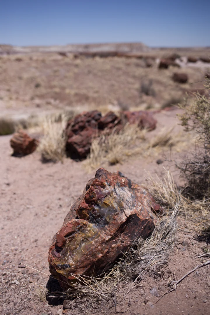
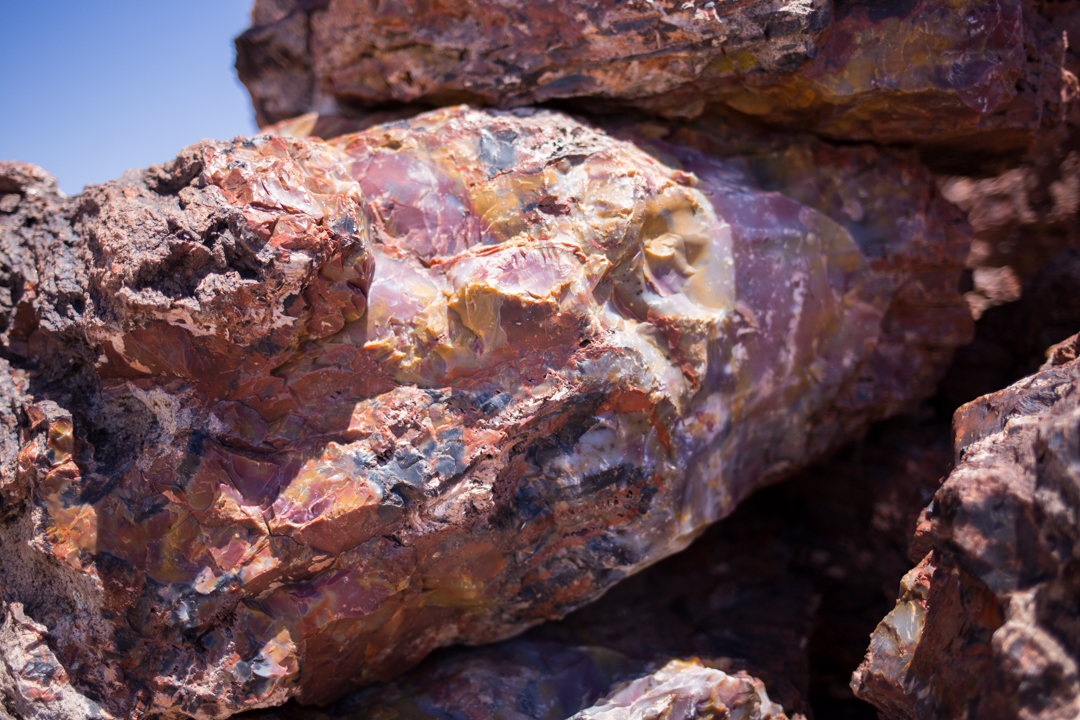
The park is so named for the large amount of petrified wood found within—fossils of fallen trees that lived 225 million years ago when the climate was humid and sub-tropical. Streams flowing across the plain carried trees and other plants and animals, most of which decayed normally.
Occasionally, organic matter is buried so quickly by sediment containing volcanic ash that it becomes fossilized when silica from the ash forms quartz crystals in place of the organic matter. Traces of iron oxide and other substances create the color variation, and millions of years later you have petrified wood—it retains the shape and texture of the original wood, but polishes to a shine like any other crystal.


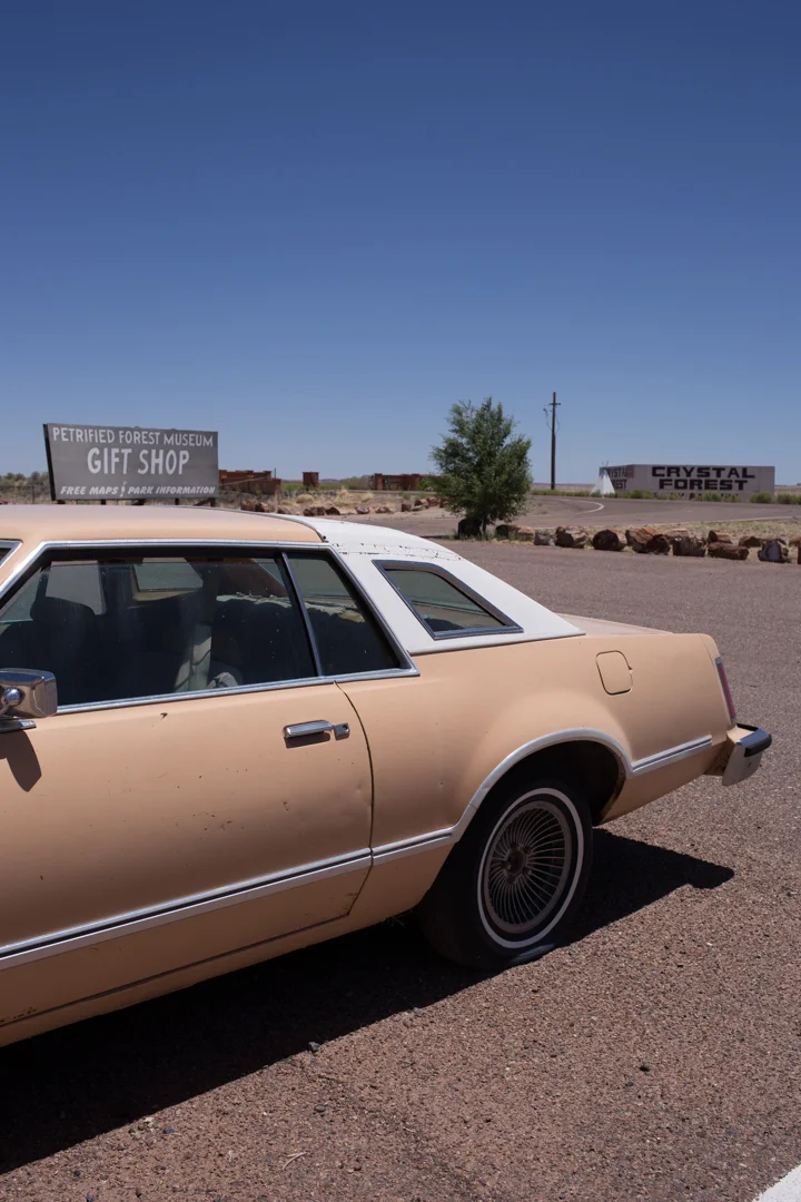


Taking petrified wood from the park—even a small chip—is against federal law, but there are plenty of places nearby to buy rough or polished specimens in all shapes and sizes. I had never really seen much petrified wood until visiting Arizona but its in every trading post and souvenir shop that we stopped at along the way. I’m shocked that there is any left in the national park. There are two large shops conveniently located right outside of the park, with restrooms, snacks and some dinosaurs that have definitely seen better days.


We mostly drove through the park, stopping to get out and take photos whenever something caught our eye (which was often). There is so much more to the park than just petrified wood, including Newspaper Rock, the Agate Bridge, the teepees (not to be confused with the Wigwam, which we had stayed in the night before), the Blue Mesa and the rainbow and crystal forests. On the Giant Logs trail you’ll find just that, including “Old Faithful,” a huge log that is almost 10 feet across at its base.


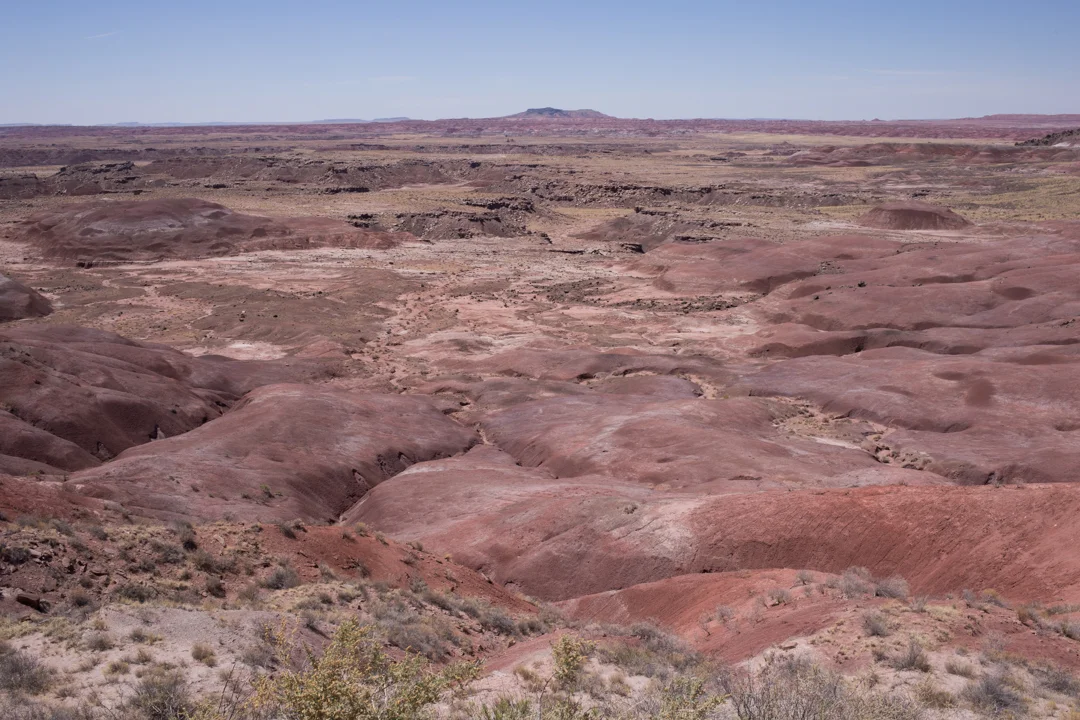

I’ve never been to the Grand Canyon, but some of the sweeping views felt like we were getting close. In fact, the Painted Desert is a part of the Colorado Plateau, which includes nine National Parks—Arches, Black Canyon of the Gunnison, Bryce Canyon, Canyonlands, Capitol Reef, Grand Canyon, Mesa Verde, Petrified Forest and Zion—and 18 National Monuments.


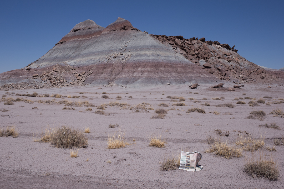
The park is open every day of the year except Christmas, and Arizona doesn’t observe Daylight Saving Time so it’s on Mountain time all year round. It is mostly dry in the desert, of course, but I was shocked to learn that the Petrified Forest has a monsoon season and it even snows in the winter. It was bright, clear, hot and extremely windy when we went in June—so windy in fact that our map blew out of our car and I had to chase it across the plain.


Petrified Forest National Park is the only national park to once have claimed a section of Route 66, which bisected the park until it was decommissioned in 1985 (Interstate 40 took its place). The park has preserved a small grassy section of the Mother Road, marked with a rusty car and a line of small, wooden telephone poles.
Petrified Forest National Park
The park stretches north and south between Interstate 40 and Highway 180.
There are two entrances into the park.

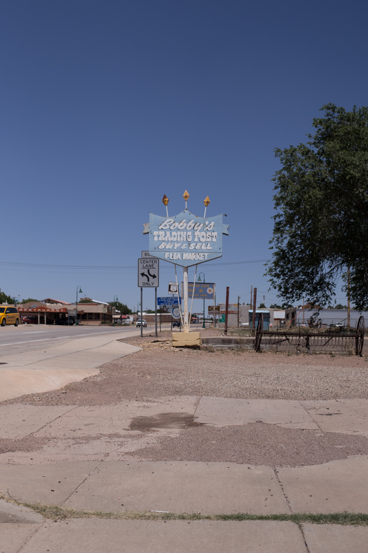
Tucumcari

Both of our flight times changed on our return flights from Albuquerque, which resulted in me dropping JMP off at the airport at around noon. I didn't have to be back to the airport for my flight until 11:30 pm, and I had the rental car until then, so I headed east along Route 66 to Tucumcari, New Mexico.


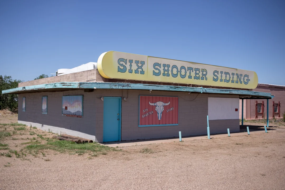
Tucumcari was founded in 1901 as a construction camp for the Chicago, Rock Island and Pacific Railroad. The camp was called Ragtown and then Six Shooter Siding before being formerly renamed Tucumcari, after a nearby mountain, in 1908. It's the largest city on Route 66 between Amarillo, Texas and Albuquerque, with a population of less than 5,000 as of 2016.


In its heyday, the town attracted Route 66 travelers to one of its 2000 motel rooms with billboards for miles in each direction proclaiming "Tucumcari Tonite!" They later adopted the tagline "Gateway to the West," but voted to return to their previous slogan in 2008 (a scene including one of the billboards is painted on the side of the Blue Swallow Motel).


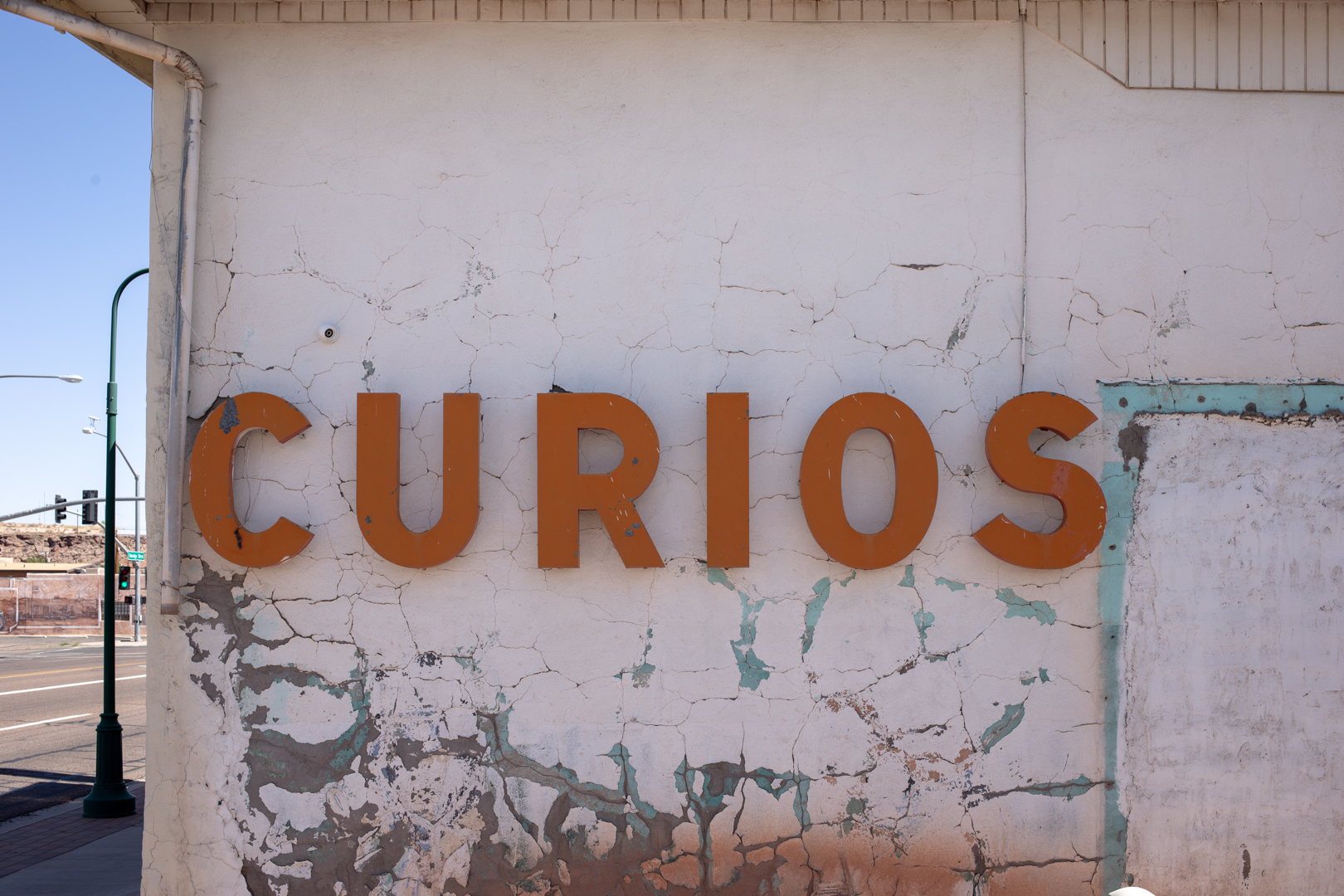
I didn't have time to spare, but I easily could have spent days exploring the abundance of abandoned businesses and neon signs that line both sides of the road. I raced from sign to sign—getting in and out of my blissfully air conditioned car—and I eventually became so overwhelmed (and overheated) that I stopped for lunch at Del's, in business since 1956. The only other place I went inside of was Tepee Curios, a former Gulf gas station, where I bought a tepee pin and squished a souvenir penny.


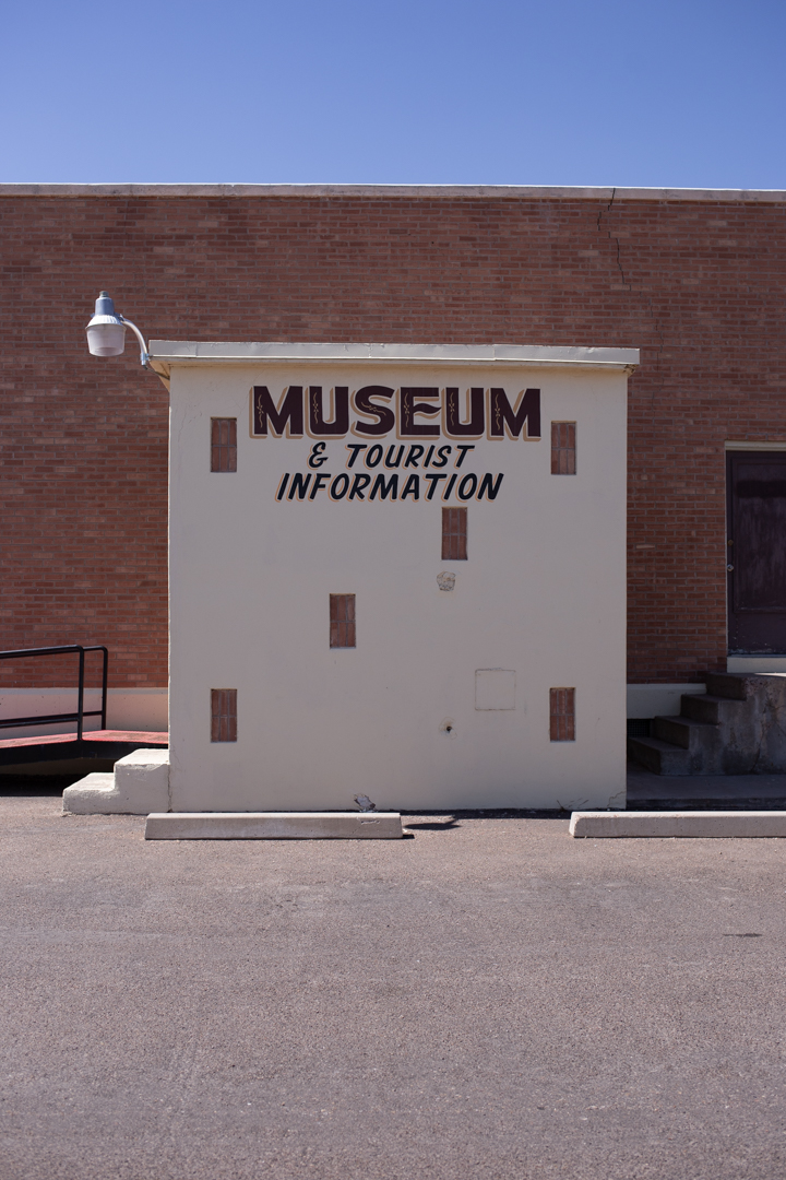
While most of the motels and restaurants appear to be abandoned, and the status of some businesses wasn't immediately clear, Tucumcari—somewhat improbably—lives on. Although I didn't have time to visit any of them, Tucumcari has four museums: Mesalands Dinosaur Museum, Route 66 Museum, Tucumcari Historical Museum and the Railroad Museum, and several historic motels are still welcoming road-weary travelers to spend the night.


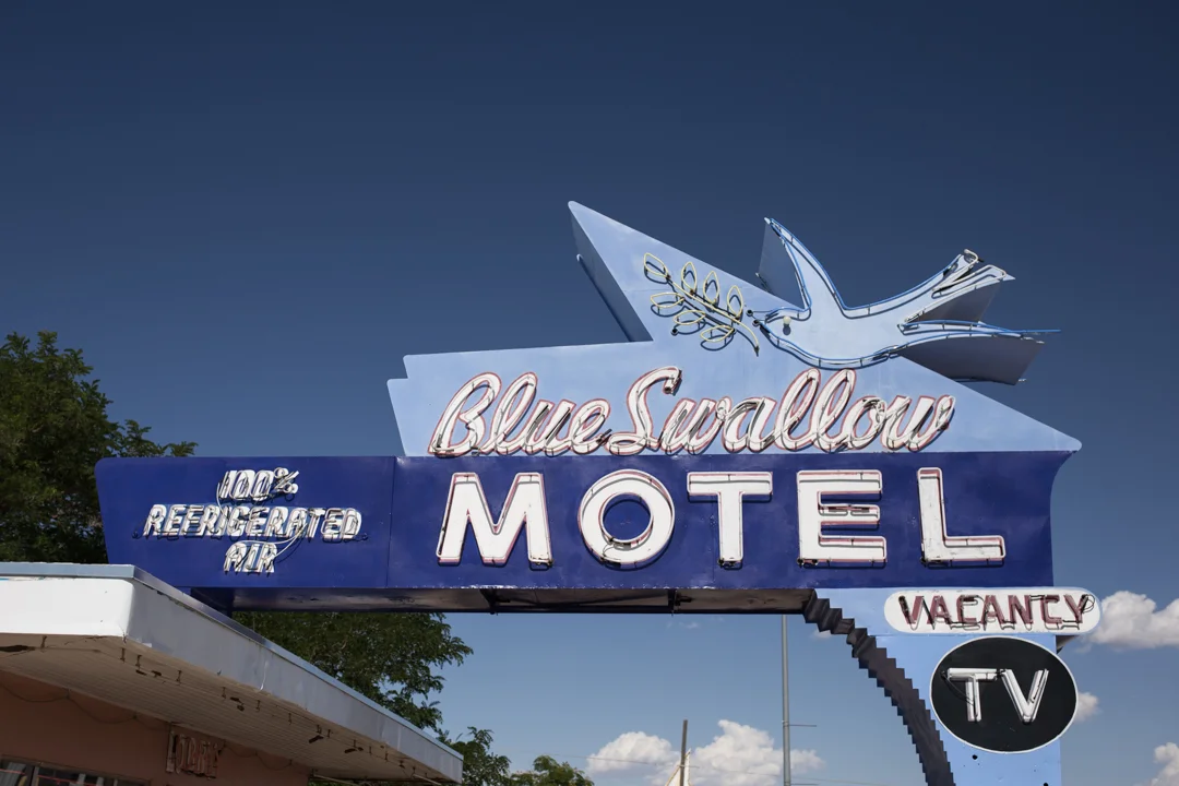


I only spent a few hours driving the 2.5 mile stretch through town, but Tucumcari was by far my favorite stop along Route 66. If I had an extra night, I would have loved to have spent it in the 100% refrigerated air of the Blue Swallow Motel, serving travelers along the Mother Road since 1939. The neon signs are beautiful in the daytime, but I won't feel complete until I also see them lit up at night.

Muffler Man: Dude Man

After a long day on (and off) the Mother Road, exploring trading posts (both open and abandoned) in Arizona, we crossed into New Mexico and headed to Gallup. We had a room booked for the night at the El Ranchero and I was eager to meet another Muffler Man.
But as we pulled into Gallup, I realized that I was feeling overwhelmed by all of the roadside delights that we had seen that day, so I intentionally drove past the Muffler Man, saving it for the next morning when I could fully appreciate him. I trace my awareness of this phenomenon to my first trip to Italy—after days and days of seeing important works of Art, I eventually reached a saturation point where I just couldn't absorb any more. Since Muffler Men are basically the American version of the David, this has happened to me on nearly every road trip I've taken. Luckily, all I need is a good diner breakfast or a few hours of sleep and I'm ready to enthusiastically collect delights again.


After seeing the very first Muffler Man ever made in Flagstaff, AZ I was slightly disappointed that there was only one left to see on our agenda for this trip. There are hundreds of Muffler Men spread out around the country but I get frustrated sometimes that I will probably never see them all at the pace I'm going. The Gallup Muffler Man (nicknamed "Dude Man") is the 19th fiberglass giant that I've met, but I might have better luck seeing every UniRoyal Gal since they're much more rare.


Dude Man stands on the roof of John's Used Cars, and while it's not technically located on Route 66, it's close enough to consider him a Route 66 attraction. I can't find any information on the provenance of Dude Man, but he appears to be well maintained. He has a cowboy hat and a pistol and wears jeans and a western-style shirt. I love the pennant flags that radiate around him, and the employees of John's were seemingly unbothered by me wandering in and out of their lot to take photos (his back side is visible from a nearby alley).
John's Used Cars
416 W Coal Avenue,
Gallup, NM 87301
Gates to the lot are closed after business hours, but Dude Man is visible at all times

Route 66: Gallup to Grants

I have had a lifelong dream of packing up everything I own (well, more like everything I need) and traveling along Route 66 from one end to the other. But I also like having a paycheck and health insurance, so until I can somehow find out how to survive without those, I'll have to settle for seeing Route 66 piece by piece. On our recent trip out west we traveled a good chunk of the Mother Road, from Flagstaff, Arizona to Tucumcari, New Mexico.


President Eisenhower's Federal Interstate Act of 1956 called for the creation of four-lane highways across the country and by the late '60s most of Route 66 was replaced, chopped up or bypassed completely by I-40 in Arizona and New Mexico. Route 66 was officially decommissioned in June of 1985 (just two months before I was born!), although about 85 percent of the original road still exists.


Gallup, New Mexico is the largest city located between Flagstaff and Albuquerque. A large portion of the population is Native American, from the Navajo, Hopi and Zuni tribes. We stayed overnight at the El Ranchero (worthy of its own post) and headed east the next morning. JMP got in the driver's seat and when I offered to drive she replied, "so you can stop every five feet and take photos?" She knows me very well, of course, because that's exactly what I proceeded to do, and I didn't stop until a few days later when I boarded a plane back to New York.


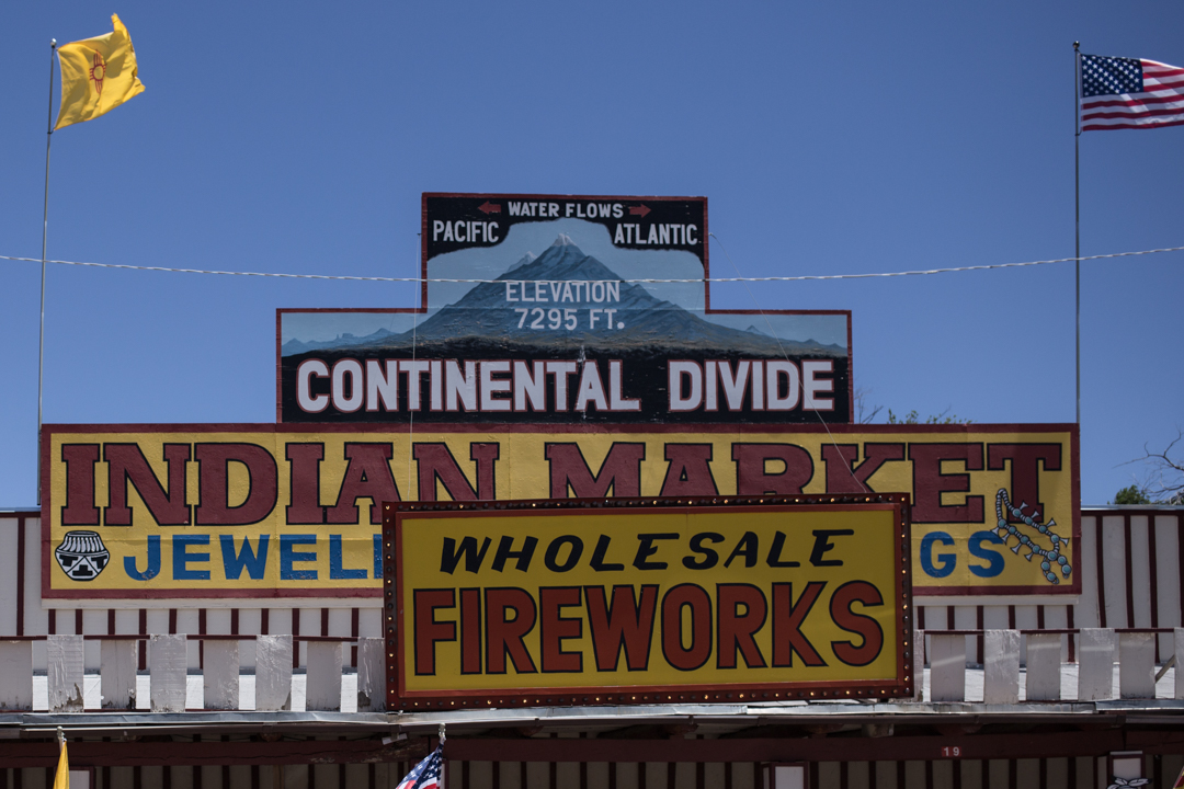
For anyone who knows me it might be surprising to hear that I didn't have much on our itinerary for some of the days. This flexibility allowed us to discover places like the abandoned diner or add extra stops when it looked like we'd have time, like the Rehoboth Mission Cemetery. The best thing about traveling on Route 66 is that you don't need to have an itinerary or to blindly follow your GPS from stop to stop. You're guided by the road, not the destination and we'd pull off whenever we saw something that caught our interest—like the Continental Divide, which we both learned is the point where all water to the west flows to the Pacific Ocean and water to the east flows to the Atlantic.
When I noticed that our drive from Gallup to Albuquerque was looking a bit sparse, I consulted my friend Tag who grew up in New Mexico. He confirmed that there wasn't much to see between the two cities, but mentioned that we should try to pass through the Route 66 town of Grants.


We drove on I-40 when we had to, but tried to follow the Historic Route 66 signs as much as we could. Grants is a small town (population less than 10,000) about halfway between Gallup and Albuquerque. Founded as a railroad camp in the 1880s, residents found success with logging, Route 66 tourism, uranium ore mining and agriculture—at one time Grants was even known as the carrot capitol of the US.


Today, like most of the Route 66 towns we drove through, Grants feels like a ghost town, full of abandoned homes and businesses. The Hollywood Diner was a favorite of mine, and it looks like it has had several lives—we found evidence that it has housed not only a diner but a tattoo shop and pet grooming business (hopefully not at the same time?). Some of the buildings have been left to crumble but others have been demolished entirely—nothing left but their ambitious neon signs standing guard, no longer beckoning travelers at night, but cracking and fading in the desert sun.
A lot of these photos are available as prints over in my Society 6 shop, and I will be adding more as I sort through the overwhelming amount of photos I took on this trip.