

Archive
- Abandoned
- Alabama
- Arizona
- Bahamas
- Books
- California
- Cemetery
- Climate
- Colombia
- Connecticut
- Diner
- Egypt
- Feature
- Florida
- Friday Fun
- Georgia
- Holidays
- Illinois
- Iowa
- Italy
- Kentucky
- Louisiana
- Maryland
- Massachusetts
- Mississippi
- New Jersey
- New Mexico
- New York
- North Carolina
- Novelty Architecture
- Ohio
- Pennsylvania
- Personal
- Peru
- Project 365
- Protest
- Rhode Island
- Roadside Attraction
- South Carolina
- Tennessee
- Texas
- Travel Guide
- Virginia
- Walks
- Washington DC
- West Virginia
- Wisconsin

Route 66: Albuquerque to Santa Rosa

This may actually be the last post about my AZ/NM Route 66 road trip—a trip I took back in the beginning of June. I’ve tried to space out the posts to prevent neon sign overload (is there even such a thing?), but we squeezed so much into just a few days that it’s truly taken me six months to process the entire trip. I’m about to leave tomorrow on another five-day trip—which will include a few stops at the very beginning of Route 66—so I’m currently operating at the height of my pre-road trip excitement.


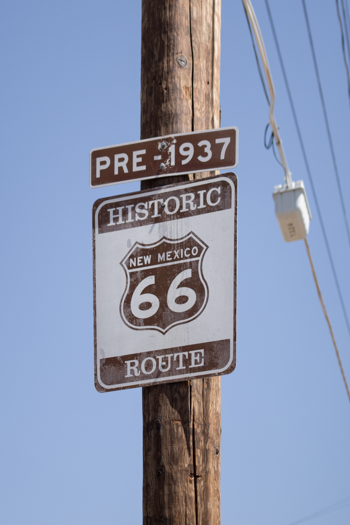
Before I decided to add Tucumcari to my itinerary at the last minute, Albuquerque was as far east as we were going to go in New Mexico. My friend Tag is from New Mexico and he was very generous with his tips on what to see while we were in town. Albuquerque is the most populous city in New Mexico and it’s divided into quadrants by Central Avenue. Central Avenue was part of old Route 66 from 1937 until the highway was officially decommissioned in 1985, but the area began to decline economically when Interstate 40 was built in the ‘60s.
We only spent a day and a half in ABQ, but we drove the length of Central Avenue, visited a few Breaking Bad filming locations, explored a cemetery, ate at the Dog House and met a few local giants.


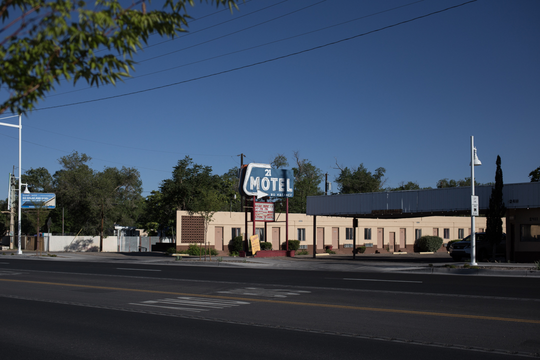

We stayed for one night at the Monterey Non-Smokers Motel located in the Old Town neighborhood. The location was excellent—right on Central Avenue and adjacent to several other historic motels and restaurants—the room was clean and the staff was friendly. I can’t think of one time that I’ve been let down by choosing a motel or restaurant based solely on its signage and the Monterey Motel neon sign looks just as good in the daylight as it does lit up at night.
A lot of the motels on Central Avenue have fallen into disrepair or have a bad reputation, but it’s not all doom and gloom in ABQ. The El Vado Motel, located right next to the Monterey, has recently undergone an $18 million renovation. Opened in 1937, the El Vado sat vacant for several years after it closed in 2005. The previous owner had wanted to tear down the motel and build luxury townhouses, but the city fought to seize the property (something we could use more of here in New York).


In the morning, we had breakfast at the El Camino Dining Room, located on a section of the pre-1937 alignment of the Mother Road, and right across from arguably the best sign in ABQ, the El Camino Motor Hotel. The El Camino was built in 1950 and is now owned by a local mother and daughter—the green chile huevos rancheros was excellent, and the classic diner decor is perfect.


On my way from ABQ to Tucumcari, I couldn’t resist stopping at Clines Corners, a rest stop serving Route 66 travelers since 1934. After the build up—like South of the Border, billboards herald its arrival for miles—it was a bit of a let down, but it’s a good place to use the restroom or shop for New Mexico souvenirs.


Located about halfway between ABQ and Tucumcari is the tiny town of Santa Rosa. Despite its desert-like climate, Santa Rosa has several natural lakes and was once a booming Route 66 town. I passed several diners with excellent signs but unfortunately didn’t have the time to stop for more than a few quick photos. In 1940, Santa Rosa was featured in John Ford’s adaptation of The Grapes of Wrath, but like most other Route 66 towns it feels as if time really stopped in the 1960s.
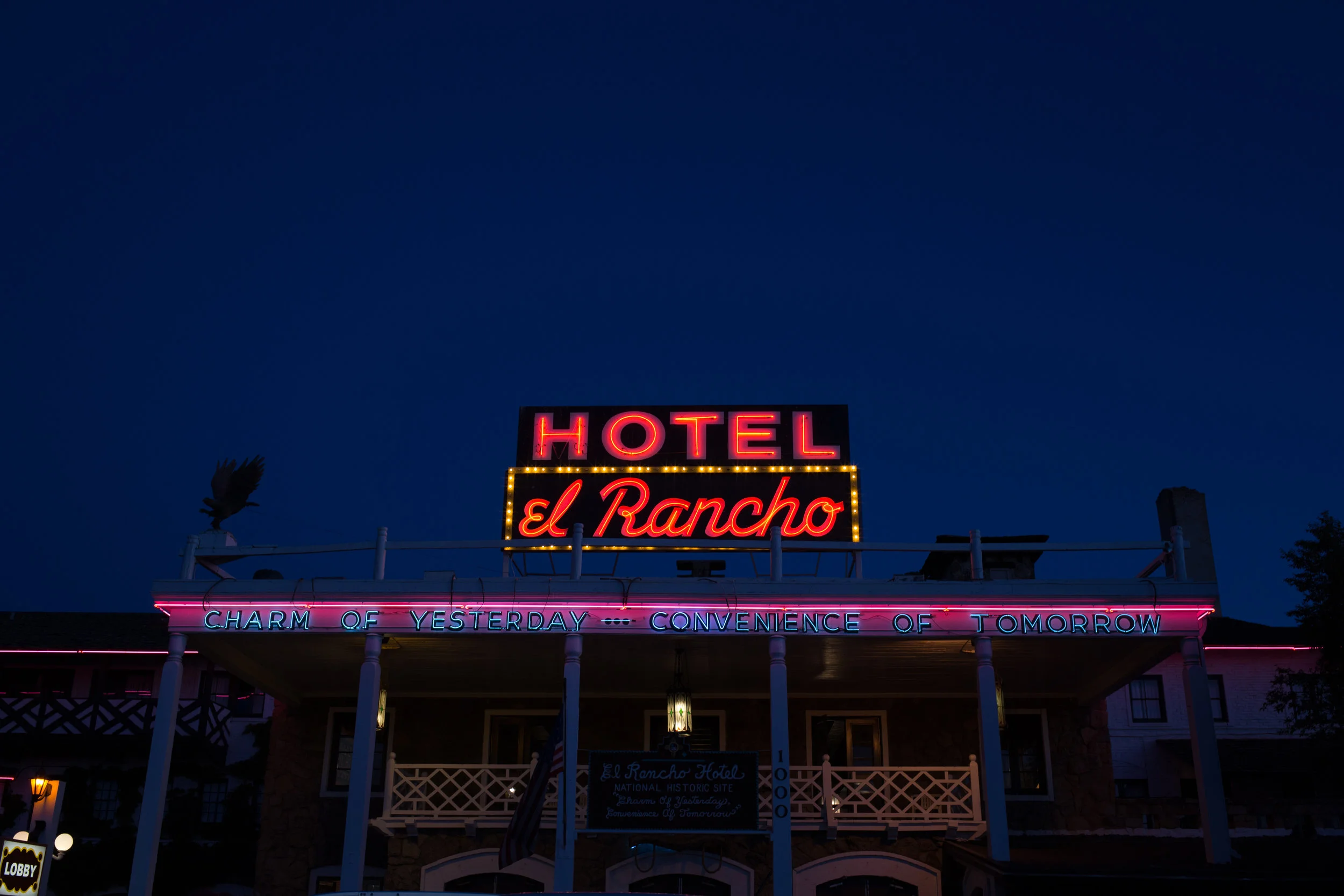
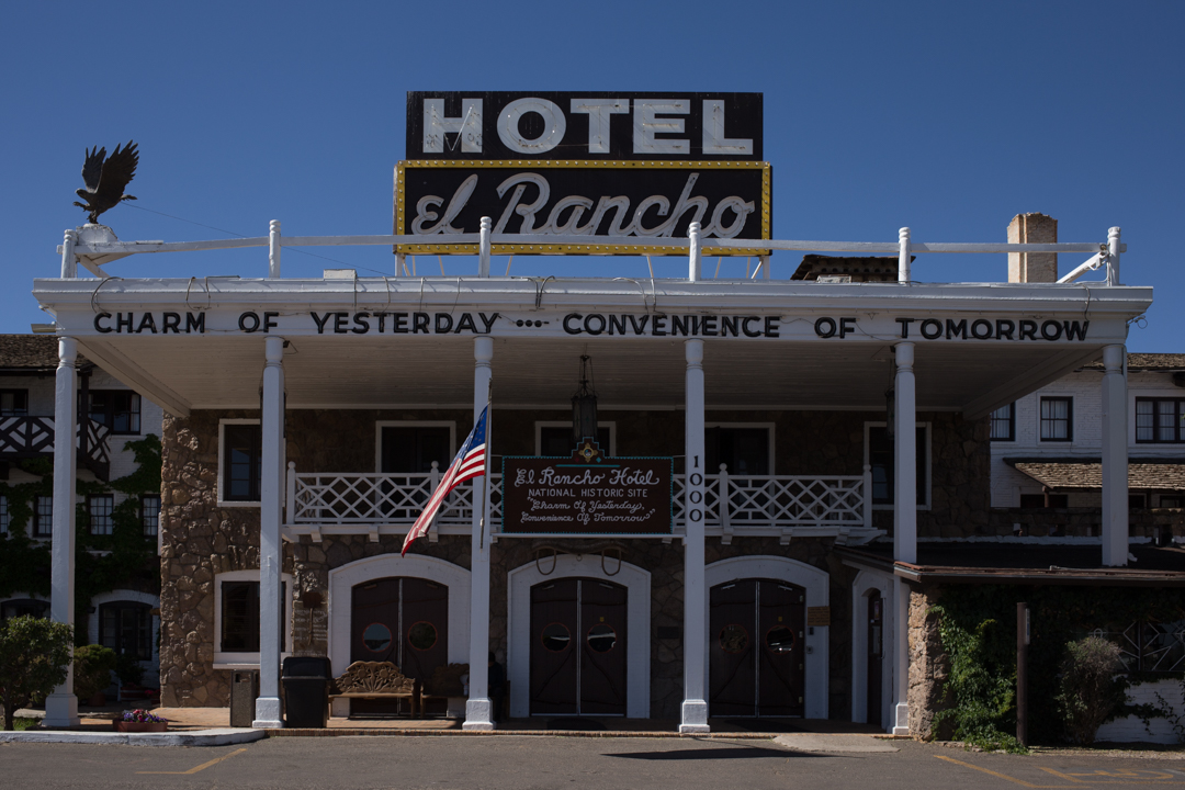
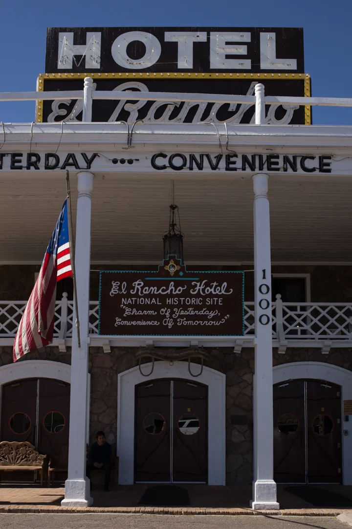
El Rancho

The El Rancho hotel and motel in Gallup, New Mexico, opened in 1936. It was built by film director D. W. Griffith as a base for numerous movie productions. As a result, the hotel has hosted hundreds of movie stars over the years, including Errol Flynn, Gregory Peck, Humphrey Bogart, Jane Fonda, Jimmy Stewart, Joan Crawford, Katherine Hepburn, Kirk Douglas (still alive!), John Wayne, Lucille Ball, Mae West, Rita Hayworth and Ronald Reagan. As you drive along Route 66, there are billboards for miles advertising the El Rancho’s “celebrity” credentials, although most of the people used in the advertising campaign haven’t stayed at the El Rancho (or any other hotel) for quite some time.


This was the first trip that I’ve taken where every hotel that we stayed in was just as much of an attraction as our other stops. Route 66 has no shortage of roadside motels but the El Rancho—older than a lot of the other surviving hotels—feels special. There isn’t much to see in Gallup (be sure to say hi to Dude Man), but it’s a great place to stop for the night in between Holbrook and Albuquerque.


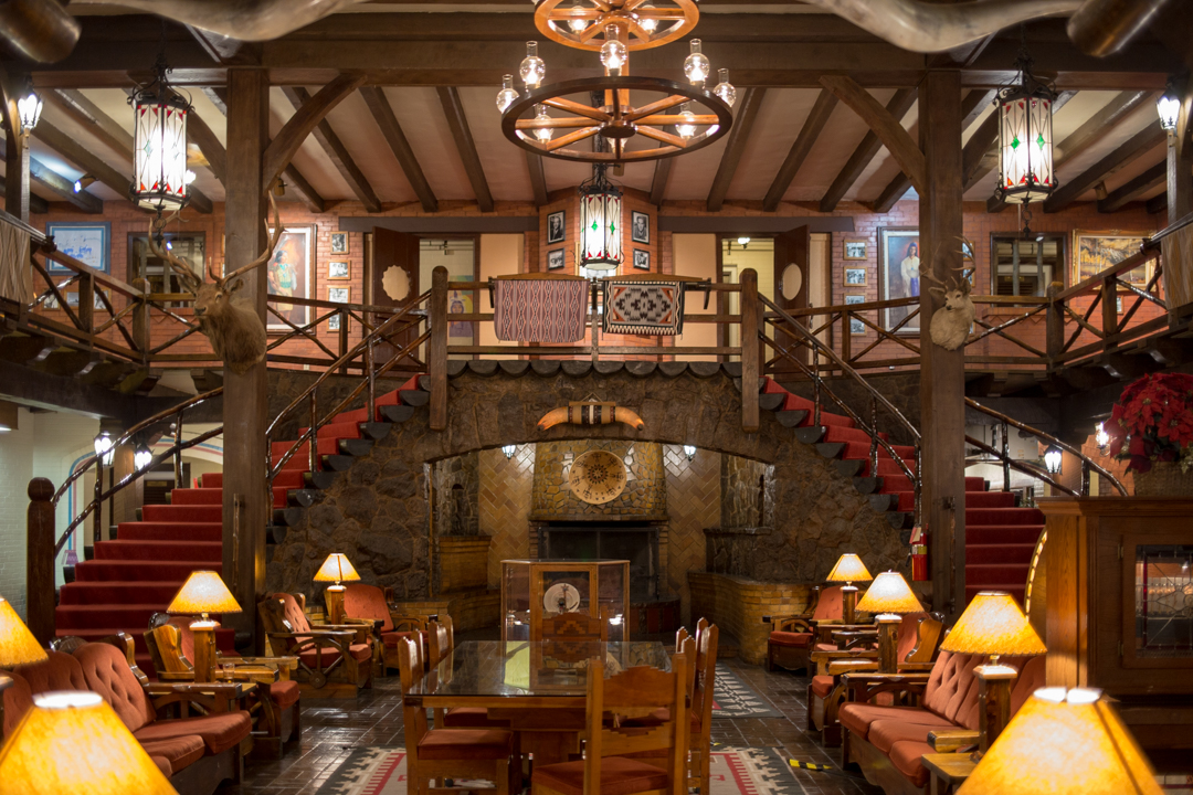


The rooms are all named for its famous past residents, and they’re spacious and clean. If you don’t want to stay over I recommend at the very least stopping in to see the beautiful lobby or to have a drink in the 49er Lounge, named one of the Top 50 bars in the US by Esquire magazine. We had dinner and breakfast in the hotel restaurant and both meals were fantastic—green chile enchiladas (when in New Mexico…) and the crispiest pancakes I’ve ever had.


The El Rancho has a lot of competition among all of the classic neon signage to be found in Gallup and along Route 66, but the El Rancho holds its own with a blinking sign that reads both “motel” and “hotel.” Their slogan is “the charm of yesterday with the convenience of tomorrow,” and while I’m not so sure the latter is still true, the El Rancho more than makes up for it in the charm department.
El Rancho
1000 E. Highway 66
Gallup, NM 87301

Breaking Bad

I watched Breaking Bad when it was on TV and while I loved it, I also felt that watching it was like experiencing one, five-season-long, panic attack. Upon repeat viewings I didn’t find it to be as stressful as I remembered, but I’m comforted by spoilers and in hindsight, 2008-2013 was a simpler time (I don’t recall worrying about the state of the world once while Obama was President).
While JMP and I were Albuquerque I casually asked her if she watched Breaking Bad and when her response was an enthusiastic “I love that show!” we decided to visit a few of the Albuquerque filming locations.
Walter and Skylar’s House
3828 Piermont Drive NE, Albuquerque, NM

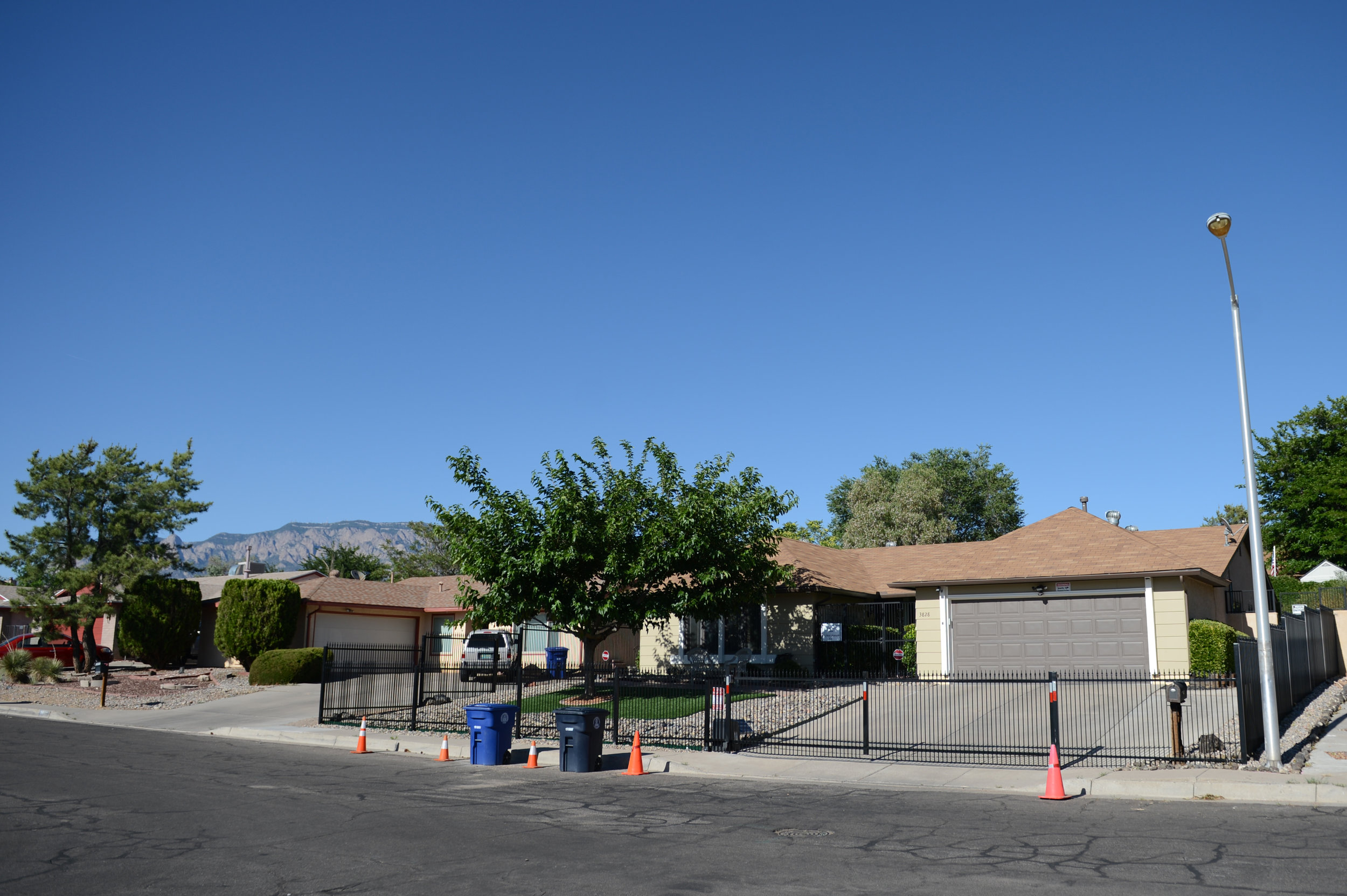
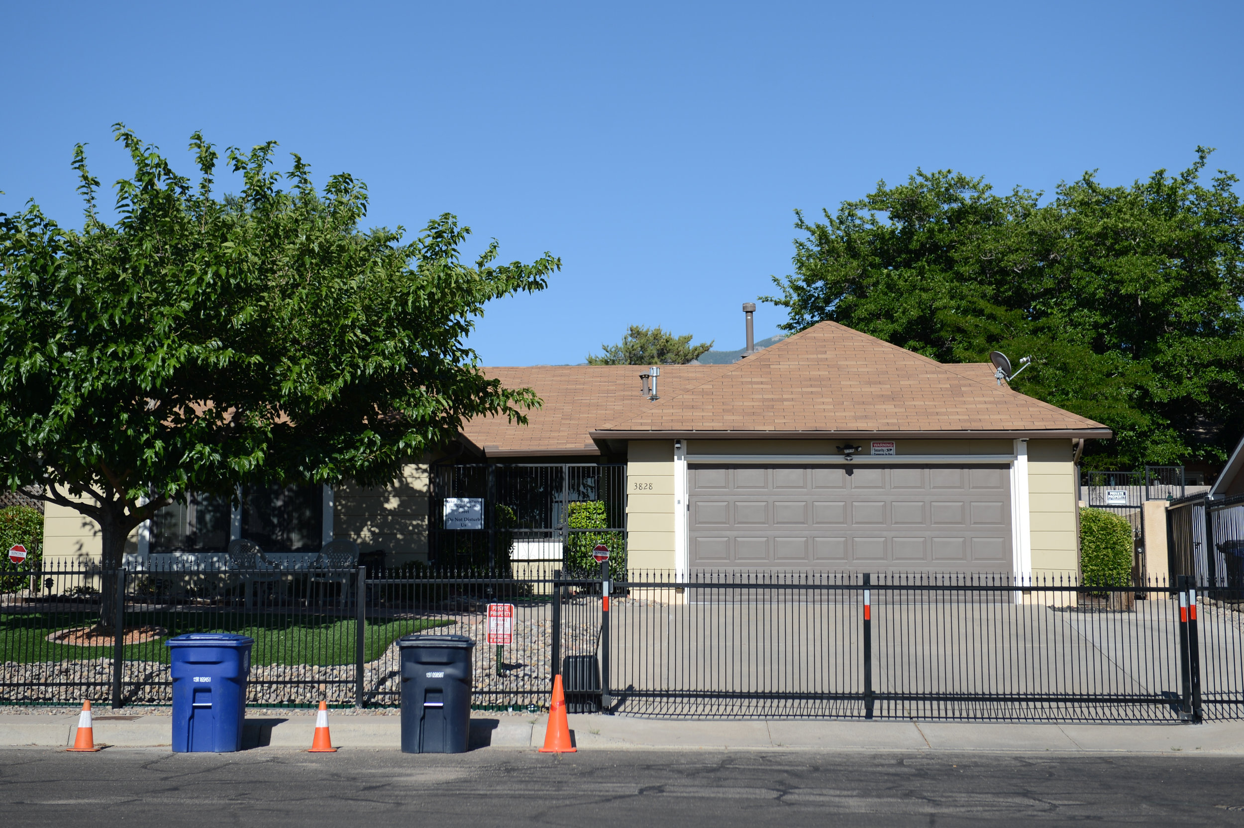
The owners of this private house are not welcoming of visitors—and can you blame them after having to scrape several pizzas off their roof? They recently installed a fence (and traffic cones, security cameras and several signs) to discourage people from getting too close, so be respectful, park across the street and snap a quick photo.
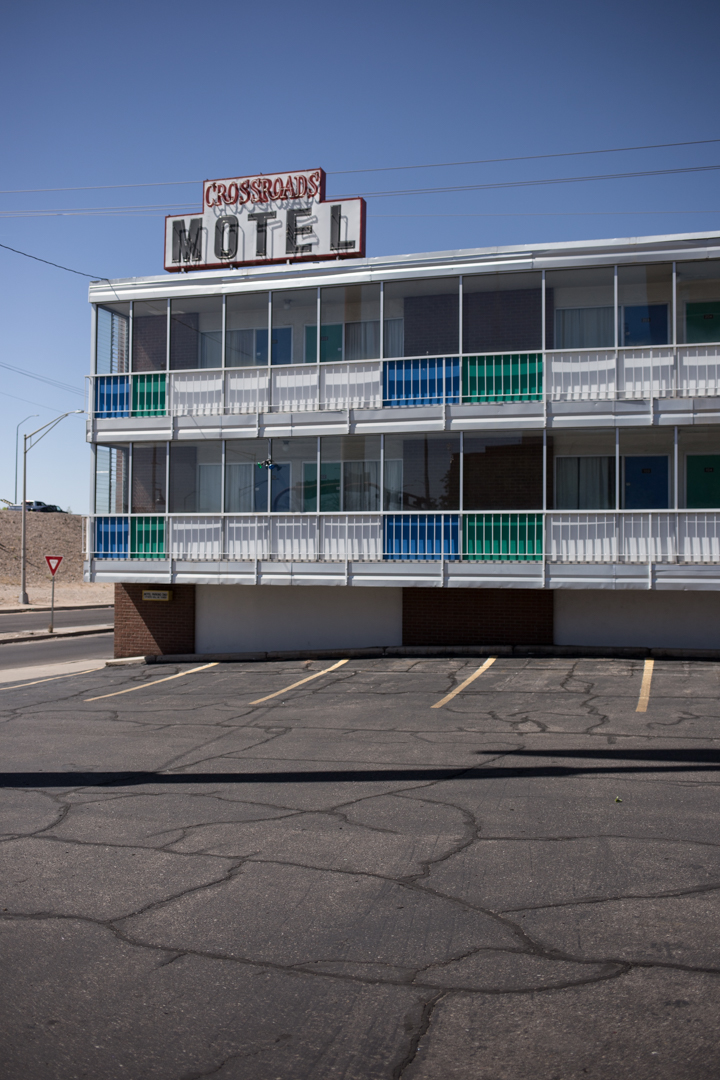
The Crossroads Motel
1001 Central Avenue NE, Albuquerque, NM

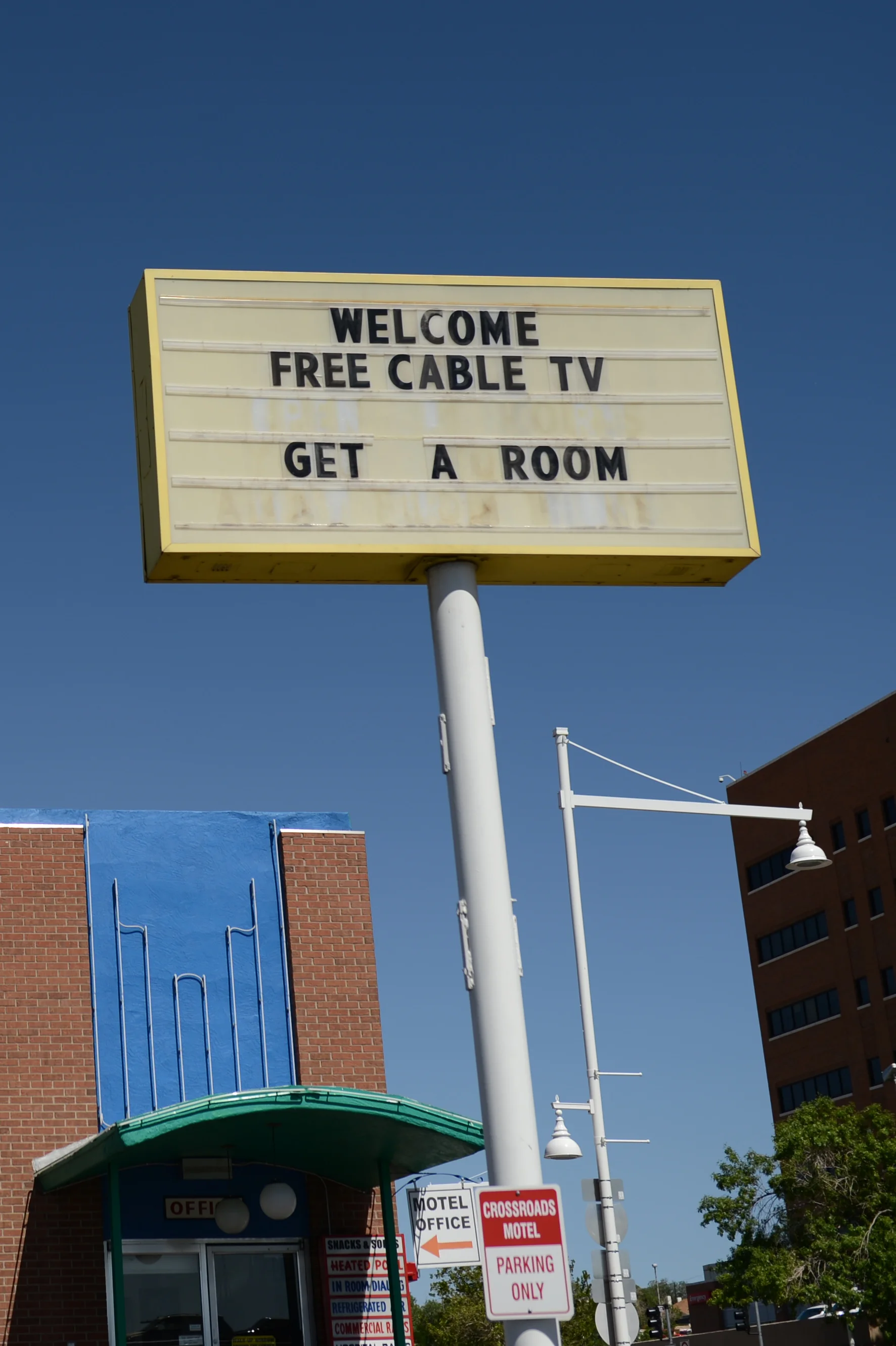

Referred to as "The Crystal Palace" by Hank, The Crossroads Motel was featured several times throughout the series. In season one, Hank takes Walter Jr. to the motel to scare him by showing him the destructive power of drugs. In season two Jesse goes to the Crossroads (with its resident meth-head, Wendy) to stage an alibi and in season three Wendy shows up again, along with footage of the motel.
This stretch of Central Avenue was once Route 66 and it’s full of old motels with excellent signage (and questionable clientele) similar to The Crossroads. I’ve heard that management isn’t amenable to tourists snapping photos, but we didn’t encounter any pushback during our quick visit.
Jesse Pinkman’s House
322 16th Street SW, Albuquerque, NM


Originally owned by Jesse's Aunt Ginny, Pinkman lived here after she died, turning it into a meth lab and famously ruining the upstairs bathroom when he tried to dispose of a body in the bathtub (but ended up dissolving the floorboards along with it). He was later evicted by his parents but purchased the house back anonymously. In real life, the two-story Spanish Colonial revival house was on the market for $1.6 million in 2015.
A1 Car Wash
9516 Snow Heights Circle NE, Albuquerque, NM


In season one, Walter White works part-time at the car wash and later he and Skylar buy the entire thing to use as front for their money laundering. The car wash is still in operation, however it operates under the Mister brand so your chances of being told to “have an A1 day” are probably slim.
The Dog House
1216 Central Avenue NW, Albuquerque, NM

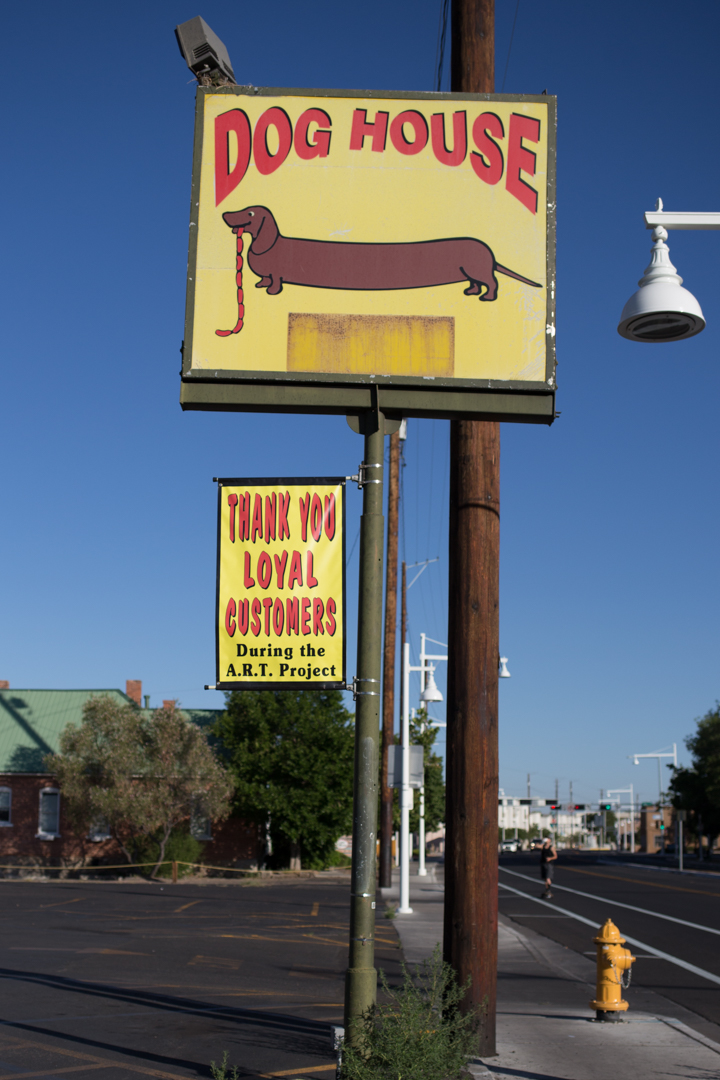


I could write an entire post waxing poetic about the incredible neon signage at The Dog House, an Albuquerque staple located on old Route 66 for more than 70 years. Despite being warned about the inevitable heartburn, we did eat their spicy-chili-topped footlongs and they were delicious (and thankfully, not as digestively destructive as I expected). The Dog House appears a few times in Breaking Bad, and I loved its moving signage so much that I came back to photograph it several times during our trip.
Los Pollos Hermanos
4257 Isleta Blvd, Albuquerque, NM

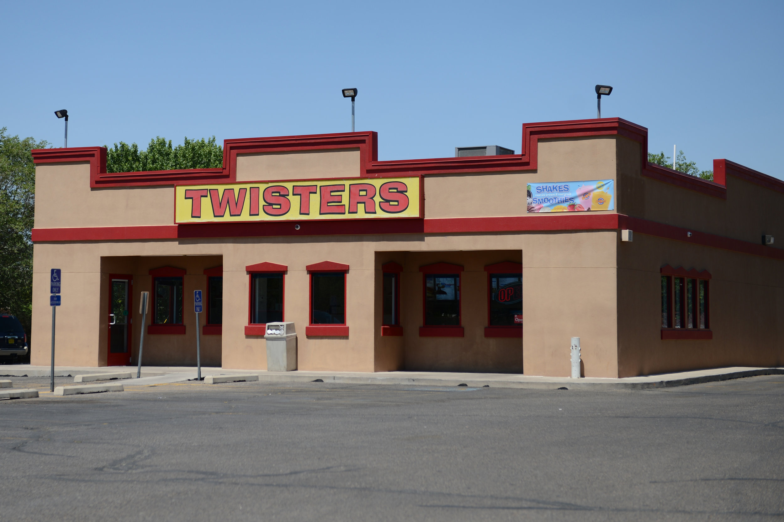
This Twisters location looks almost cartoonishly generic, making it the perfect place for Gus Fring’s (fictional) crystal meth front, Los Pollos Hermanos. While we didn’t go inside, apparently the interiors were filmed here as well and fans of the show have accounted for a 10% profit boost to Twisters, a New Mexican cuisine restaurant chain serving burgers and burritos.
All Dog House and second Crossroads Motel photo(s) by me, screencaps from Netflix and all other photos by JMP.

Tucumcari

Both of our flight times changed on our return flights from Albuquerque, which resulted in me dropping JMP off at the airport at around noon. I didn't have to be back to the airport for my flight until 11:30 pm, and I had the rental car until then, so I headed east along Route 66 to Tucumcari, New Mexico.


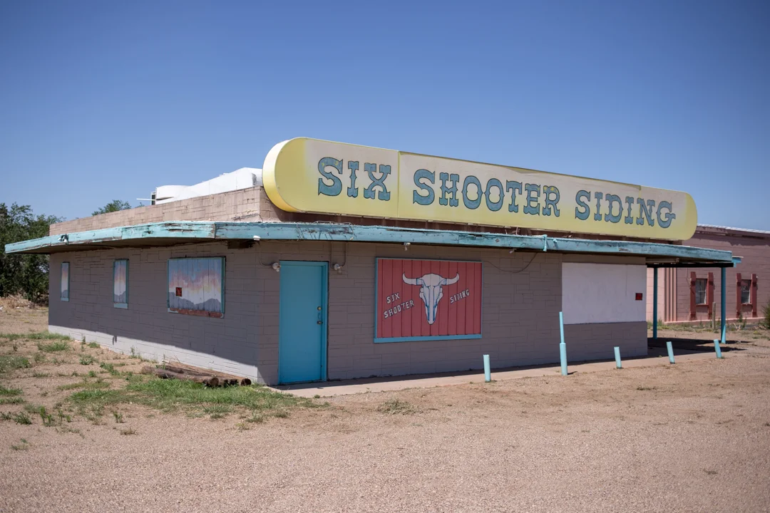
Tucumcari was founded in 1901 as a construction camp for the Chicago, Rock Island and Pacific Railroad. The camp was called Ragtown and then Six Shooter Siding before being formerly renamed Tucumcari, after a nearby mountain, in 1908. It's the largest city on Route 66 between Amarillo, Texas and Albuquerque, with a population of less than 5,000 as of 2016.


In its heyday, the town attracted Route 66 travelers to one of its 2000 motel rooms with billboards for miles in each direction proclaiming "Tucumcari Tonite!" They later adopted the tagline "Gateway to the West," but voted to return to their previous slogan in 2008 (a scene including one of the billboards is painted on the side of the Blue Swallow Motel).


I didn't have time to spare, but I easily could have spent days exploring the abundance of abandoned businesses and neon signs that line both sides of the road. I raced from sign to sign—getting in and out of my blissfully air conditioned car—and I eventually became so overwhelmed (and overheated) that I stopped for lunch at Del's, in business since 1956. The only other place I went inside of was Tepee Curios, a former Gulf gas station, where I bought a tepee pin and squished a souvenir penny.


While most of the motels and restaurants appear to be abandoned, and the status of some businesses wasn't immediately clear, Tucumcari—somewhat improbably—lives on. Although I didn't have time to visit any of them, Tucumcari has four museums: Mesalands Dinosaur Museum, Route 66 Museum, Tucumcari Historical Museum and the Railroad Museum, and several historic motels are still welcoming road-weary travelers to spend the night.


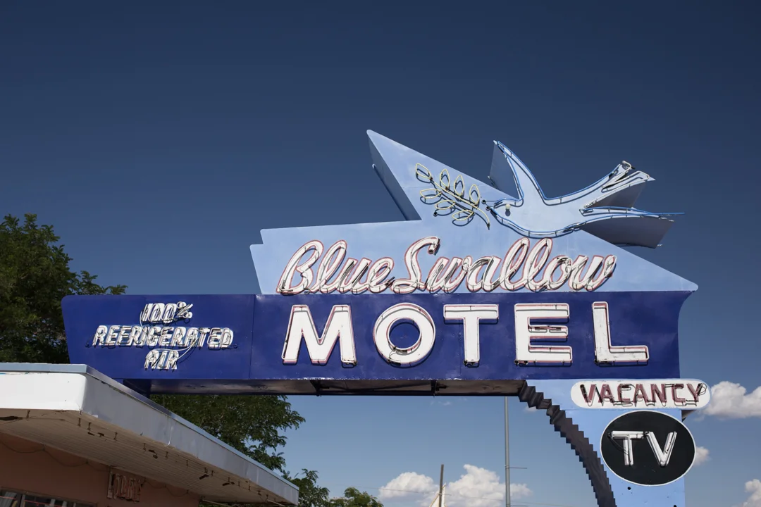


I only spent a few hours driving the 2.5 mile stretch through town, but Tucumcari was by far my favorite stop along Route 66. If I had an extra night, I would have loved to have spent it in the 100% refrigerated air of the Blue Swallow Motel, serving travelers along the Mother Road since 1939. The neon signs are beautiful in the daytime, but I won't feel complete until I also see them lit up at night.

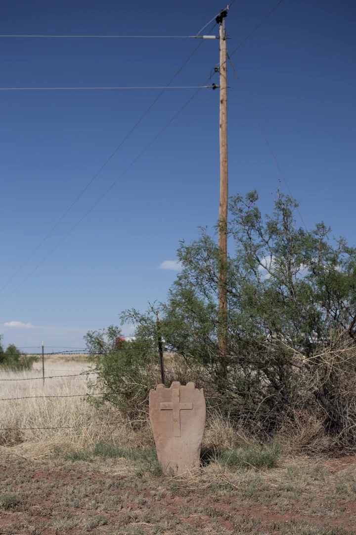
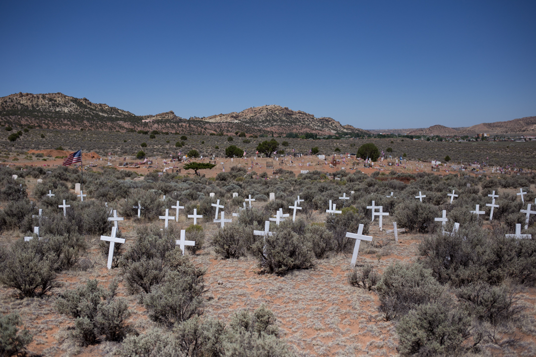
Montoya Cemetery

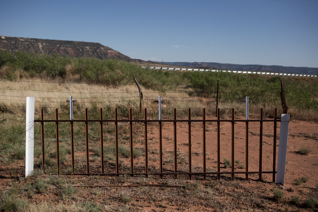
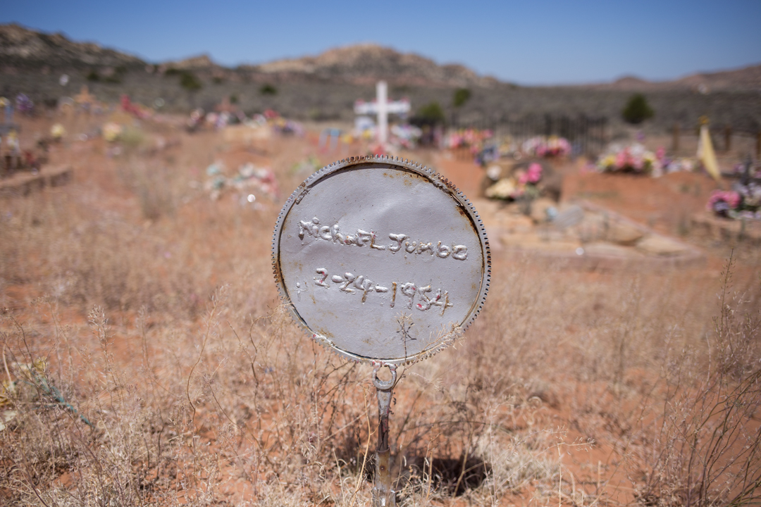
As I was driving back to Albuquerque from my whirlwind tour of Tucumcari (and before I explored Santo Niño Cemetery), I stopped at Montoya Cemetery, another randomly selected stop found with the Find A Grave app. Montoya Cemetery was established in 1910 and it's located right along Route 66, about halfway in between Tucumcari and Santa Rosa.


Montoya Cemetery is literally a roadside cemetery, sandwiched between the highway and a smaller road. Not a single car drove by on the smaller road while I poked around, although it seemed like a nicely maintained burial ground. The town of Montoya was founded in 1902 as a loading point for the Southern Pacific Railroad. Not much remains of the town, except a few crumbling structures, but Richardson’s Store and Sinclair Station—open from 1925 until the '70s —was once a popular stopping point during Route 66's heyday.


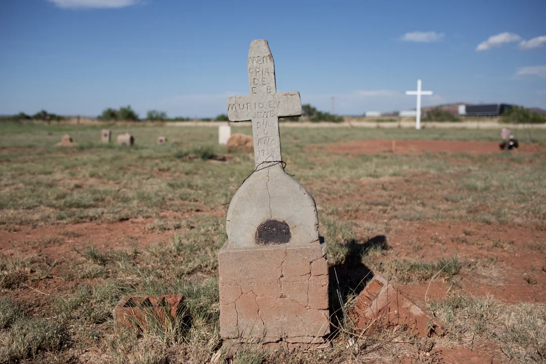


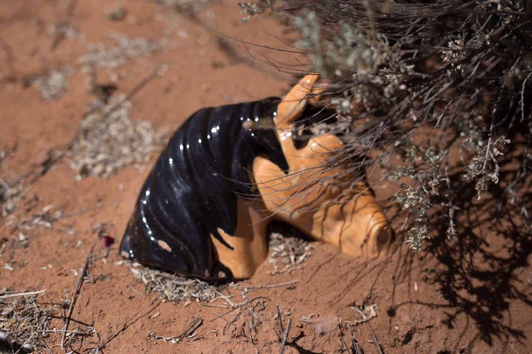
The most recent burial I could find occurred in 2015, but a lot of the birth dates are from the late 1800s. Like other desert cemeteries I visited on my trip, Montoya is full of unique markers—wooden crosses, crudely carved cement tombstones, picket fences and more contemporary granite stones are scattered around the dusty plot of land.


Montoya would be a peaceful spot if it weren't for the occasional rumble of a semi-truck speeding nearby, but it was the perfect place to pull off the road and stretch my legs for a few minutes. Although I didn't get photos, while I was trying to find out the history of the cemetery, I found the intriguing epitaphs of Eliseo (Lee) J. Sanchez and his wife, Gregorita Agapita Garcia Sanchez. His: "He Walked in Sunshine" / Hers: "And She Took Care of the Rain."

Santo Niño Cemetery

On my last day in New Mexico, I had nearly a full day since my flight back to New York wasn't until after 11pm. I drove 2.5 hours east to Tucumcari, a place so perfect that I'm still too overwhelmed by it to even attempt to look at the obscene amount of photos I took in the short time I spent there. I can sometimes be obsessive about getting places on time—especially the airport—but I left enough time on the way back to squeeze in two cemeteries.


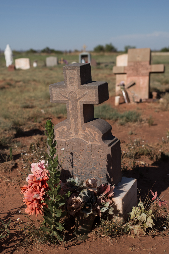
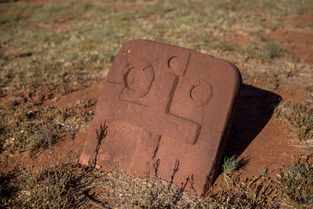
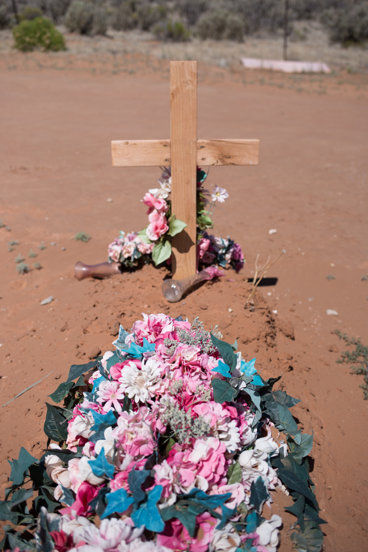
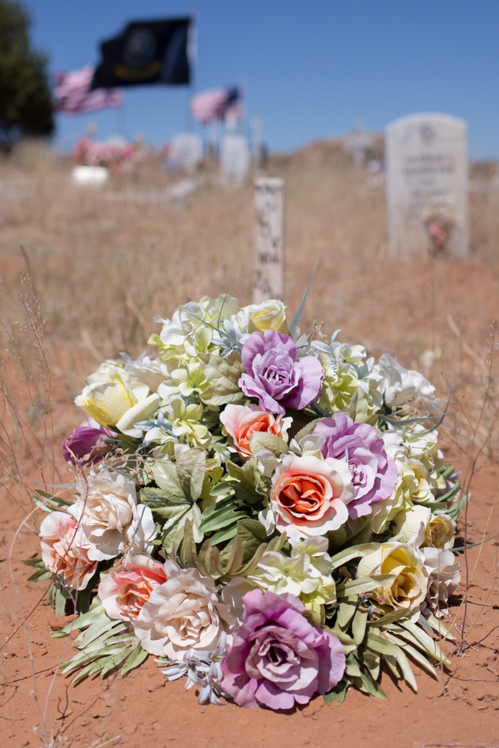
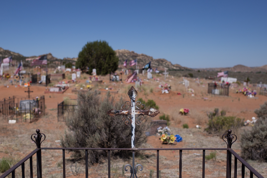
Santo Niño Cemetery is located just south of old Route 66, east of the Albuquerque city limit. It's located on a site that was once home to an Anasazi Pueblo village from A.D. 1100-1600 and a historic Hispanic settlement. It contains less than 300 interments and the oldest recorded burial dates from 1899.


I found the Santo Niño Cemetery via the Find A Grave App, which I've mentioned before. Sometimes I find the lack of information (and especially photos) frustrating, but it really is invaluable when I'm visiting a new place and I want to make sure I don't miss an interesting cemetery nearby. Cemeteries are usually just off the beaten path and I never want to find out after the fact that I missed out on a great one.


This cemetery was considerably smaller than the Rehoboth Mission Cemetery, but it was similarly picturesque with the mountains in the background. In a souvenir shop in New Mexico we saw a postcard that referred to Albuquerque as the "other mile-high city," and at 5312 feet, its elevation is higher than Denver. Also like Rehoboth, this desert cemetery was full of tiny little lizards darting around the grave markers (and scaring the shit out of me in the waning dusk light).


The cemetery is surrounded by a fence and a sign on the gate says that it's private but I don't think any of the residents minded that I poked around for a few minutes. I love how personal and unique each grave marker feels, especially compared to the uniform granite subdivision-like cemeteries that are now common in the northeast. The flowers, trinkets and in some cases handwritten names, help to remind you that these markers represent actual people who in death are being lovingly cared for, and remembered, by the living.
Santo Niño Cemetery
GPS Coordinates: 35.5422, -105.5847

Albuquerque Statues

I will go almost anywhere if I'm promised a Muffler Man sighting, but in the absence of official Muffler Men, I'll settle for other big statues—whole, or in pieces. In Albuquerque, New Mexico, we met two big partial men—one missing arms, the other missing his entire lower half.
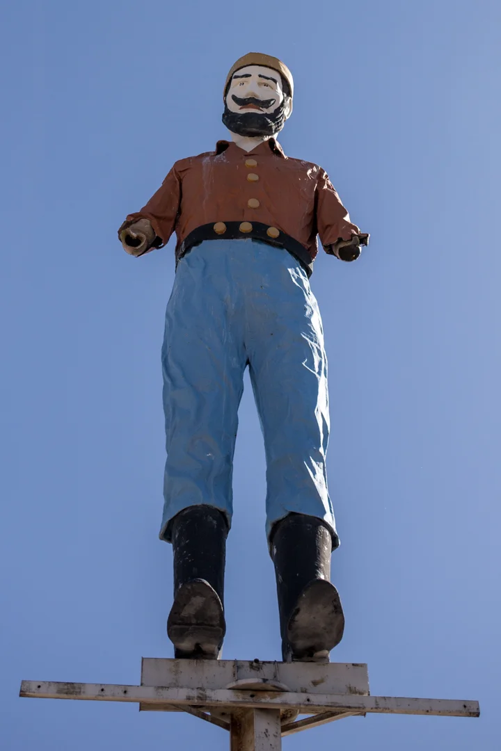
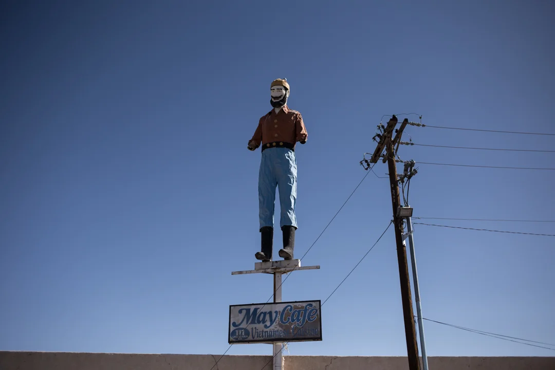
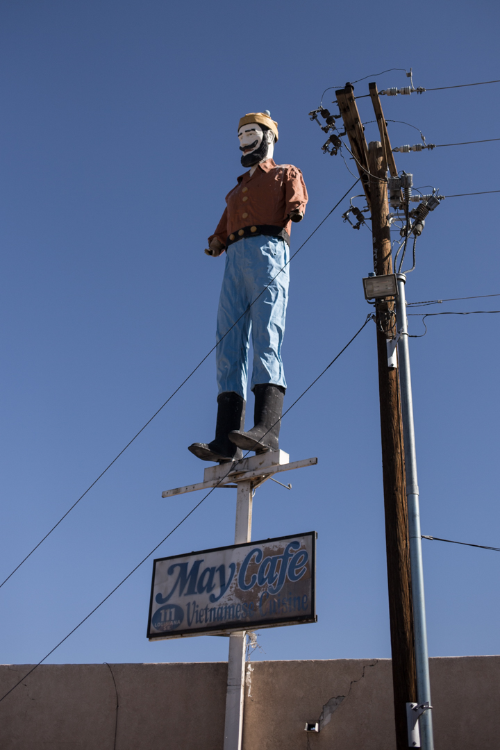
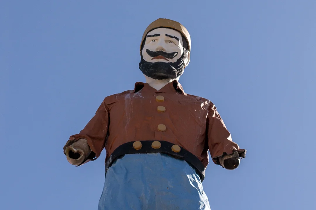

Referred to as the Bunyan Mutant or "Fidel," from far away you might mistake this guy for a real Muffler Man. This 2,000 pound fiberglass statue is perched on a customized steel beam 25 feet above the ground. His arms were damaged in a windstorm sometime after 2013, but he once held an axe just like a traditional Bunyan statue.
He originally stood outside of the Duke City Lumber Company store in the early 60's. The space is now home to a Vietnamese Cafe, and it's located on the corner of Louisiana Blvd and Central Avenue (old Route 66). He would be illegal to build today, but remains standing thanks to a grandfather clause in the Albuquerque sign ordinance.


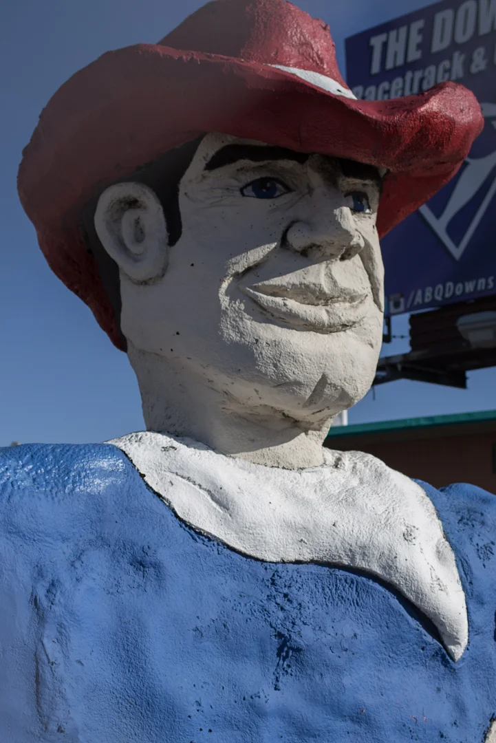
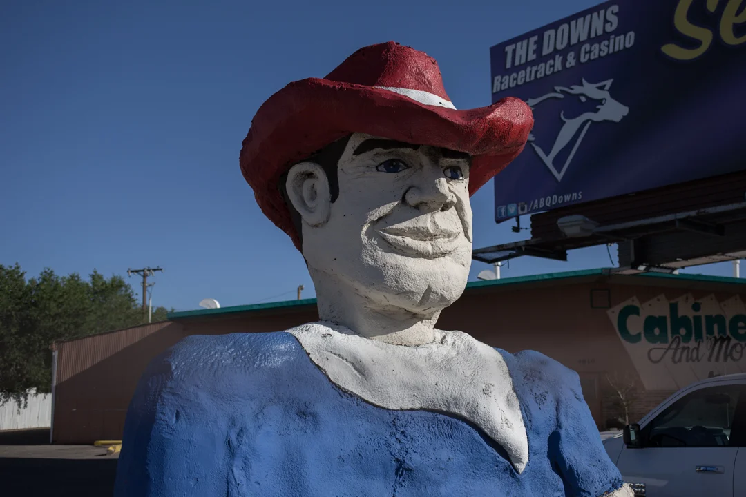

The second statue is a blobby concrete cowboy, who isn't missing anything but was only constructed from the waist up. He sits outside of Aesop's Gables, a cabinet company located just off the Pan American Freeway in Albuquerque. Our GPS was very confused trying to get us to this guy, and we circled around a few times before we finally found him.

The best part about this statue is how he appears on Google Maps. Before most trips, I try to look up attractions on street view just to verify that the address I have is correct. I know that Google's algorithm can't distinguish from real people's faces and statues, but I still laughed when I zoomed in on this guy and I wonder if I should feel bad now for violating his privacy.
Bunyan Mutant at May Cafe
111 Louisiana Blvd SE A,
Albuquerque, NM 87108
Half cowboy at Aesop's Gables
4810 Pan American Fwy,
Albuquerque, NM 87109

Muffler Man: Dude Man

After a long day on (and off) the Mother Road, exploring trading posts (both open and abandoned) in Arizona, we crossed into New Mexico and headed to Gallup. We had a room booked for the night at the El Ranchero and I was eager to meet another Muffler Man.
But as we pulled into Gallup, I realized that I was feeling overwhelmed by all of the roadside delights that we had seen that day, so I intentionally drove past the Muffler Man, saving it for the next morning when I could fully appreciate him. I trace my awareness of this phenomenon to my first trip to Italy—after days and days of seeing important works of Art, I eventually reached a saturation point where I just couldn't absorb any more. Since Muffler Men are basically the American version of the David, this has happened to me on nearly every road trip I've taken. Luckily, all I need is a good diner breakfast or a few hours of sleep and I'm ready to enthusiastically collect delights again.


After seeing the very first Muffler Man ever made in Flagstaff, AZ I was slightly disappointed that there was only one left to see on our agenda for this trip. There are hundreds of Muffler Men spread out around the country but I get frustrated sometimes that I will probably never see them all at the pace I'm going. The Gallup Muffler Man (nicknamed "Dude Man") is the 19th fiberglass giant that I've met, but I might have better luck seeing every UniRoyal Gal since they're much more rare.


Dude Man stands on the roof of John's Used Cars, and while it's not technically located on Route 66, it's close enough to consider him a Route 66 attraction. I can't find any information on the provenance of Dude Man, but he appears to be well maintained. He has a cowboy hat and a pistol and wears jeans and a western-style shirt. I love the pennant flags that radiate around him, and the employees of John's were seemingly unbothered by me wandering in and out of their lot to take photos (his back side is visible from a nearby alley).
John's Used Cars
416 W Coal Avenue,
Gallup, NM 87301
Gates to the lot are closed after business hours, but Dude Man is visible at all times

Route 66: Gallup to Grants

I have had a lifelong dream of packing up everything I own (well, more like everything I need) and traveling along Route 66 from one end to the other. But I also like having a paycheck and health insurance, so until I can somehow find out how to survive without those, I'll have to settle for seeing Route 66 piece by piece. On our recent trip out west we traveled a good chunk of the Mother Road, from Flagstaff, Arizona to Tucumcari, New Mexico.


President Eisenhower's Federal Interstate Act of 1956 called for the creation of four-lane highways across the country and by the late '60s most of Route 66 was replaced, chopped up or bypassed completely by I-40 in Arizona and New Mexico. Route 66 was officially decommissioned in June of 1985 (just two months before I was born!), although about 85 percent of the original road still exists.


Gallup, New Mexico is the largest city located between Flagstaff and Albuquerque. A large portion of the population is Native American, from the Navajo, Hopi and Zuni tribes. We stayed overnight at the El Ranchero (worthy of its own post) and headed east the next morning. JMP got in the driver's seat and when I offered to drive she replied, "so you can stop every five feet and take photos?" She knows me very well, of course, because that's exactly what I proceeded to do, and I didn't stop until a few days later when I boarded a plane back to New York.


For anyone who knows me it might be surprising to hear that I didn't have much on our itinerary for some of the days. This flexibility allowed us to discover places like the abandoned diner or add extra stops when it looked like we'd have time, like the Rehoboth Mission Cemetery. The best thing about traveling on Route 66 is that you don't need to have an itinerary or to blindly follow your GPS from stop to stop. You're guided by the road, not the destination and we'd pull off whenever we saw something that caught our interest—like the Continental Divide, which we both learned is the point where all water to the west flows to the Pacific Ocean and water to the east flows to the Atlantic.
When I noticed that our drive from Gallup to Albuquerque was looking a bit sparse, I consulted my friend Tag who grew up in New Mexico. He confirmed that there wasn't much to see between the two cities, but mentioned that we should try to pass through the Route 66 town of Grants.


We drove on I-40 when we had to, but tried to follow the Historic Route 66 signs as much as we could. Grants is a small town (population less than 10,000) about halfway between Gallup and Albuquerque. Founded as a railroad camp in the 1880s, residents found success with logging, Route 66 tourism, uranium ore mining and agriculture—at one time Grants was even known as the carrot capitol of the US.


Today, like most of the Route 66 towns we drove through, Grants feels like a ghost town, full of abandoned homes and businesses. The Hollywood Diner was a favorite of mine, and it looks like it has had several lives—we found evidence that it has housed not only a diner but a tattoo shop and pet grooming business (hopefully not at the same time?). Some of the buildings have been left to crumble but others have been demolished entirely—nothing left but their ambitious neon signs standing guard, no longer beckoning travelers at night, but cracking and fading in the desert sun.
A lot of these photos are available as prints over in my Society 6 shop, and I will be adding more as I sort through the overwhelming amount of photos I took on this trip.

Rehoboth Mission Cemetery

I couldn't go on a trip out West without checking Kaylah's blog for ideas—especially since the highlight of this trip was attending her ghost town wedding! I always plan a million stops before I start any road trip, but there's always time to squeeze in a few more places, and Rehoboth Mission Cemetery was one of these last-minute additions to our itinerary.


As much as I love exploring cemeteries, finding the right research source for locating good ones has of yet eluded me. The Find A Grave app is helpful, but I often get annoyed by the lack of information available. If it's not a well-documented cemetery, I'm not able to determine whether the cemetery is going to be interesting, or a total bust. I suppose the unknown is part of the fun of exploring, but I cram a lot into these trips and ain't nobody got time for that.


But thanks to Kaylah's post, I knew that the Rehoboth Mission Cemetery was worth a stop, and we were also prepared for the somewhat strange route we had to take to get there. To access the cemetery, you have to drive through the Rehoboth Christian School campus and it feels as if outsiders might not be welcome, despite a sign literally declaring "all are welcome." Past the parking lot is a winding dirt road that continues up a hillside, eventually ending at the cemetery. There was actually a moment when we wondered if we should park our car and walk but whatever you do, don't do that (just keep driving!).


The Rehoboth Christian School was started in 1903 by Christian missionaries who came to New Mexico to spread the word of God to the Navajo and Zuni peoples (the white crosses mark missionary graves). In the 1940s, a high school was added and today the school has more than 500 preK-12th grade students, 68% of which are Native American. I couldn't find much information about the cemetery itself, but it's a beautiful place to visit and unlike most of the cemeteries that I frequent here on the East Coast.


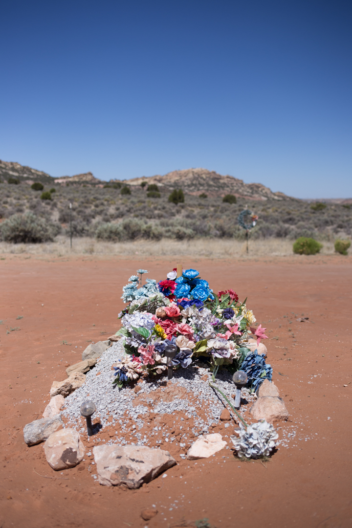


Most of the grave markers here are pretty simple, but the graves themselves are elaborately decorated and obviously maintained. This cemetery is exactly what I imagined a desert cemetery to look like—dusty but colorful, both dead and very much alive at the same time. The grounds may have literally felt alive, not because of spirits, but because of extremely fast little lizards that kept darting across my feet—each one startling me more than any spirit ever could.
Rehoboth Mission Cemetery
7 Tse Yaaniichii Lane
Rehoboth, NM 87322
Once you're on the school campus, follow the signs for "cemetery" and be prepared to drive for a while on a winding, dirt road—just go slow!
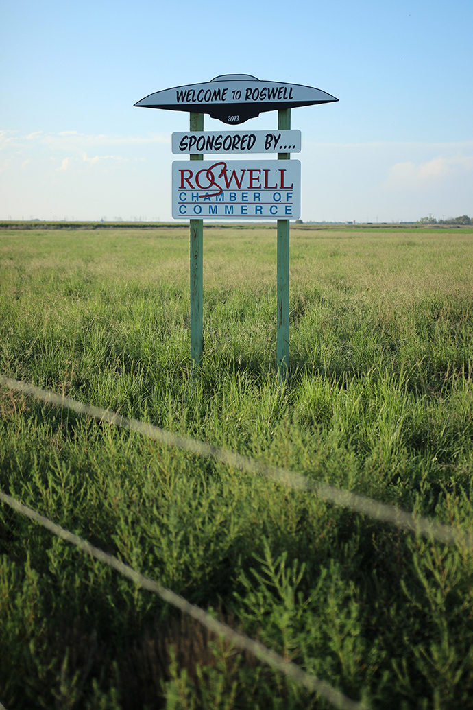
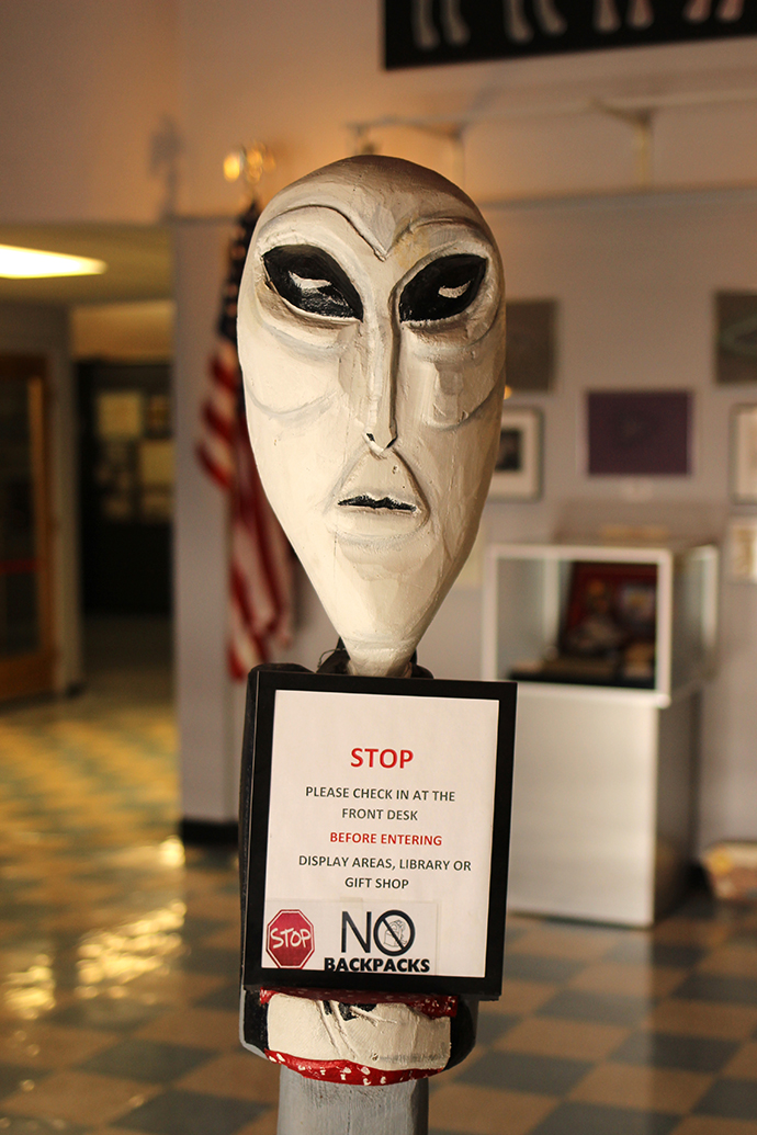
Roswell: Alien Zone

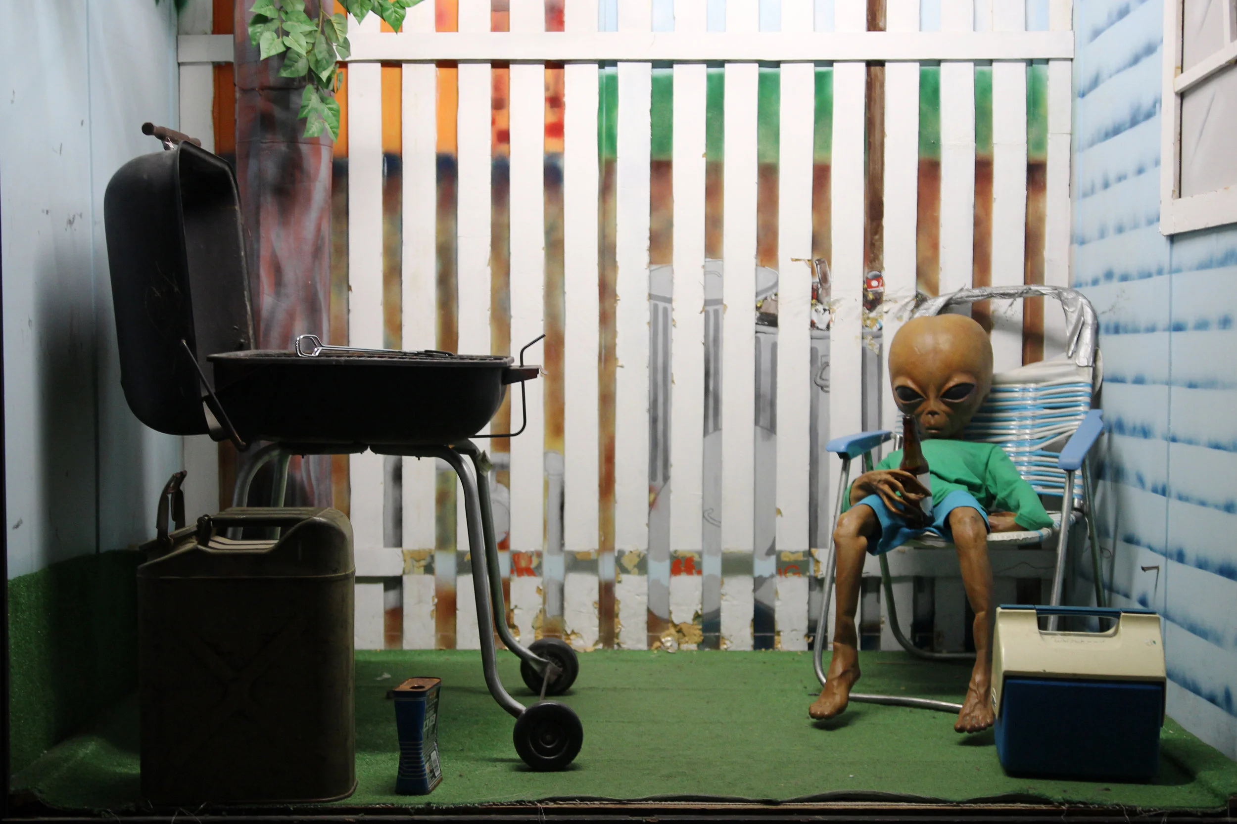
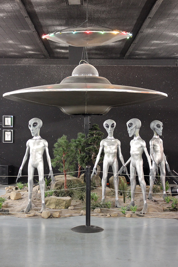
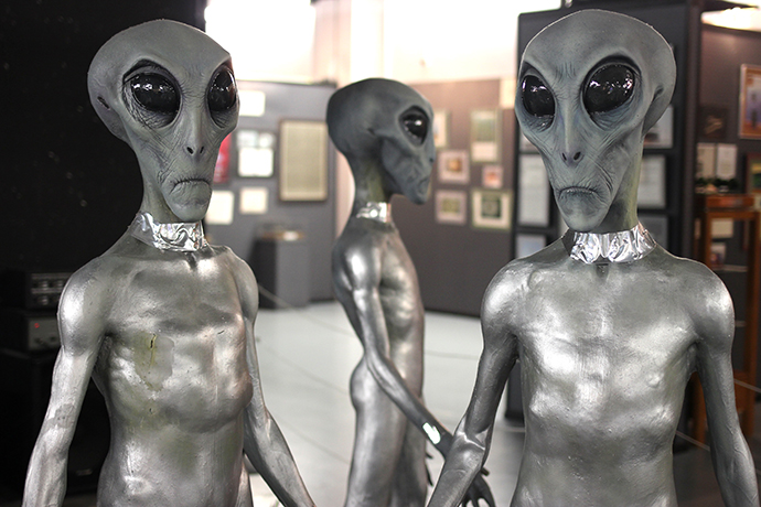
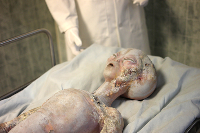
It's been a while since I've been on a road trip, and while I was daydreaming about Roswell the other day I realized that I never shared photos from one of my favorite attractions: Alien Zone. Alien Zone was built in 1998 by a local commercial artist and pastor, and features approximately 20 different dioramas with which visitors are encouraged to interact and take photos. My sister texted me about Alien Zone when we were planning our trip and it was just as cheesy and ridiculous as we expected.


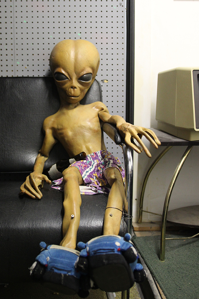
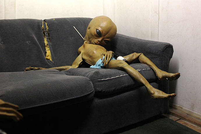

The dioramas are pretty elaborate and entirely hilarious. Each one features an alien or two in a different "real life" situation: at a kitchen table, passed out on the couch, drinking a beer, climbing out of a crashed UFO, awaiting an autopsy, bartending, having a cookout, etc. A lot of the dioramas have seen better days, condition-wise, but the homemade quality is also part of the appeal.


The scenes are really quite clever, and set up specifically for great photo-ops—the kitchen table scene is oriented upside down so when you flip the photo, it looks like you're on the ceiling. You can crawl inside of the crashed UFO, sit next to an alien in an outhouse, and grab a cold one from the bar. I'll spare you the photos that included my sister, brother-in-law, niece and I interacting with the scenes, but trust me—the admission was just $3 a person, but the memories (and photos) we made were priceless.

White's City + Carlsbad Caverns
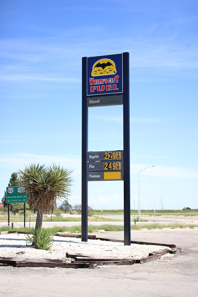
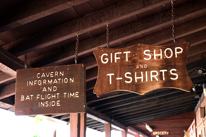
On our recent Roswell road trip—after our short hike through Bottomless Lakes State Park—we headed to Carlsbad Caverns. We planned to spend the entire day there, exploring the cave until it was time to watch the bat flight. But before we even got to the cave, we stopped at White's City, located four miles east of Carlsbad Caverns National Park.
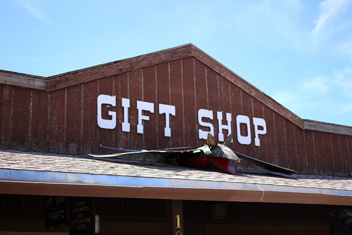
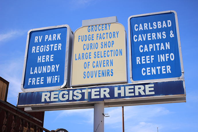
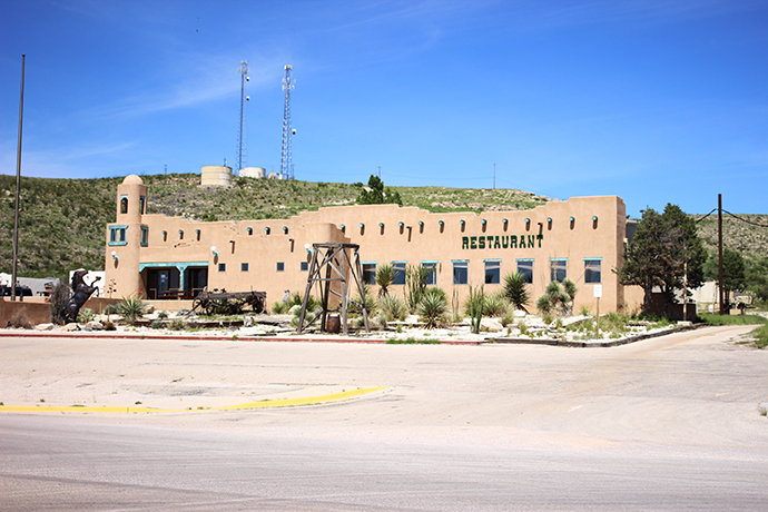

White's City was established as a campsite in the early 1900s, and over the years grew to include a Pueblo Motel, drug and grocery store, museum, chair lift ride to the top of Walnut Canyon, theater, water park, arcade, gift shop, saloon and other touristy attractions. Unfortunately White's City's heyday appears to be over—aside from an RV park, gift shop, (terrible) restrooms and a desolate restaurant, not much else appeared open or inhabited.
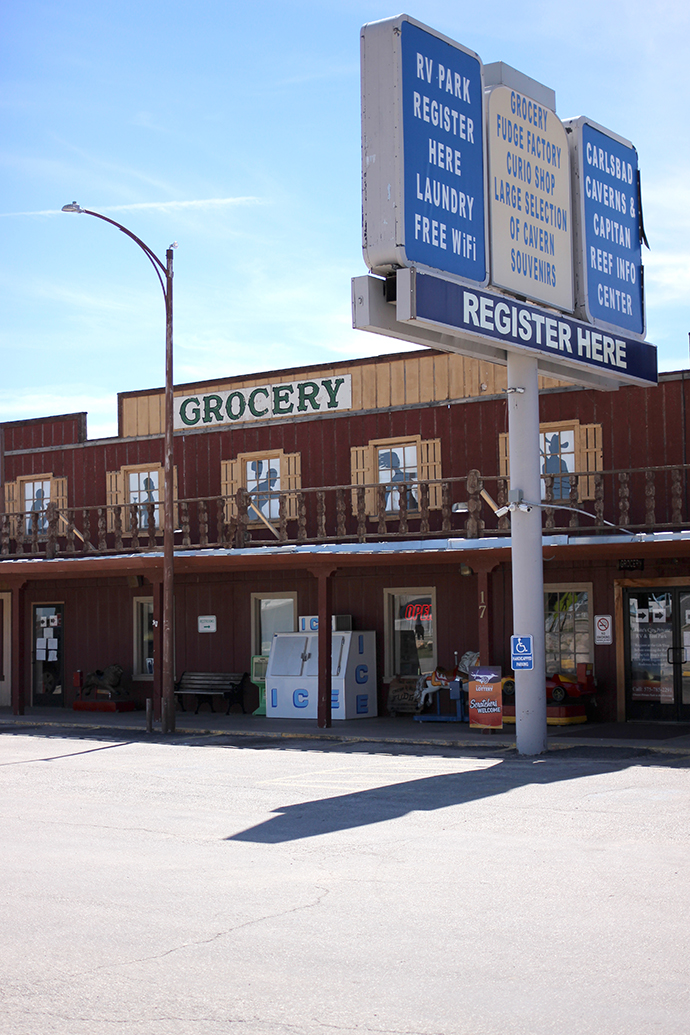
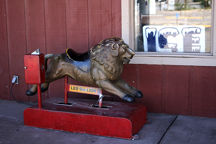
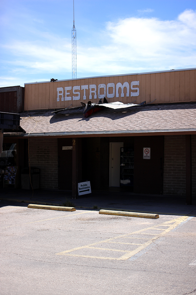
After extreme build-up in the form of what seemed like hundreds of signs along the highway advertising the many attributes of White's City, the actual destination was a bit of a let down. But, like a lot of roadside attractions today, if you look hard enough you can still catch glimpses of its glory days via its signage, spacious—albeit dusty—gift shop, and old-timey Wild West-theme.
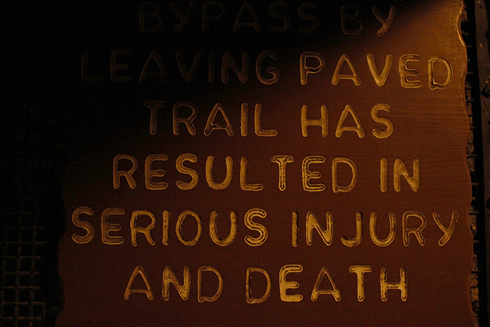
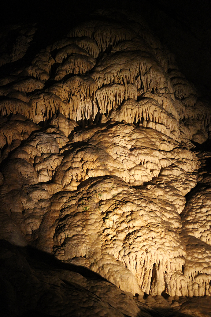
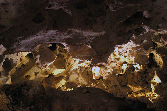
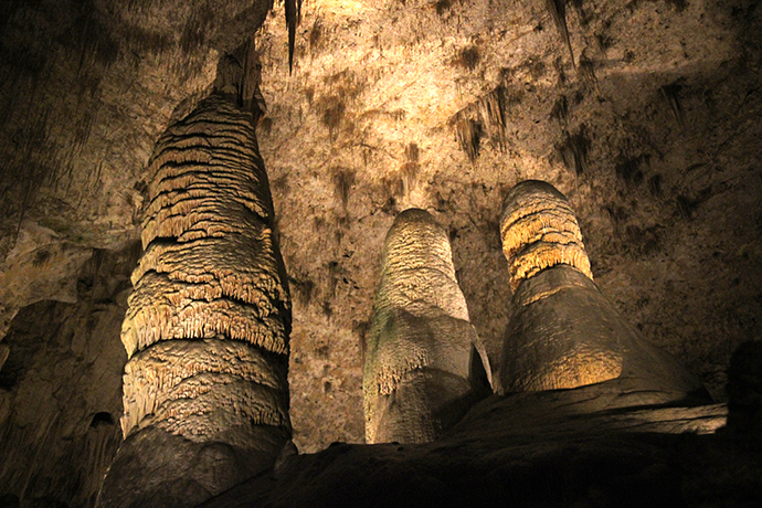
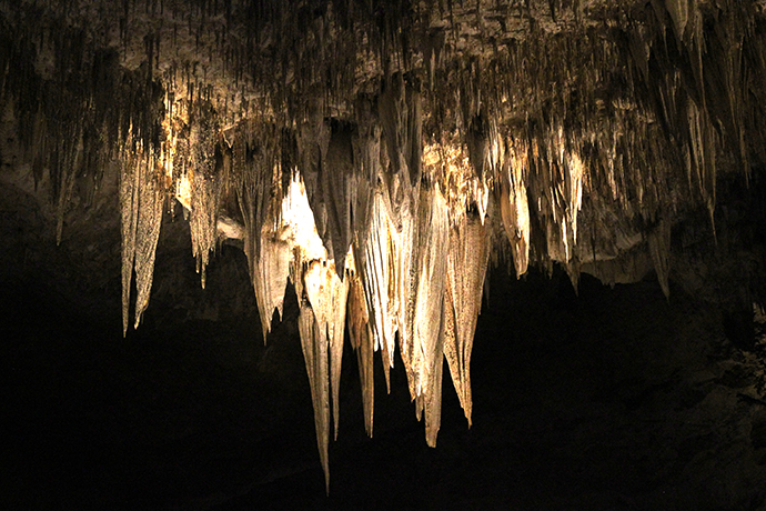
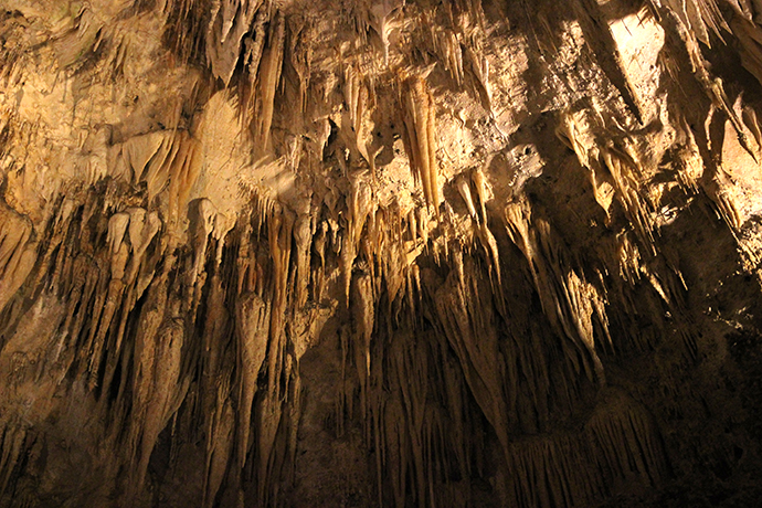

After squishing some pennies and buying a dusty floaty pen (depicting the bat flight!), we headed to the main attraction. Carlsbad Cave National Monument was established in 1923, but the limestone cavern is 250 to 280 million years old. We took the self-guided tour down through the natural entrance, a 1.25 mile hike with a descent of 750 feet. I definitely recommend the natural entrance trail if you're comfortable walking distances, but there's also an elevator that will deposit you right into the Big Room.
All along the trail I kept oohing and ahhing over the formations—nature is really, really nuts—and I couldn't possibly imagine how it could get any better. But when we finally made it to the Big Room, I realized why it was the star—it's breathtaking. The Big Room trail is another 1.25 miles, but we were forced to take the shortcut by rangers who told us politely that we were overstaying our welcome (the last elevator up was at 4:30pm, but they started putting the pressure on us around 4pm).

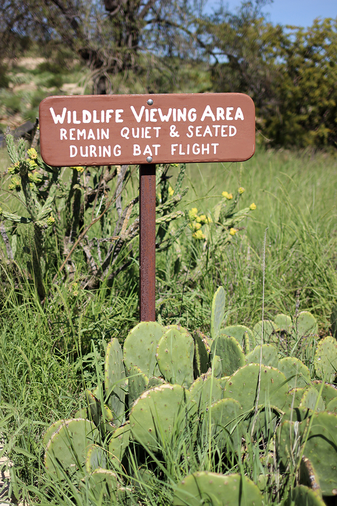

But even after the kitsch of White's City and the grandeur of the cavern, the bat flight still managed to impress. Photos and videos are not allowed during the flight, and it's nice (in addition to being helpful for the bats) to actually experience something nowadays without the pressure of documenting it in just the right way. I think this about most things, but the bat flight really needs to be experienced—there are videos, but they can't possibly capture the sights, sounds, smells and feelings of sitting beneath thousands and thousands of flying bats. I didn't know there were that many bats in the world, let alone in one cavern—we watched for an hour until it was too dark to see, but the ranger said the flight can last from two to four hours.

New Mexico: Bottomless Lakes State Park

Bottomless Lakes State Park is located along the Pecos River, about 14 miles southeast of Roswell in New Mexico. It contains nine small, circular lakes, formed by collapsed limestone caves—Lazy Lagoon, Cottonwood Lake, Mirror Lake, Figure-Eight Lake (they count this as two lakes), Pasture Lake, Lost Lake, Lea Lake and my favorite, Devil's Inkwell. These natural sinkholes (called cenotes) are not fed by streams, but rather by underground water. Because the evaporation rate is greater than the rate at which they are refilled by rainwater, the lake water is brackish—with a higher salinity than freshwater, but not as high as seawater.


The nine lakes aren't really "bottomless"—they range from 17 to 90 feet deep—but appear that way due to blue-green algae and other aquatic plants. Cowboys dropped lengths of rope into the lakes, but couldn't reach the bottom and the name stuck. Legend has it that things dropped in one lake have resurfaced in others, sometimes miles away, but the park ranger insisted that this was just heresay. The area is also known for producing "Pecos diamonds," which aren't actual diamonds, but quartz crystals formed in the gypsum-rich soil.


We didn't spend much time at the park, mostly because it was crazy hot and I was getting devoured alive by mosquitoes. Since most of my life has been spent on the East Coast, desert landscapes will always fascinate me. The red rock formations, dusty soil, cacti, lizards and crazy beetles all felt so foreign to me—maybe the feeling was mutual and I was simply an exotic delicacy to the New Mexican mosquito palate.

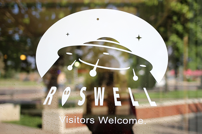
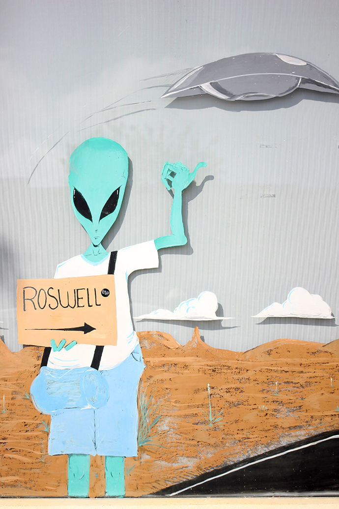
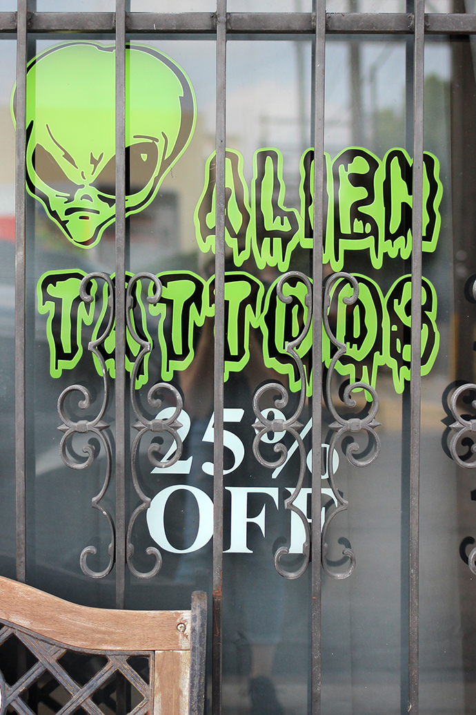
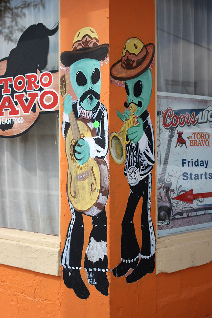
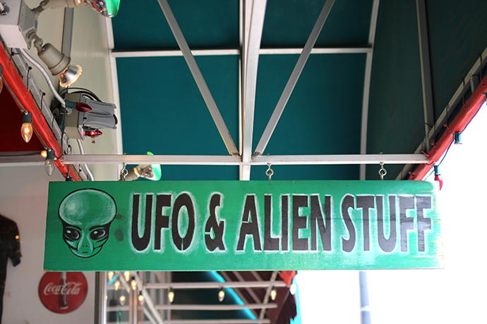
Roswell: Aliens
My sister and I had been planning a roadtrip to Roswell for a few years, and we finally made it happen last month. She lives in Dallas, which is a 7-hour drive from Roswell, so we made a proper roadtrip of it (shout out to my bro-in-law for doing all of the driving!). Whenever I mentioned to anyone that I was going to Roswell, those that had been there cautioned that there wasn't much to see in town. I was prepared for a small, cheesy, tourist-trap of a town—and while Roswell was all of those things it was also entirely delightful because it was all of those things.
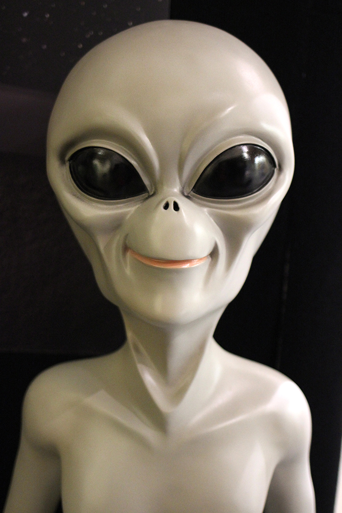
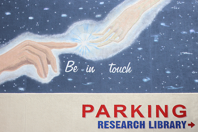
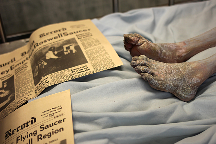
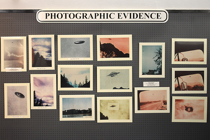
In July of 1947, debris was found on a farm about 30 miles north of Roswell, New Mexico. Whether that debris belonged to a weather balloon, secret military spy aircraft or an alien UFO is up to you to decide. The UFO Museum has some fascinating information on the crash, as well as UFO sightings throughout the years. My favorite section was on photographs that were proven to be frauds—a top hat, a hubcab and a button were just a few of the objects that people have used to produce fake UFO photographs.
I definitely believe that there are "aliens" out there—simply based on the fact that the universe is infinite, Earth can't possibly be the only planet with intelligent life. Do I believe that little green men crashed their spacecraft into the New Mexico desert in 1947? Not really. But I couldn't get enough of all of the aliens—gray and green—in Roswell, and finding them everywhere never got old.
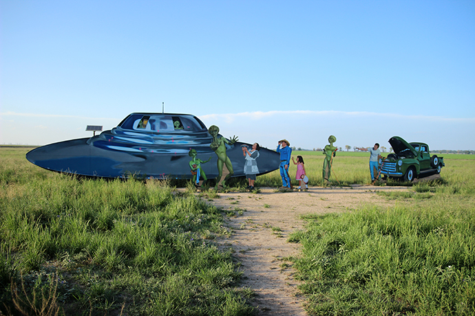
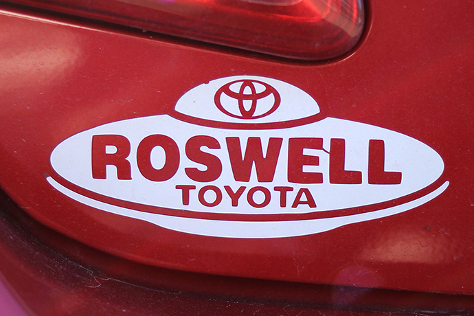
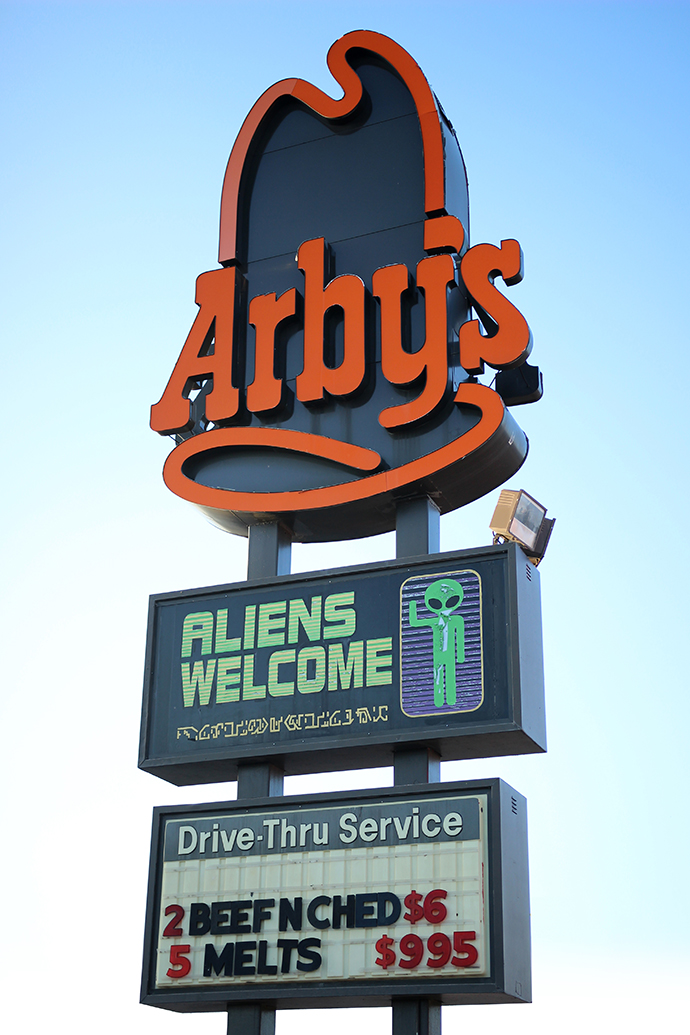
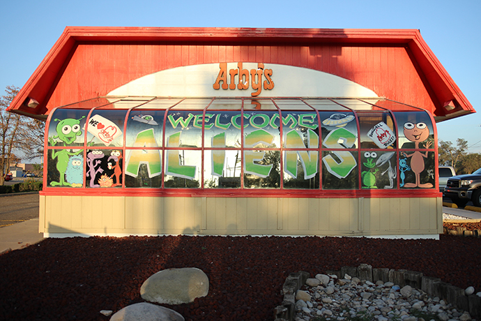
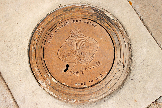
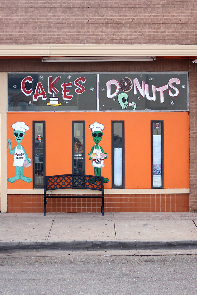
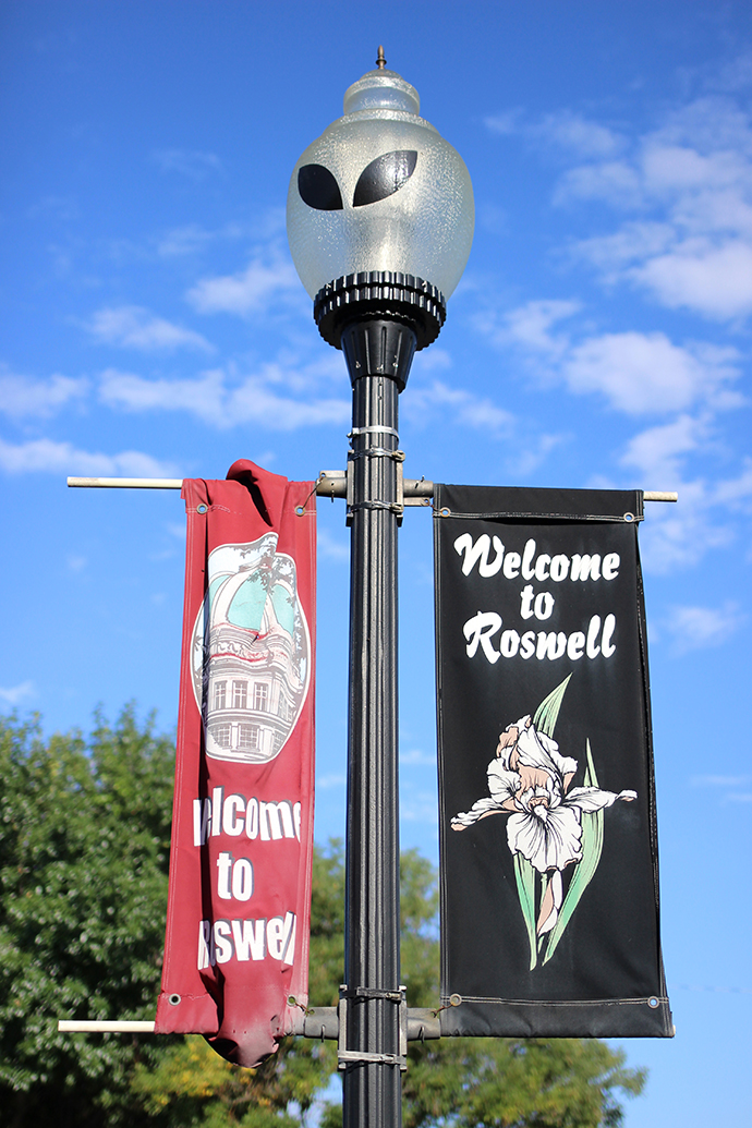
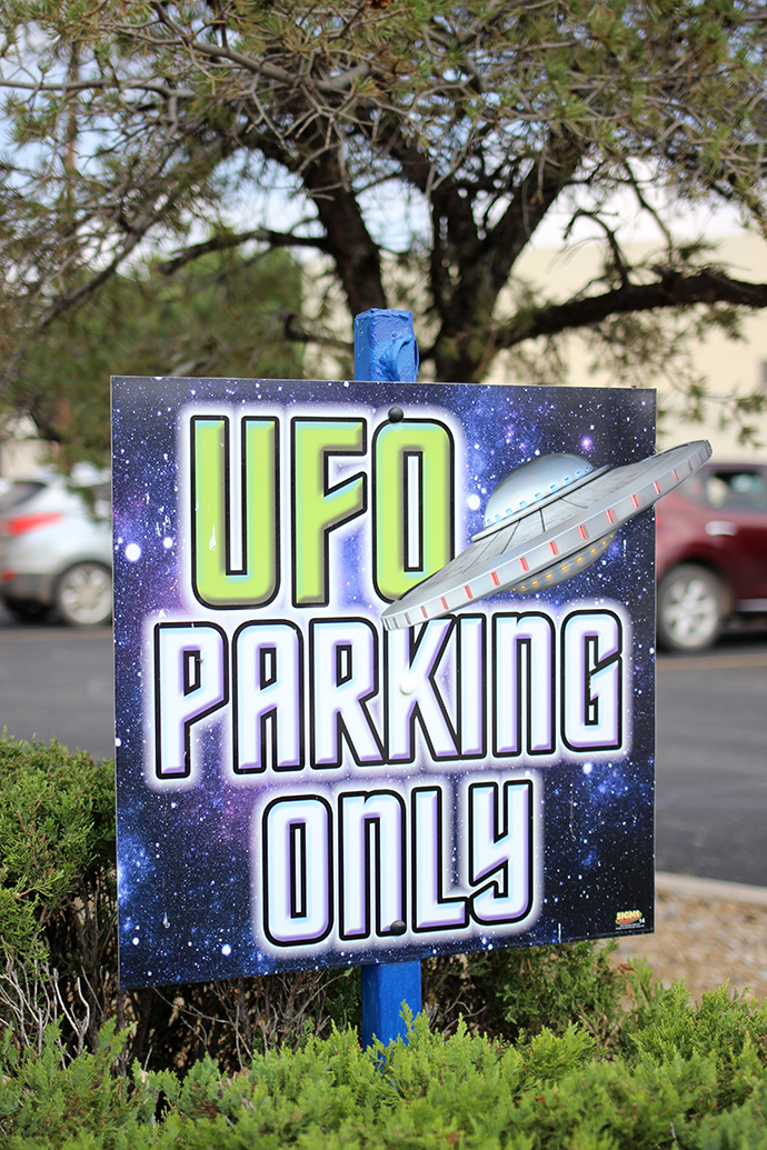
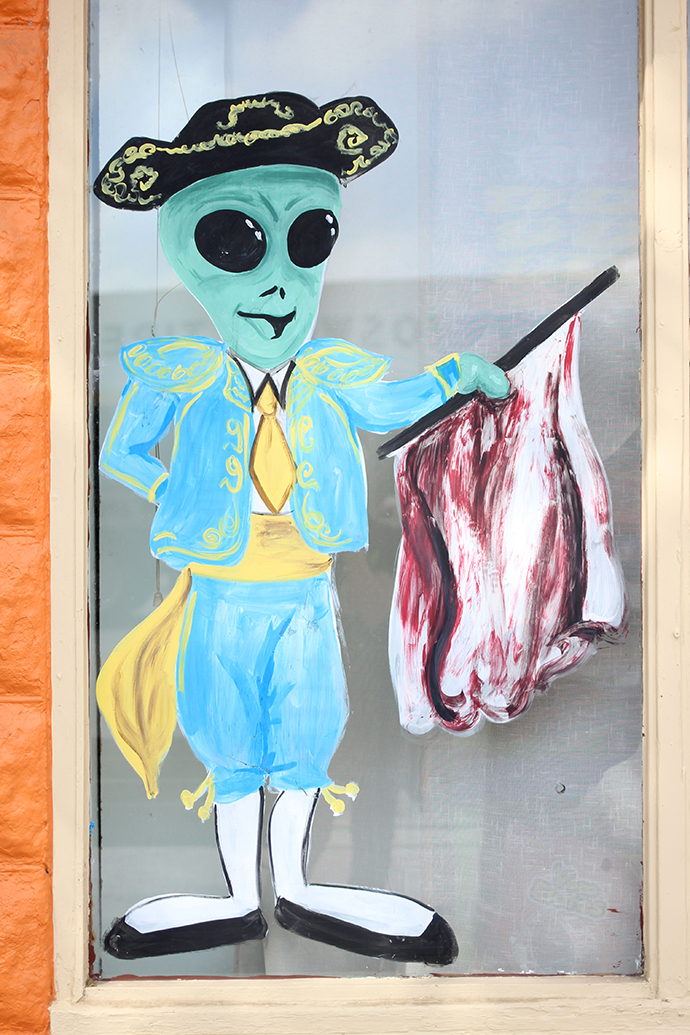
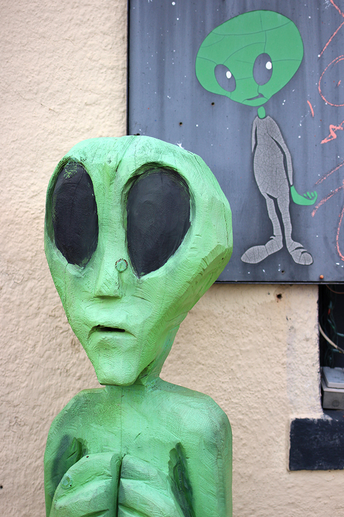
Luckily for cheesy, tourist-trap-loving people like me, Roswell definitely embraces their notoriety as the alien capital of the US. Aliens and UFOs are everywhere: on the back of cars, on the side of the highway, on restaurant signs, manhole covers and bakery windows. I was immediately
enamored with the UFO-shaped McDonald's
, and even the streetlights have been turned into aliens thanks to local artists (I do wish they were green, though).
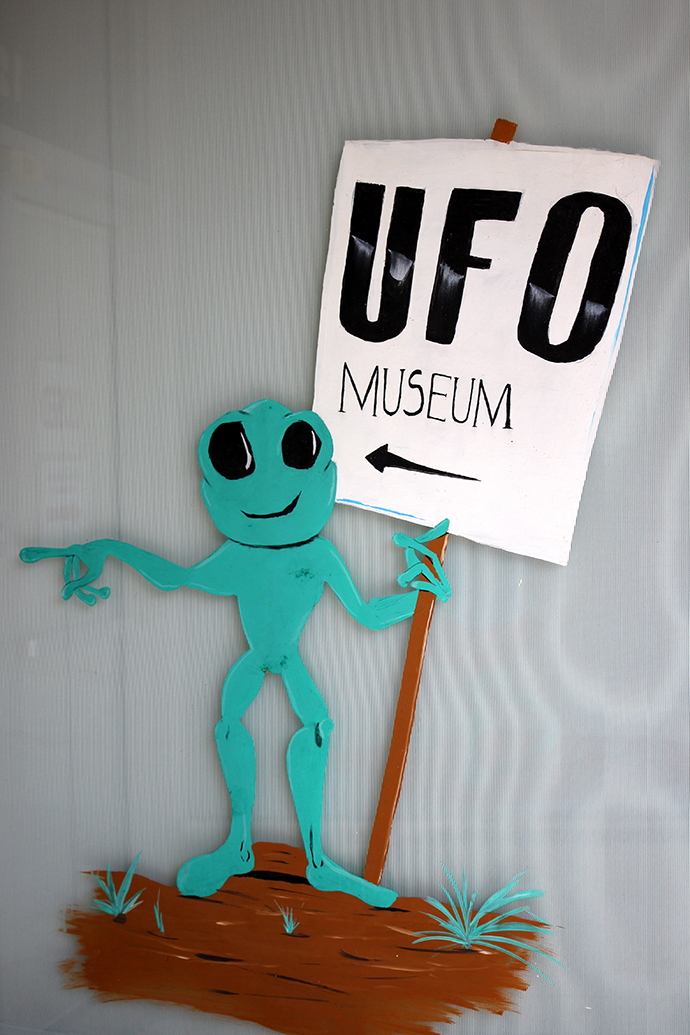
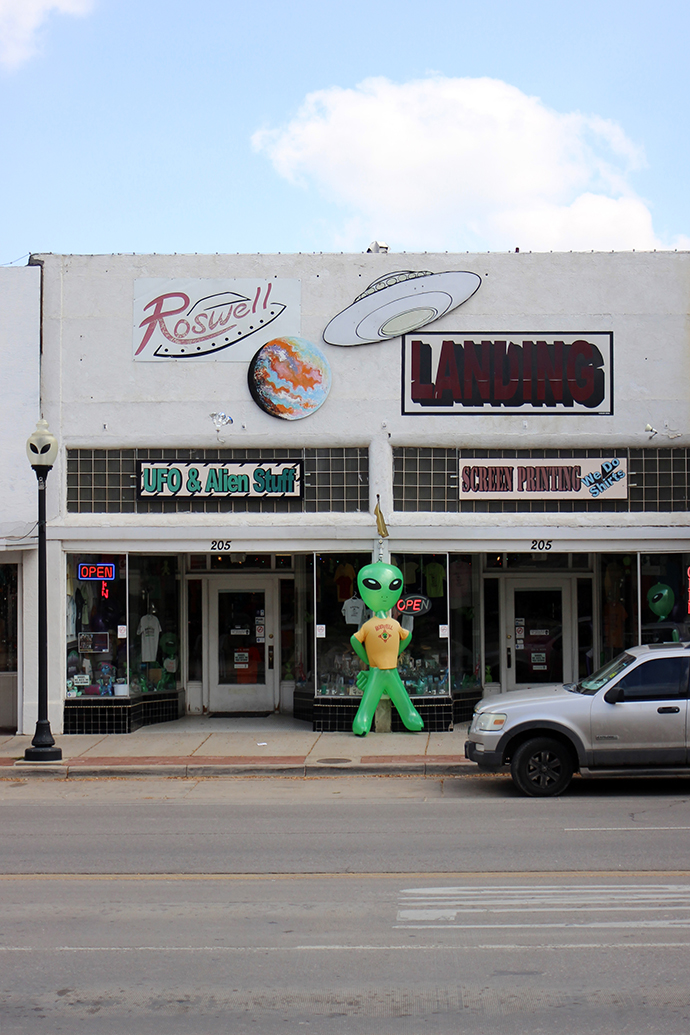

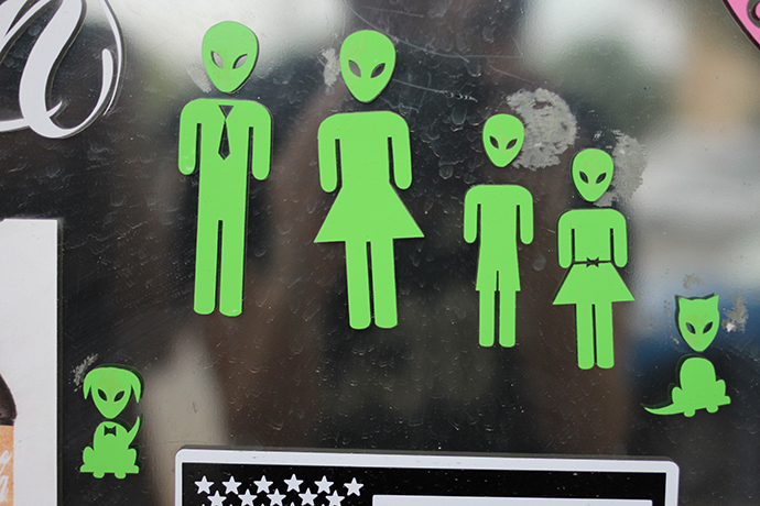
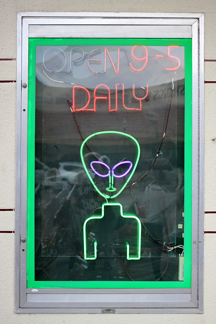
Aside from the museum and a few other attractions, the majority of downtown is filled with souvenir shops. If you can imagine an alien-themed trinket, you can probably find it in Roswell. I bought a floaty pen and made a few squished pennies, but we discovered that the best t-shirts were at a Walgreens next to our hotel (for $5.99!). I'm so glad that we finally made it to Roswell, which was—along with day trips to White Sands and Carlsbad Caverns—definitely worth the drive.

Muffler Man: Fox Cave

On the way from Roswell, New Mexico to White Sands National Monument along East Highway 70—an hour before we came across the World's Largest Pistachio—we drove past Fox Cave. Realizing they had a Muffler Man, we made a note to stop on the way back. When we did stop, it was about ten minutes before they closed, so I frantically ran around the grounds snapping photos of all the wonderful roadside kitsch.


Fox Cave's claim to fame is that it was once used as a hideout by Billy the Kid. The primarily limestone cave was originally known as "Ice Cave," and only one large room is open to the public. The gift shop is full of Native American souvenirs, aliens and gemstones. They also have a "gem mine" which might be a scam, but 12-year-old me would have definitely been into it.


I was thrilled to meet my ninth (!) Muffler Man along with a menagerie of other roadside creatures. Fox Cave reminded me a lot of Trader's World, and their Muffler Men are very similar. I love that this Muffler Man points to the entrance with one hand and holds a gem in the other—he's also in really great condition, and looks as if he just received a fresh coat of paint.


There's a "cemetary" with a tombstone for Billy the Kid, a handful of dinosaurs and dinosaur heads, a buffalo, carved wooden aliens and a cement-mixer-spaceship. I love the random assortment of roadside animals—statues that have no real purpose and don't make sense together, but is there a better break in the monotony of the road than to glance over and see two huge fiberglass hands rising from the ground?


Fox Cave also has its share of strange mannequins, including two guys sitting outside of a jail (photo-op alert!), a miner that has seen better days and a dismembered torso resting on a tractor. Fox Cave was a quick stop, but that's part of what I love about roadside attractions. Sure White Sands was incredible, but the journey there ended up being just as memorable.

White Sands National Monument

After spending a day in Roswell, we had a spare day before heading to Carlsbad. We decided to drive two hours to the White Sands National Monument, and I'm so, so glad we did. White Sands is like nothing else I've ever seen, or will ever see again. Located in the Tularosa Basin in between Las Cruces and Alamogordo, New Mexico, White Sands is 275 square miles of gypsum sand dunes, the largest such dunefield in the world.


WSNM is controlled by the National Park Service and you drive through the park in a big loop. You can stop along the way and explore the dunes, and I was surprised at how much freedom we had. We stopped at a few different points in the park, but all of the dunes start to look the same after a while. There are bathrooms at every stop, and cute little picnic shelters that somehow manage to look both vintage and futuristic.


I had read that you're allowed to sled on the dunes, and they conveniently sell sleds (and buy back used ones) at the gift shop. I bought two, and we all took turns on the dunes. The funniest thing about the sledding is that as you're hovering over the edge of a massive dune, it looks terrifying—I kept imagining this scene from Christmas Vacation. But once you start going, the sand turns out to be a less-than-ideal sledding surface and you descend relatively slowly. I even bought wax and applied it liberally but it was a bit anti-climactic—although that didn't stop me from wiping out in slow motion, as I do in most athletic situations.


We arrived at White Sands at about noon, which is probably the very worst time to be there—it was hot. Luckily for a family of tourist-hating tourists, this also meant that the park felt almost empty, which was worth the dehydration and potential sun-stroke. Speaking of which, White Sands is very much a desert—the first one I've ever experienced—and the signs reminding you to make sure you have water are not to be taken lightly. During our visit we noticed no less than four ambulances tending to people who presumably became overheated, and I can't imagine what it's like in July or August.
The sand feels like beach sand, but finer, and cool to the touch. The whole area also had a vaguely chemical smell that I imagine comes from the gypsum, used to make plaster of Paris and fertilizers. It's so strange to be surrounded by so much sand but not an ocean, and the mountains in the background only added to the surreal moonscape. I imagine that White Sands is as close as I'll ever come to feeling as if I've landed on another planet, without leaving the US.

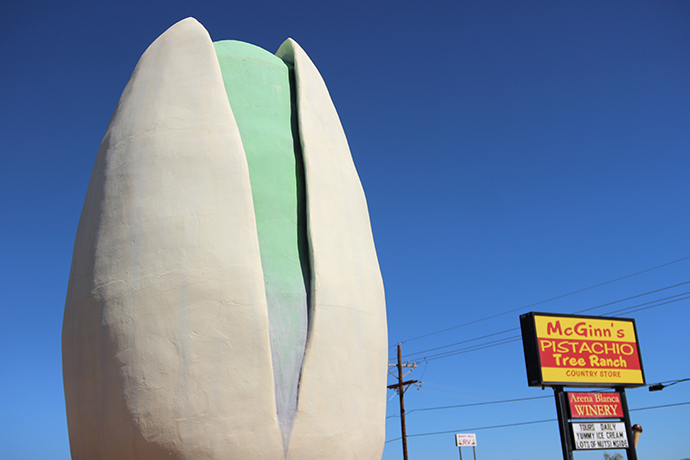
World's Largest Pistachio
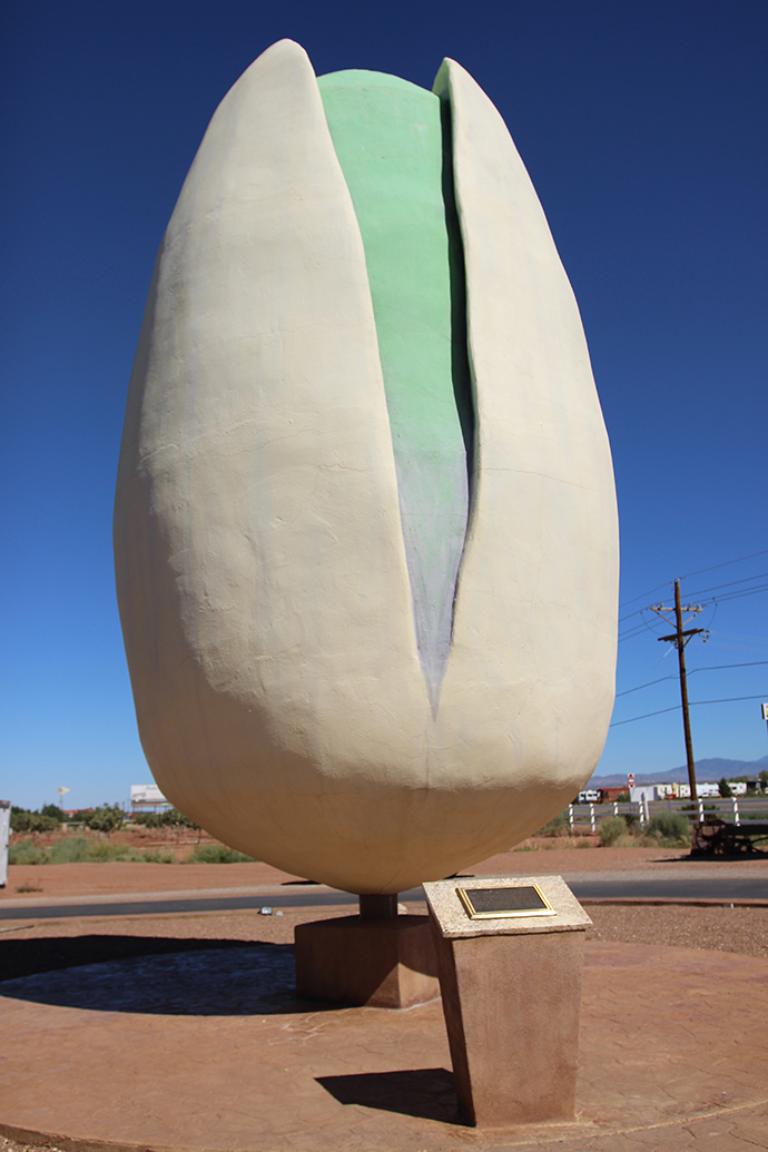
If I had one dream job, it would be for someone to pay me to travel to each and every one of the World's Largest Things. I love strange, roadside attractions pretty much more than anything else. Maybe it was all those early years I spent watching Pee-Wee's Playhouse, but I love anything novelty-sized—bigger, or smaller than it should be. I've seen the third World's Largest Garden Gnome, the World's Largest Longaberger Basket, the World's Tallest Uncle Sam and the World's Longest Go-Kart Track, but I'm always eager to add more to that list.


As we were driving to White Sands alongside highway 54/70 in Alamogordo, New Mexico, we came upon McGinn's Pistachio Tree Ranch , home of the World's Largest Pistachio. My sister and I both immediately recognized it from Roadside America and yelled "AHHH IT'S THE WORLD'S LARGEST PISTACHIO PULLLLL OVERRRR," to my startled brother-in-law behind the wheel.
McGinn's is an 111-acre pistachio farm and vineyard, and of course there's a large shop to explore after the huge pistachio lures you in. They sell pistachio-emblazoned everything, and an old miner (not unlike the ones we saw at Howe Caverns and the Niagra Wax Museum) greets you at the door. But of course I was most excited to discover that McGinn's has their very own pressed penny machine, featuring the pistachio with the words "Alamogordo, Pistachioland."
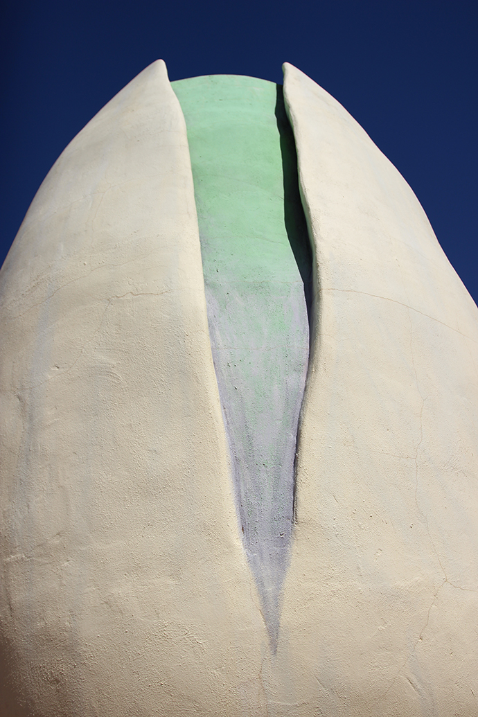


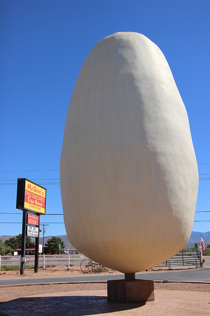
The World's Largest Pistachio is not a real pistachio (this should be obvious by now), but it's big enough and ridiculous enough to be a true roadside gem. The plaque beside it reads: "This monument is dedicated to the lasting memory of Thomas Michael McGinn (1929-2007). The founder of the pistachio tree ranch, this little slice of New Mexico desert was Tom's canvas to create his tireless legacy his tireless dedication to his dream made his farm the success it is today. Tom dreamed big, expected big, and accomplished big things. He would have said this monument is not big enough. His legacy lives on."
There's really no point to the huge pistachio—other than a mandatory photo-op—but I bet most of the people that stopped at McGinn's did so because of it. We certainly did, and ended up buying souvenirs and pistachios before getting on the road again. The world needs more people like Thomas McGinn and his big dreams—and more novelty-sized roadside attractions to honor them.

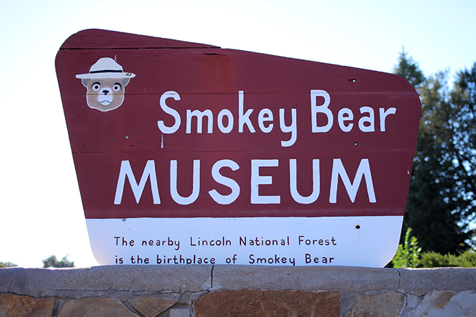
Smokey Bear Historical Park

On our way back from a day spent sledding the dunes at White Sands National Monument during a recent New Mexico road trip, we weren't quite ready to call it quits for the day. My sister had mentioned that we were nearby Smokey Bear's grave, and even though we knew we weren't going to make it before the museum closed for the day, we still thought it was a worthwhile stop.

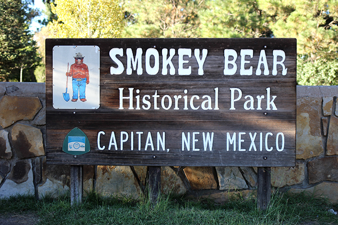
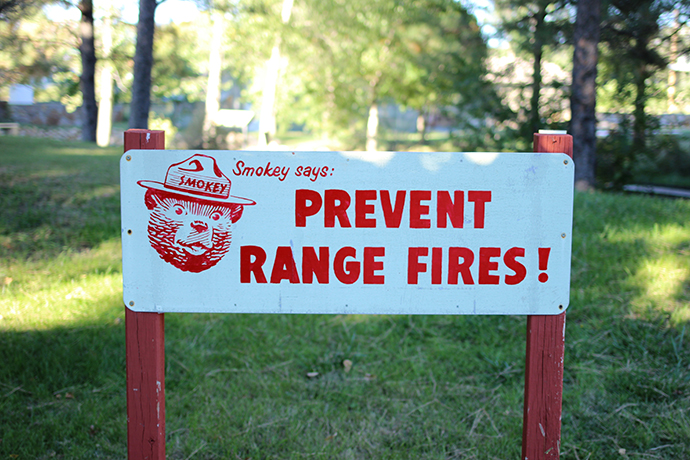
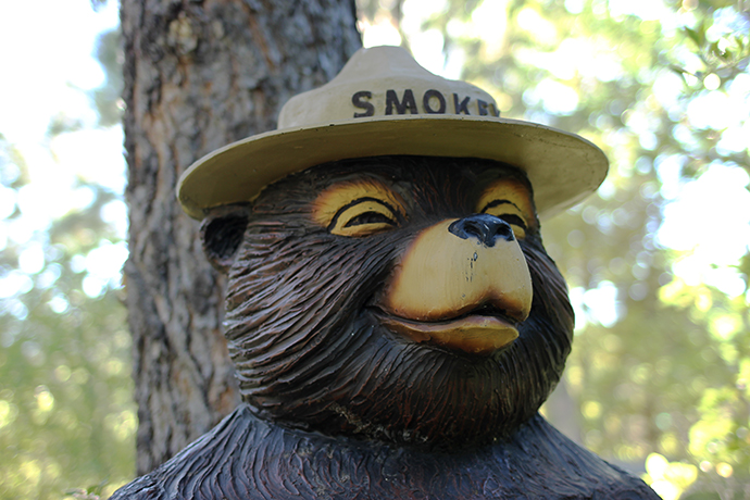
Smokey Bear was a real bear cub, originally called "Hotfoot," who was found by firefighters in 1950, badly injured after a fire in Lincoln National Forest. He was renamed Smokey, and came to represent the character that had been created during WWII to help educate campers on the dangers and destructive force of forest fires. Although he lived in the National Zoo in DC (alongside Ham the Astrochimp!), he was brought back to, and buried in Capitan, NM when he died in 1976.
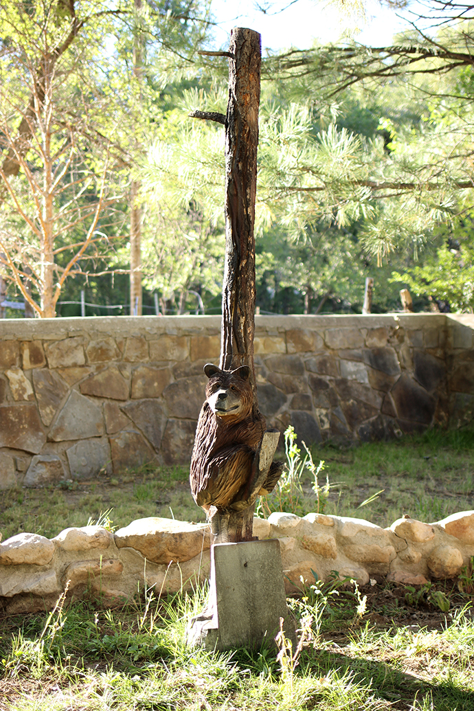

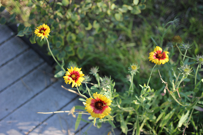
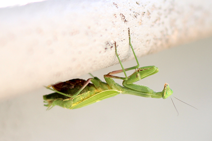


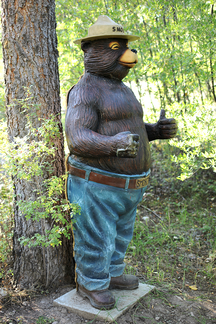
Of course I'd heard of Smokey Bear, but I'd never realized that he'd been modeled after a real bear. Ever since I visited my first pet cemetery, I've been eager to see as many not-exactly-traditional cemeteries and graves as I can—I was delighted to be able to add Smokey to that list. His grave is marked by a carved wooden bear cub and plaque, along a wooded path that includes statues, handpainted signs, beautiful flowers and at least one praying mantis (although I can't guarantee that last one will stick around).

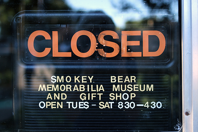
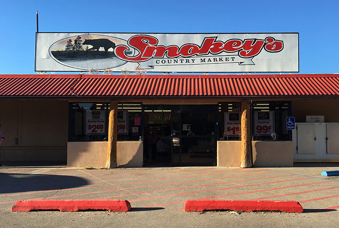
The park is such a good kitschy roadside stop—including a squished penny machine and fully-stocked gift shop that was maddeningly closed. The entire (very small) town of Capitan is very proud of its hometown hero—there's a Smokey motel, restaurant and even grocery store. Even if I'm forever disappointed to not be able to add a Smokey squished penny to my collection, I am glad we got to pay our respects to such an iconic figure.